
Not this bad
An extremely deep trough will develop over western North America this week, as illustrated by the upper level (500 hPa) map at 2 AM Thursday morning. I have rarely seen so many lows at one time within a large eastern Pacific trough. Let's call it Supertrough. The jet stream (where the lines are close together) is not only strong, but extends across central CA. Not the usual situation-- more like January.

The deep trough is associated with cool low-level air. To illustrate, here is the 850hPa temperatures (roughly for 5000 ft) for 8AM Wednesday. Down to 0C! Cold enough for mountain snows.

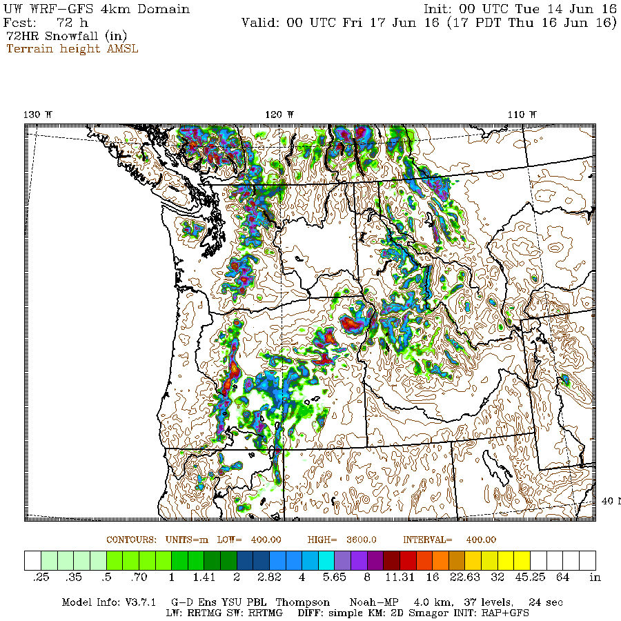
So take a look at the forecast snow total for the 72h ending at 5 PM Thursday. As much as 4-8 inches above roughly 4500 ft.
And did I mention that is was SNOWING tonight (Monday) at Paradise Ranger Station at 5500ft? It will get quite wintry up there during the next few days.
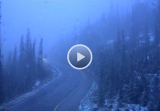
Cam from road near Paradise Ranger Station, Mt Rainer
Total precipitation for the same period? Except for the dry Columbia Basin, everyone will get wet, with .5-1 inches in the mountains and even more over eastern Oregon. This will help delay the fire season or serious drought worries. The only concern is some errant lightning-caused fire.

And finally, thunderstorms. Cold unstable air will move in on Tuesday and Wednesday, with the upper trough giving lift. Thus, good chance for isolated boomers. The NOAA Storm Prediction Center notes at least a 10% chance of thundesrtorms over western WA:

The latest WRF model predicts unusually large amounts of "thunderstorm juice" known as CAPE (Convective Available Potential Energy) for tomorrow afternoon.

So please be careful if you planning on playing golf tomorrow afternoon. Lightning loves to hit golfers, particularly those with metal spikes on their shoes. And if you where a hat like this, you might check you life insurance policy. You won't last long out there.

Finally, the upper trough will not be in a rush to leave us. As proof, the forecast map for Saturday shows that our cool/wet guest weakens but still is hanging around.

Announcement
My graduate student, Connor McNicholas has developed a wonderful FREE weather app that collects pressures on Android smartphones and gives you all kinds of valuable weather information. We believe we can revolutionize weather prediction using dense collections of pressures from smartphones. We need folks to try this app (and it already has been evaluated by dozens of folks) to ensure it works well. If you are willing to help, you can get more information and download it here: https://www.cmetwx.com/
My graduate student, Connor McNicholas has developed a wonderful FREE weather app that collects pressures on Android smartphones and gives you all kinds of valuable weather information. We believe we can revolutionize weather prediction using dense collections of pressures from smartphones. We need folks to try this app (and it already has been evaluated by dozens of folks) to ensure it works well. If you are willing to help, you can get more information and download it here: https://www.cmetwx.com/


Good, ol' reliable and dependable June Gloom is here. Gotta love it!
ReplyDeleteStill surprisingly cool air mass north, having been moving fairly slowly east, while at the same time caused to move and spread daily more southward by significant degrees for the past week or so, also impacted by the topography of the greater Coast. (?)
ReplyDelete