For us in the Pacific Northwest, the atmospheric rivers that reach our shores often come from the southwest, starting somewhere near Hawaii (see graphic of water vapor content summed up in the vertical). Thus, they are often called a pineapple express.

But sometimes, a very different configuration occurs, with moisture extending northward in the western Pacific, then heading nearly due east into our region. Traversing an amazing distance of over 5000 miles. Let's call this the Midway Express. And one of them will reach us on Saturday.
Here is the satellite view of water vapor content over the Pacific region for Friday afternoon. Lots in the tropics (warm air holds more water vapor than cold air), with large values surging northward in the western Pacific. Do you see a narrow east-west feature in the north Pacific, with what looks like a fist at the end. THAT is the atmospheric river that is heading our way.


A warm-front, will accompany the atmospheric river, something illustrated by the surface pressures (solid line) and temperatures (colors) at 5 AM Saturday morning. Behind the warm front, temperatures will rise, moisture values will surge and winds will accelerate. The warm moist air, forced to rise by our regional terrain, will drop copious moisture.

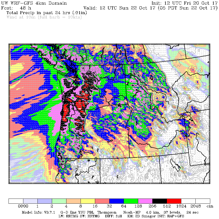
How much? Here is the 24h total ending 5 AM Sunday morning. The heaviest rain will be in the Cascades and coastal mountains from roughly Seattle southward. Some locations could be hit by 5-10 inches.

And there will be strong wind speeds, particularly near the San Juan Island and coast Saturday morning.
For those of you worried about the water supply, be comforted. As shown by the water levels at Seattle's Tolt Reservoir, recent rains have not only stopped the summer drawdown, but has caused a rapid rise during the past few days.


Looks more like a flying back kick to me than a fist. Packing lots of energy as it comes ashore.
ReplyDeleteI think the phrase you're looking for is "in the offing".
ReplyDeleteSome wet snowflakes mixed with rain just north of Winthrop Saturday morning. Not complaining. A good day to watch football.
ReplyDelete"in the offing" (not offering)
ReplyDeletehttp://www.dictionary.com/browse/in--the--offing
It was a little slower to start, but Puyallup ended up with 1.75"
Remarkably dry 10 day forecast now (for Oct)
There is snow on the ground in Winthrop now.
ReplyDeleteWe got 8+ inches of snow in the hills northeast of Winthrop!
ReplyDelete