Today is probably going to be the warmest day of June for western Washington, with highs this afternoon rising into the mid-80s over much of the western lowlands.
Lots of sun.
But during the next week, there will be a major transition, with cooler, cloudy marine air pushing into western Washington and Oregon.
You know what it is called: June Gloom
The visible satellite image shows the lurking "gloom," and by that I mean extensive low clouds over the Pacific (below)

You can see the clouds are low, since they are blocked by the coastal mountains. Clouds are along the coast from central Oregon to San Diego.
Clear conditions along the Washington Coast are associated with offshore-directed flow, pushing dry continental air offshore (see map around 2500 ft at 11 PM Saturday).

This flow is now starting to weaken and will reverse during the next few days.
Later in the week, low clouds will dominate over western Washington and Oregon, as shown by the cloud forecast for Friday morning.

The predicted temperatures at Seattle by weather.com show the large, gloom-bound transition, with 80s making way to mid-60s by the end of the upcoming week.

Our current warming is associated with high pressure aloft, which produces sinking air, offshore-direction flow, and clear skies (see map below at 500 hPa pressure, about 18,000 ft). Red indicates higher than normal heights and pressure, and blue, below normal.

By late this week, the ridge of high pressure will be replaced by a trough of lower heights/pressure just offshore. This pattern will bring cooler temperatures and a chance of rain, particularly over Oregon.

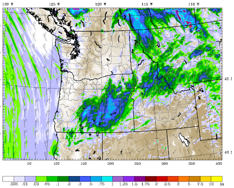
Talking of rain, here is the predicted total precipitation through Friday. Eastern Oregon will get some thunderstorms and showers.
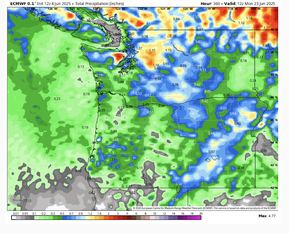
One week later, western Washington will have joined the wet fun (see below for predicted totals through 23 June).

From a cycling standpoint, June gloom means weaker winds, so I can't complain too much. This little warm spell is nice, but we still have nearly a month to go before the "official" start of summer.
ReplyDeleteSay what?
DeleteThe June solstice in Seattle will occur on June 20, 2025, at 7:42 PM PDT. This is the date when summer starts in the USA. While the summer solstice is acknowledged as the astronomical start of summer, some countries use June 1st. Other places have different ideas. You can look it up.
It's a commonly held opinion in Western Washington that summer doesn't really begin until early to mid July due to the June gloom. Yes, the official summer season does start on June 20th, but that doesn't mean the weather will suddenly flip from spring conditions to summer conditions s on that date.
DeleteWhat is shown on the visible satellite image isn't clouds it is fog that's been just offshore for days now. I live 8 blocks from the beach and it's sunny at my house so not being blocked by the mountains to the east of me. We finally got a break from the cold north winds today to enjoy one of our few "summer" days here on the Oregon coast.
ReplyDeleteCraig....fog are clouds. Clouds that reach the surface..The satellite is showing low stratus clouds..cliff
DeleteUnrelated: NWS at KELN Ellensburg got stuck at 10:05 AM, reading 84° on the opening page. On the "history" page (every few minute updates) they have 94° at 12:53. The forecast had 89° for the afternoon high.
ReplyDeleteCle Elum [Bullfrog (TBULL)] has a similar issue.