This blog discusses current weather, weather prediction, climate issues, and current events
January 31, 2009
A Nice Day
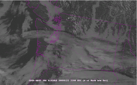
The front is through, the convergence zone has weakened, and a nice day beckons (gardening day for me!). Take a look at the latest high-resolution visible satellite image (attached). Mostly cloud free and sunny over central an southern Puget Sound, with a very weak residual convergence zone feature near Everett. Offshore you will see some scattered showers moving in, but they are very weak and most won't make it across the Olympics. So partly sunny and mid-40s over the Puget Sound lowlands and some minor snow showers over the Cascades. No precip in eastern Washington's Columbia Basin.
PS: For those that are interested, I will be talking about mountain meteorology and snow at REI on Thursday evening at 7 PM. And doing a book signing afterwards.
January 30, 2009
Wimpy Front, Great Convergence Zone
The front today had very little precipitation and attenuated cloud, but the convergence today was well-defined with a beautiful precipitation band...take a look at the recent radar image...
Way too warm for snow in the lowlands with it... Tomorrow looks generally dry over the lowlands...with some light snow showers in the mountains.
Dense Fog
There is dense fog around the Sound right now....that is generally a very good sign for day ahead. To get dense fog at low levels, one generally needs intense surface cooling...which generally requires clear or nearly clear skies aloft. You also need little mixing (otherwise you would have a thicker fog layer, which tends to be less thick at any one level). So in many areas, particularly away from the Sound, this fog should burn out during the next few hours.
There is a well-defined surface-based inversion over us right now (see graphic), with the cool, moist air only about 500-700 ft thick. Pilot reports at Sea Tac indicate the low clouds and fog top out at around 700ft.
January 29, 2009
Coldest Temps
The answer to my question in the last blog: the coldest temperatures are generally in the hour AFTER sunrise--so this time of the year around 8 AM. Temperature is controlled mainly by two factors: solar radiation during the day that warms, and infrared radiation emitted by the surface that cools (day and night). When the sun sets there is only infrared cooling and thus fairly rapid cooling sets in, cooling continues albeit at a lesser pace all night, when the sun just rises its feeble warmth is still dwarfed by the infrared cooling, so net cooling occurs and temp can still fall. Not until about an hour after sunrise is the sun's warmth large enough to balance the infrared cooling and temperature starts to rise.
I have attached the plot of temperature on the roof of the atmospheric sciences bldg at the UW that illustrates many of these points...the plot on the bottom is the solar radiation and air temperature is the third plot from the top.
Weatherwise, a weak front will approach western Washington late tomorrow afternoon, and showers should be felt tomorrow evening. The mountains will get some light snow--but not enough to really help. A convergence zone should form Saturday am and with cold air moving in behind the front, there could be some wet snowflakes in the CZ, particularly above 300 ft. More on this tomorrow.
January 28, 2009
Dirty Ridge
A term often used in meteorological circles is "dirty ridge." No, this is not some kind of meteorological pornography. Rather its when there is a "ridge" or area of high pressure that is not strong enough to keep us dry and cloud free. Weather disturbances with sufficient amplitude can inject clouds and rain into the northern portions of the ridge...that is the dirty part. Take a look at the upper level pattern for Thursday at 4 PM (see graphic). This represents the heights of the 500-mb pressure surface about sea level and is roughly at 18000 ft (sea level pressure is typically around 1012 mb). The ridge is obvious.
I have included the 24h precipitation for the next two days...you see some precipitation over the northern portion of the domain...particularly over the mountains. Lots of rain shadowing. This is typical for dirty ridges since the flow tends to have a strong westerly component (from the west), which produces good rain shadowing (and strong orographic enhancement).
By the way, when do you think we typically get the lowest temperatures of the day? 9 PM, midnight, 3 AM, 6 AM, or 8 AM...or perhaps some other time? Will give the answer in the next blog.
January 27, 2009
Coastal Weather Radar
It is time for all those interested to push for a coastal weather radar in our region.
As I have discussed in this blog and in a web page on the topic, http://www.atmos.washington.edu/~cliff/coastalradar.html , the Pacific Northwest has the worst radar coverage of any coastal location in the continental U.S. (see graphic, red indicates no coverage). The only weather radar in western Washington is on Camano Island and its beam is blocked by the Olympics, so there is virtually no coverage over the coast and nearshore waters. We have some of the most active weather in the U.S., but we can't see the details of the storms coming in. Here in Seattle we can plan our days and understand the weather using the weather radar...in Gray's Harbor county you can't. We can't get see heavy precipitation on the SW and W windward slopes of the Olympics, or the coastal mountains of SW Washington. There have been a number of short-term forecast failures that could have been prevented if we had such a radar.
Strong support for the radar exists in the coastal communities, from environment groups, to the forestry industry, to the fishery community, and local municipalities.
The radar would cost around 4.5 million, plus installation costs and land--no more than 6-8 million in total. The region could save that in a single major storm, if the forecast could be improved (e.g., the major flooding in December 07 on the Chehalis). A location somewhere between Westport and Pacific Beach would work. Several of our senatorial and congressional delegation have been supportive, with Senator Cantwell taking a lead (see the web page for more info on this).
There will be hundreds of billions spent on infrastructure improvements for our nation. Wouldn't improving the weather prediction and warning infrastructure for our region be an exceptionally wise use of such funds? And the project is "shovel ready." Radar hardware vendors could deliver and install the unit within a year.
I would be happy to answer questions about this in this blog. But I am suggesting that you contact our U.S. Senators (Maria Cantwell, Patty Murray)...asking for their help (contact info is at http://www.atmos.washington.edu/~cliff/contact.html). Also contact your local congressperson...with those in Norm Dicks district (who have the most to gain) taking a lead.
After so many years of inferior weather radar coverage along the coast and offshore, it is time to fix this serious problem. Perhaps the growing community of those interested in NW weather can finally make this happen. Thanks, cliff
Snow is here
The snow is here--nearly on schedule (light precipitation almost always starts an hour or two before the models indicate). Look at the radar...light precipitation.pretty much all snow is extensive south of Seattle...but the forecast rain shadow over Seattle and to its north is evident. Temperature aloft are cold enough for snow (as seen in the Seattle profiler), but strong southerly winds are pushing in aloft and they will eventually cause sufficient warming to turn it all to rain.s
WSDOT camera show some light snow on the roads in the south sound (see image)...so be careful...cliff
January 26, 2009
Rainshadow and snow/rain
I will update in more depth later...but another Pacific disturbance is approaching (see figure) and we will get precipitation...the question is the how much and whether it will be rain or snow. Because the disturbance is moving towards us from the northwest, there will be a strong westerly component as is approaches and moves over us. Westerly flow produces a rainshadow over the central Puget Sound region...as demonstrated last month. The air over us is cold and dry, dry enough the there will be lots of initial evaporative cooling as the precipitation falls into it from above. Evaporative cooling only acts for a short while..until the air becomes saturated. And then the movement of warm air into the region associated with the system will take over and turn the precipitation into rain.
The current run of the high-resolution local model provides the following 24-h snowfall ending 4 PM tomorrow (see figure). The mountains do well (6-18 inches) and light snow is found over portions of NW and SW Washington, and over the Kitsap/Hood Canal area. But little over Seattle. By mid-day all the precipitation over the lowlands should turn to rain. Strong winds will also occur over Puget Sound and NW Washington as low pressure moves north of us tomorrow morning and afternoon.
Here is the latest 24-h snow from the Monday night run...but from the coarser 12-km resolution version. Pretty much the same story.
January 25, 2009
Humility
Well, one thing a forecaster learns quckly is humility. There is a weak upper level disturbances that is causing this light precipitation. The heaviest precipitation is on the eastern side of the Sound. Take a look at the radar animation to see the details ( http://www.atmos.washington.edu/~ovens/loops/wxloop.cgi?atx_n0r+/2h/ ). The models did not handle this light precipitation well...in most of the region there is no accumulation...but some of you are getting up to around an inch (Woodinville and Snohomish seem to be ground zero for the worst). It WILL end later this afternoon and early evening....guaranteed.
Light precipitation is a clear weakness of our current models...working on this issue is definitely on my to-do list....cliff
Sunday Morning Update
The air above us is now cold enough for snow...and there are a few light flurries going on now as the final bands of showers from the passing weather disturbance move through (see figure). Last night some locations received 1/4 to 1/2 inch (a few slightly more)..particularly at higher locations in the North Sound. And as I mentioned last night, the model's definitely underplayed it. Cooler, drier air is now moving through the Fraser River Valley. Take a look at the surface chart (attached)..strong NE winds (20 knots sustained) at Bellingham Airport..with a temp of 27 and a very dry dewpoint of 2F! If you want to get a better idea of the winds go to the Ferry Weather Web page (http://i90.atmos.washington.edu/ferry/Ferryjs/mainframe1.htm) and click on the San Juan Island close up map...winds of 25-30 kts are found at some locations.
The sky has opened up in Bellingham and clearing will move southward slowly during the day. Light snow is still falling over portions of central and southern Puget Sound and will do so until midafternoon. Expect temps to drop into the 20s and teens Monday AM--so protect those vulnerable plants.
Several of you have mentioned the issue of snow on Tuesday, when the next disturbance comes in, with cold air in place. Temps will warm rapidly as the associated front approaches and there should be considerable rain shadowing from Seattle northward. So it is possible that some locations will initially see some snow (particularly south Tacoma) that will turn to rain. More on this tomorrow. But we will have a sunny day on Monday, with a high around 40F first...and no air pollution.
January 24, 2009
Modest Model Failure
The numerical models from this morning and earlier underplayed the precipitation over the region. The latest runs appear to have caught up with reality with light precipitation this evening. As a result we are seeing a wintry mix of rain, rain/snow mix, and some light snow over the lowlands, particularly north of Seattle. There is a dusting at some locations right now..particularly above 200-300 ft. The latest 24-h snowfall from the latest high resolution model is attached. Amounts up to around 1 inch are possible..but I suspect that such values will be on the high side. So no big snowstorm, but light snow is possible tonight. The precipitation should be over by 10 AM tomorrow.
Snow Update
January 23, 2009
The Fraser Gap Wind
One of the more interesting local weather features of our region is the gap flow through the Fraser River valley...and this phenomenon will be quite evident this weekend. In fact, it has already started.
Take a look at the topographic map I have attached. The most substantial weakness in the Cascades north of the Columbia Gorge is the Fraser River Valley, located just north of Bellingham. When cold, dense air fills the interior basin of BC, a big pressure difference occurs down the Fraser..and as a result cool, dry air pushes along its axis to the SE. Bellingham often gets strong NE winds and cool, dry air as a result.
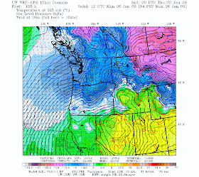
The surface chart for tomorrow at 4 PM shows cold air (blue and purple colors) and high pressure over the interior of BC. This will enable a strong Fraser River flow.
In fact, the Fraser Gap flow started already this afternoon. The plot of wind speed (attached) showed a decided acceleration at Bellingham around 20 UTC (noon PST). At the same time, the relative humidity plummeted as the continental air from the interior hit that location (see plot). Another plot of temp and temp point shows a drop in humidty (dewpoint declined), but the temperature rose quickly. Why? The reason is that strong winds from the Fraser mixed up the air, destroying the inversion and scouring out the cold air that was in place. Later on, as the primo cold air from the interior pushes through the Fraser, Bellingham will be a relative cold spot.
The winds exited the Fraser will be quite strong, especially Sunday morning. Take a look at the computer simulation for 4 AM on Sunday...sustained NE winds of 35 knots are being predicted around the northern portion of the San Juan Islands...people there should be prepared for a good blow.
On Sunday, dry cold air will spread across the region...and it is clear that lowland snow will not occur. Only the mountains will get a light dusting late Saturday and early Sunday. Expect sun the second half of Sunday from Seattle northward and Monday should be sunny too. But the period will be cool, particularly Monday morning, when temps will drop in the 20s and even upper teens in the colder interior locations.
January 22, 2009
Evening Update
The new round of forecast models retains the same story...some cooler air moving in on Saturday and Sunday, but no snow over the western Washington lowlands. Perhaps a few light snow shower near Portland. In fact, it looks like the skies over Puget Sound will clear on Sunday and you will see some sun.
A big issue is that the mountains have not received any new snow in while. Icy and no powder. The only silver lining is that this snowpack is solid and stable. They don't call it Cascade concrete for nothing...so very small avalanche threat.
Cold, but no snow in Seattle
I have been studying the latest computer forecasts and it is clear that this weekend will bring major changes....but no snow in Seattle.
Starting with today, low clouds and the inversion are still in place over Puget Sound and eastern Washington (see satellite picture and the latest profiler temperatures in Seattle). The inversion is a weaker than last week on the west side...and some locations are seeing some sun midday. But the clouds fill back in overnight. And tomorrow won't be very different.
I have added a figure showing temperatures over the past four weeks against the average highs and lows (red and blue lines). During the last week we have been much cooler than normal..which comes as no surprise. The spike of really warm temperature two weeks ago was the pineapple express flooding period.
Now to the forecast. An intense high, associated with very cold air, will form over the Yukon and N. British Columbia and move southward towards our region. By tomorrow morning at 4 am, a 1054 mb high will be over northern BC. (see figure), and cool air will begin seeping into northern Washington. By saturday cool air will be moving SE in the Fraser River Valley and NE winds will be hitting Bellingham and NW Washington (see figure). Colder air will move southward on Sunday, but right now the models indicate very little precipitation....so no snow. Moderated arctic air will move over western Washington and we will probably clear out on Sunday. With dry conditions and offshore flow the strong inversion and fog that we have experienced should be history.
January 21, 2009
Transition to colder air over the weekend
Several of you have commented on the potential for a transition to much colder air over the weekend. I have held off talking about it until we were close enough, but now it seems clear we will move to much colder air overhead later on Saturday. By Monday will be deep in moderated arctic air (see forecast output for 4 AM Monday). Blue indicates air cold enough for snow.
By Sunday AM we will be cold enough aloft for snow..but there is a real question on how much precipitation will be around. The latest runs only indicate light snow south of Seattle. The current forecast configuration does not look amenable to a significant snowfall. I will update much more on this tomorrow.
January 20, 2009
Black Ice
What is the the weather condition that kills and injures more Washington State residents than any other? Floods...no. Windstorms..no. Tornadoes or Thunderstorms. No way. I am pretty sure it is roadway icing...and that threat is very real this week.
Roadway icing is often called "black ice"--but it really isn't really black...it can look dark at some angles and twinkle in others. Roadway icing usually is associated with high pressure situations, with no rain and light winds. There are several ways you can get ice on the road:
1. Frost--skies clear under high pressure and the earth radiates heat to space via infrared radiation. The surface thus cools sufficiently that frost forms on the ground. Frost can be slippery, but it is generally thin.
2. Fog. The big threat. If the ground cools to below freezing and if some nearby fog passes over the ground, it can rapidly and severely ice up.
During the past few days both of these have occurred. Two days ago, I had frost on the street outside my home. Then the fog bank moved in and a 1/4 of ice covered everything...just treacherous.
Keep in mind that on cold, clear or nearly clear nights the temp of the ground can be 3-6 F cooler than the air temperature at 6 ft, where official measurements are made. So if you hear that temps have dropped to 36F or your car thermometer is down to 35...you should be worried, particularly if fog is around.
Once in a while I have testified at legal proceedings about icing accidents, and many of them have occurred under clear nights, with nearby fog, a bend in the road or a turn, and often someone driving to fast for the conditions.
If you want to review a detailed tutorial on this subject, check out:
http://www.atmos.washington.edu/~cliff/Roadway2.htm
By the way, the inversion has strengthened over the central Sound and in some places the fog remained most of day (like at the UW). (see graphic of inversion from the profiler). You can easily get out of the murk by going up (above 600 ft should do it). Air quality has declined as result, so no burning if you don't have to.
Finally, a reminder that I will talk about Lowland Snowstorms at Third Place Books in Lake Forest Park tomorrow (Wed) at 7PM.
January 19, 2009
Videos at top of Tiger Mt Yesteday and Fog Today
If was quite windy at the top of Tiger Mountain yesterday, with easterly winds probably gusting to 25-30 knots. Check out the video I made up there. Also, I have a pic of my thermometer reading at the top...just in case no one believed me!
We have a cam in the department, and it is interesting to view the layer of fog today...which was just below us for much of the morning...check is out here:
http://www.atmos.washington.edu/images/webcam0/movies/20090119.mov
By the way, it was really dangerous in some locations yesterday and this morning. Many locations started out clear, and thus cooled to below freezing at the surface. Some places had frost. Then the fog moved in...with water from the fog glazing the surface. This happened in some locations in north Seattle (see picture). I stopped the car to snap this shot and almost fell down it was so slippery. My antilock brakes took over a few times on downhill stretches. So remember if it is cold and fog is around...be very careful!
January 18, 2009
Ascent of Tiger Mountain and Warm Temps
Today was a very different day than those of earlier this week in a number of ways. First, the fog and low clouds were considerably reduced west of the Cascades, particularly in the afternoon (see the sat picture at 2 PM). Low clouds did remain east of the Cascades and extended into the pass.
The pressure difference across the Cascades increased to 14 mb...higher to the east. This large pressure gradient helped to drive strong easterly winds. Some of these winds reached the surface over the eastern lowlands...from North Bend to Samamish..and when they did, the cold air was scoured out the temps jumped to near 60F. But nearly regions which remained in the cool air, below the inversion, were 10F or more colder.
The Seattle profiler showed the strong easterlies (actually southeasterlies aloft) and the profound change in the inversion and temperature structure aloft (see figure from 7 PM Sat to 7 PM Sunday). Last evening we had inversions galore... the old inversion aloft and a new radiation inversion at the surface (produced by radiational cooling at the surface). During the afternoon, the surface warmed up and the warm air above mixed down and the inversion become greatly weakened. With dry warm air mixing down, visibilities (from the Puget Sound Clean Air Agency webcams) soared....take a look at the difference between the visibility today at 3 PM and two days ago...pretty dramatic. You can see some of those residual low clouds in today's image.
As many of you have done, I hiked up Tiger Mt. today...from 500ft in the parking lot to 2522 ft at the West Tiger 3 summit...referring to a high-accuracy thermometer and an aneroid altimeter on the way up. We started at 9:10 AM--36F. There was a large temperature changed in the first 500 ft (to around 46F at 1000 ft). This was the surface-based radiation inversion. Then between rougly 1200 and 1900 ft the temp climbed into the mid 50s (the second inversion) and we entered the realm of the strong easterlies. At the top, the temps reached around 60F (high was 61.4). Excellent visibility in all directions. There was some snow on the shaded slopes in the last few hundred ft. I was impressed how much the snow level had risen on the Cascades...looked like 3000-3500 ft on the western slopes.
Looking at the computer models tonight...stuck by the lack of precipitation for the next week....nothing there really.
January 17, 2009
Fog in the pass
Several of you have asked about the fog in the pass...they thought the mountains should be clear due to their higher elevations...and in fact they have been clear for several days. The cams in Snoqualmie Pass (see attached) do show fog. In fact, the fog has been freezing on trees and other objects. Yet on top of tiger mountain and at Paradise it is sunny...what's up?
The explanation is that eastern Washington is full of low clouds and fog (as it frequently is under high pressure in the winter). They have an inversion overhead. The pressure is higher in eastern Washington than western and this difference is increasing as large scale high pressure is moving eastward. The six hour forecast valid at 10 AM this morning shows the story..cold air in eastern Washington and high pressure there, with a big pressure difference across the Cascades (roughly 10 mb..which is a lot). This difference in pressure is producing strong easterly winds in the Columbia Gorge. It is also pushing the cold air and fog up the eastern slopes of the Cascades and into the passes. You can see this in the visible satellite picture this morning (see picture).
Today, was a good example of a weakness in our current computer models...they failed to produce the low clouds of last night and this morning. We believe that an important reason for this failure is that the models mix the atmosphere too much under stable conditions (like when cold dense air is under warmer, less dense air). The simulation for today at 10 AM is a good example (see below--no clouds over PS).
Today, a good portion of Puget Sound lost the low clouds and we finally saw some sun. One reason is the inversion became so shallow that limited solar radiation could mix it out. Also the strong descending easterlies aloft (forced by the large difference in pressure) might have contributed. WIth solar energy reaching the surface, temps warmed into the mid-forties to 50F. The inversion weakened a bit...but is still there...and will restrengthen tonight as temps cool near the surface. Tomorrow morning I will try tiger mountain..with a thermometer, and see what I find.
PS: Just a reminder...I will be talking about NW snowstorms on Wednesday at 7 PM at Third Place Books in Lake Forest Park.
Will review big historical lowland storms, including the last event, and the rare conditions that produce them.
January 16, 2009
Great image
This is an ultra-high resolution image from NASA Aqua satellite....much better quality than the NWS geostationary satellites I have shown you in the past...but only available twice a day (click on the pic to see it better). You can see so clearly the low clouds over Puget Sound and eastern Washington. Look carefully and you can see fingers of low clouds pushing into mountain valleys..and even some contrails over the ocean. Also Tiger Mountain and the Issaquah Alps are apparent sticking out of the murk.
It really has been cold the last few days in the lowlands...with a lack of sun due to the low clouds. Take a look at the temps during the past two weeks (see figure). You can see that the temps the last two days has been hanging around the normal minima.
I am heading up Tiger Mt. Sunday morning..perhaps I will see some of you...want to experience some sun and warmth myself.
PS: I will be at UW Bookstore at 1 PM if anyone wants to talk in person.
January 15, 2009
Air Quality Questionnaire
There is a little mystery going on for the air quality folks...why air pollution hasn't increased more with such a strong inversion. Have people reduced their burning of wood without a burn ban? To help answer this question, they have put together a brief web questionnaire, and if you have a few minutes, please give it a try:
http://www.atmos.washington.edu/weatherforecasting/airquality/index.php
and back to our amazing inversion. It has now slowed it ascent...with the base at around 300 m. (see figure). Visibility noticeable increased today and air quality has begun to decline...particularly over the southern Sound from Seattle to Olympia. A few people took to the hills today...and it was amazing. 66F at the top of Tiger Mountain (2500ft) and nearly 70F at Paradise Ranger Station. The ridge will hold in through the weekend, but will slowly progress eastward on Sunday and Monday. The pressure difference across the Cascades has increased (greater pressure to the east), and this is pushing air westward in the Columbia Gorge....Troutdale, east of Portland, has easterly winds gusting to 40 knots now!
A reminder: I will be signing books (no lecture, but happy to answer question) at the UW Bookstore in Seattle at 1 PM on Saturday. On Wednesday( Jan 21) at 7 PM I will talk about Northwest Snowstorms at Third Place Books in Lake Forest Park.
Even Lower
Here is a wonderful picture from Stephen Van Dyck that was taken at Poo Poo Point (1820 ft) on Tiger Mt. yesterday afternoon a 4 PM. The same view will be available today. Hiking through a sharp inversion is a real treat. If you don't like hiking, drive up to the top of Cougar Mt. Park and bask in the sun.
The inversion is lower and stronger this morning. The first graphic below is the vertical sounding at Quillayute on the coast based on a balloon-carried instrument package (radiosonde). Temps (red) in C and heights in pressure (850 is about 5000 ft, 700 about 10000 ft) Very strong surface-based inversion. The blue dashed is the dewpoint...air is saturated near the surface but VERY dry aloft.
Next, I have the Seattle temperature aloft...the inversion is very strong, with the base now below 400 m (1300 ft).
The surface temperatures at 6 AM are plotted in the next figure. Big variations...from the mid-30s in the coldest locations to 55F up in the mountains. Want to warm up?...go up Keep in mind..if you are driving in fog and the temps are in the mid to lower 30s, be very careful! Black ice on the roadway is a real possibility.
Finally, air quality has held up until now, but a few locations (e.g., Olympia and South Park) have slipped into moderate...look at the latest air quality map from Puget Sound Clean Air Agency I have include.