February 28, 2010

Why was my flight so bumpy?

Aircraft wake turbulence

Last night I was flying back to Seattle from the Bay Area and it got fairly bumpy at times, with the pilot periodically putting on the seat belt sign.

What were the origins of that turbulence?

The cause last night was vertical wind shear, a large change in wind speed/direction with height. We were not flying in clouds or storms, and the turbulence was not connected with any terrain feature.

Take a look at the vertical sounding at Medford, Oregon, at about the half-way mark of my bumpy trip (see graphic). The pennants give you the winds-both the direction and speed (big solid lines are ten knots, triangles are 50 kts.) The height in pressure (millibars) and meters are shown on the left. The plane was flying around 36000 ft, 11ooo meters, for most the time. (This is around 250 mb). Between 250 and 300 mb
there was strong flow from the north (more than 100 knots), with the winds weakening rapidly below and above that level. The northerly flow slowed the plane down considerably, making the flight take longer by roughly 10-15 minutes. On the flanks of this wind maximum, above and below, there was large wind shear. At 5500 meters (500 mb) the winds were westerly at 15 knots, with weak winds below.
Wind shown by pennants (all I talk about). Solid lines are temperature and dewpoint (left one). Slanting lines you dry and moist adiabats and mixing ratio.

So why do we care about wind shear? Because if it is large enough, the atmosphere can breakdown into turbulent eddies. The fancy name for this breakdown is Kelvin-Helmholtz instability. And smaller scale turbulence can develop within these eddies. Sometimes you can even see this instability expressed in the clouds, as in the picture shown below. Looks like waves breaking at a beach...and like those waves there is lots of turbulence and sloshing around. Your plane enters an area with such shear-induced turbulence and it gets bumpy. Sometimes VERY bumpy.

I always pick a window seat when I fly (for obvious reasons!) and occasionally I see such clouds ahead. Last time I did told the person next to me to buckle up and they gave me a strange look. I told him I was a meteorologist and he smirked (the kind of smirk that says...sure...you guys can really predict ANYTHING). A few minutes later the plane was jerking all over the place and the seat belt sign was on. I bet he didn't joke about weather folks after that!

The thing about shear turbulence is that it is often limited in vertical extent and taking the plane up or down a few thousand feet can make a huge difference. That is why during uncomfortable rides pilots often chat with other planes and air traffic control to see how the "ride" is at different elevations and then alter their flight level if possible. "Testing" altitudes for better rides is not unusual. Interestingly, I know someone who flew the same root a half-hour earlier but at 41,000 ft and experienced virtually no turbulence.

Shear turbulence is probably the most important one for modern high-altitude jet travel, but there are others...mountain wave turbulence, convective turbulence from cumulus and thunderstorms, wake turbulence behind other planes (see picture at the top), and a few others. Fortunately, modern aircraft can handle the worst of it (except thunderstorms), but understanding what is going on certainly makes it more tolerable. And having your seatbelt on is essential...nearly all the injuries to passengers are to those unbelted.

The best web site for getting turbulence information is:

http://aviationweather.gov/adds/turbulence/


There you will find both current and forecast turbulence levels over the U.S.

February 22, 2010

OutdoorFun Winter Weather Index: A Record Tying Year!

You come to this blog for the latest information on weather prediction. Cutting edge technology and modeling. Today we will push the envelope with the latest UW advance:

The OutdoorFun Winter Weather Index (OWWI)

When do you feel comfortable working and playing outside? 40s are too cold for most. 50, 51, 52 a little bit chilly and you still need a sheatshirt. 53 is on the margin. But 54F! You start to feel a bit warm. You take off the sweater. You start building a bit of sweat while exercising. Life is good.

Scientists at the UW define the OutdoorFun Index as the number of days from January 1 through February 22 with maxiumum temperatures at our above 54F at Seattle Tacoma Airport. Why January 1 ? Its the new year! Why February 22? Because Feb 23rd is the official start of meteorological spring in Seattle. Don't believe this? Read my book. Even better, buy my book and then read it.

Using the extensive weather archives at the UW, our trained climatologists can now answer the question at the tip of your tongue. How does this year stack up against others using this index?

It turns out we tied for number one, considering a period of sixty years! Twenty four days reaching 54F or above! See the official OutdoorFun Weather Index graph below:1995 was also a fun outdoor winter. It is not your imagination that sweaters were practically optional this winter!

Like the daily-average temperature better? How about the number of days our daily mean temperature is greater than 43F!. Why 43F? Again, read my book. Here is the graph. You guessed it, we are number one. The big Kahuna of warm winters.
Perhaps this is what happens when you get a new mayor. Nickels gets snowappocalype and McGinn gets spring in winter. Clearly, the weather gods look favorably on our new mayor. And I hear they like tunnels and don't like Discovering Math textbooks.

PS: Mathematician Neal Johnson is credited for the above calculations!

PSS: Please no mention of global warming in the comments!

February 21, 2010

Inversion and A Significant Change

We clear skies and light winds we had perfect nighttime weather for the development of an inversion last night (remember, inversions occur when temperature increases with height). Take a look at the Sand Point observations ending 10 PM last evening. Temps in degrees C and height in meters. The yellow line was for 4 PM...no inversion then. But you see how quickly the inversion forms after that...evident by 6 PM, and strengthens after that. It doesn't have to be dark for the inversion to start forming, you just need more outgoing infrared radiation than incoming solar radiation to do the trick. Look how shallow the inversion is! Roughly 200 meters, 600 ft. By 10 PM is was 6 C (around 11 F) warmer 600 ft up.

Today, many locations got into the upper 50s to near 60F. And something else happened...the winds picked up a bit. Below are the observations taken at the UW for the last 3 days. All with super sun and warm temperatures. The solar radiation is at the bottom...they looks like something out of textbook...no cloud effects. The wind speed (sustained and gusts) are at the top. Notice something? Winds tend to be strongest during the warmest time of the day. Why do you think that is?
The reason is at least two fold. The most important is that heating at the surface causes the air to be less stable with more up and down mixing. That mixing brings down stronger winds from aloft. Why stronger aloft? Less impact of friction and drag at the surface. The other reason winds pick up is that differences in heating between land and water and lowland and mountains produce diurnal winds (sea breezes, mountain-valley winds, etc) that increase wind speed.


Tomorrow will be the final perfect day. The last April day in February. On Tuesday a weather system will approach with a chance of showers later in the day. Then we switch into a cloudier, wetter pattern...but not too extreme. The El Nino impact is still clear, with the jet stream splitting to the north and south. We get some clouds and a few showers. Nothing interesting.

But I did but a lot of vegetables in today and planted my peas. Will they germinate? Will my lettuce and kale grow? If this keeps up it will be time for tomatoes in a few weeks (just kidding!).

February 19, 2010

Big Diurnal Range in Temperature

During the last two days we have had something we haven't seen in a while. No, I am not talking about highs near 60F...although that is true. What we have had is a very large diurnal (daily) range of temperature. Look at the plot above at Sea Tac, today the high was 59 with a low of 39F, a 20F temperature range....far greater than we have had since December. Many locations got colder than that and frost graced many a car this am.

Why so large a range? Most important have been clear skies and our strengthening sun. You feel the warmth? Remember the sun right now is as strong as in mid October, with much longer days than two months ago. And the clear skies associated with high pressure aloft allow maximum heating during the day and maximum cooling at night as the earth radiates infrared energy to space.

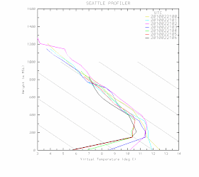
But why no clouds and fog...which often occur in midwinter? The secret is that we have a modest east-west pressure difference (higher pressure to the east), which is producing easterly flow across and down the western Cascade slopes. Such downslope air produces drying and warming. Check out the latest profiler data from north Seattle...you can see the easterly flow.

But too much easterly flow would cause warming due to compression and keep our temperatures up at night. But fortunately for diurnal temperature range lovers the easterly flow is strong enough to keep us clear, but not strong enough to cause too much warming.

These conditions will continue through the weekend...warm enough for tee shirts during the day, but cold enough for frost in the morning at many locations.

Today's Contest: WHO HAS THE LARGEST DIURNAL RANGE?

PSS: There is an article in the Seattle Times today (Saturday) on the early spring

February 17, 2010

Sunny Skies are Good For Olympic Snow


The forecasts for the next four or five days at the Olympic venues is for lots of blue skies and sun. No snow. None.

Believe it or not, this is very good for maintaining snow at Whistler and Cypress Mountains! The worst of the snow melt is over. The games will be ok.

So why is sun and lack of clouds and rain a good thing?

It turns out that the very worst enemy of snow is what they had a few days ago:

Strong winds, low clouds and fog, heavy rain, warm air.

It sounds like the plagues of Pharaoh.

And you know what was probably worst of all? The fog.

Warm air is obviously bad...it causes snow to melt. Strong winds and warm air are even worse, since the wind continuously brings more warm air to melt the surface. But believe or not, warm air is not an efficient melter of snow. It can do the job, but it takes a lot of time. In the business we call the effects of warm air sensible heating.

Now warm rain is not great in the melting department either. Warm rain can bring some heat to the snowpack, and if it refreezes it releases the latent heat of fusion into
the snow (about 80 calories per gram). Yes, heat is released when water freezes...the reach orchardists east of the Cascades spray water on their trees when the temperatures drop below freezing during critical periods.


But you want real melting? If the air is moist, and foggy/cloudy air is nice and moist, the water vapor can condense on the snow and that releases the latent heat of condensation...which is HUGE....around 600 cal per gram. Mega heat source.

And one more thing, clouds and fog intercept and remit infrared radiation leaving the surface, preventing cooling to space.

So the conditions earlier this week at Cypress Mt and lower Whistler were as bad as it gets: strong winds, warm temperatures, heavy rain, clouds to stop the radiation from escaping, fog and humid air for maximum latent heat release.

Today. Lighter winds, cooler air, no clouds or fog. Drier air. No warm rain. Snow reflects much of the solar radiation that falls on it, but is a very good emitter in the infrared. In short, they are in a much better place for maintaining the snow.

February 15, 2010

Ridgodzilla


What is very big, very persistent, brings lots of heat on one side and chills on another? A huge ridge and blocking pattern...or in meteorological parlance-- RIDGODZILLA! And its coming to a winter Olympics in your neighborhood!

Take a look at at series of upper level (500 mb pressure level) charts starting Wednesday at 10 AM. You will notice substantial ridging (higher values of this chart indicate high elevations for this pressure level). Winds are parallel to the lines. Ridging is associated with sinking air and lack of precipitation.


On Friday....the ridge is stronger...now a very strong closed high. And flow and a low are now cutting undernearth into California.


On Sunday...a strong high is over the NE Pacific and a low off of California. RIDGODZILLA! In fact, this configuration also has another name...a REX BLOCK...and is very stable. (Note: this is not named after a king, but some guy named Rex!)

Once the ridging moves in late Tuesday and early Wednesday, precipitation will completely shut off for the region. No snow, no rain. Nothing.

And temperatures will be very different on the two sides of the Cascades...much warmer than normal to the west (due to easterly flow down the Cascades) and cool temps to the east. Lots of sun on the west side. It will feel like April. What else is new?

Reminder: The Northwest Weather Workshop on March 5-6 in Seattle. The big weather meeting for laymen and professionals of the area...

February 13, 2010

Olympics Weather Forecast: Heavy Rain and Fog

Current condition at the top of Whistler: FOG!!

I hate to say it, but for the next day the weather for the Olympics venues will be better for surfboarding than snowboarding. Heavy rain. Thick fog. Not luge, but deluge.

Bringing snow to Cypress Mt.

Lets face it. Our Canadian friends were mighty unlucky...a moderate El Nino at just the wrong time. And El Ninos are bad for snow. Since southern British Columbia weather is going to be a big topic for the next few days, so lets see what is going to happen.

First, as any good forecaster would, lets begin by looking at the latest satellite picture. A deep low center is offshore (see the spiraling clouds), with a juicy looking front in the offshore waters ready to move inland. Not good.


As shown in the figure below, which presents the winds and temperatures at 1 PM today at around 5000 ft, a strong current of warm air associated with the front will be aimed directly towards the Olympic venues. Those triangular barbs indicate 50 kt sustained winds and 4 indicates 4C or 39F. Way above freezing at elevations above nearly all Olympic venues.


And rain..you bet...here is the 24-h rainfall ending 4 AM tomorrow (Sunday). Looks like 1-3 inches of rain, not snow, at Cypress Mt.


Warm rain with fog and strong winds. The ABSOLUTELY WORST conditions for maintaining a snowpack.

Now let me show a forecast product I have never used on this blog...a time-height cross section (for Vancouver, CA). A very important tool for meteorologists. The x axis is time...in GMT: 1312 is today at 4 AM, 1400 is today at 4 PM, etc. The y-axis is pressure in millibars. Lower pressure is higher in the atmosphere. 850 is around 5ooo ft, 700 around 10,000 ft. The shading is relative humidity. Darker green...above 90%. Think clouds and fog. Red gives temperature (in degrees C) and the winds are shown by those barbs (they point to the direction the wind is going, big tail lines-10 kts, 3 of them-30 kts, etc). You are now trained.

What do we see? First, the air is saturated and moist until tomorrow at 4 AM Sunday. Strong winds developing from the south. The freezing level climbing to 6000 ft or more.

WETAPPOCOLYPSE! FOGARMAGEDDON!

What will happen when all the sawdust and hay base at Cypress Mountain gets saturated? I don't want to even think of it. The first snow/sawdust avalanche in history?

Anyway, it is going to be a bad day at the Olympics today. But you can see that after the front moves through later tonight the air will dry out considerably and the freezing level will drop to below 5000 ft. Helpful for Whistler but still way too warm for Cypress Mt. The only snow there are going to get is snow they truck or helicopter in.

Whistler has plenty of snow, even though the lower elevations around the village are marginal. And there will be more high elevation snow this week.

But there is one weather feature that is really going to impact Northwest and Olympic weather later this week. It looks like a HUGE ridge will develop on Thursday through the early weekend. No precipitation at all. Warm temperatures in the lowlands. Sun. And our gardens will surge forward again.

February 12, 2010

The Northwest Weather Workshop

On March 5th and 6th there is the Northwest Weather Workshop, the annual gathering for local folks interested in Northwest weather. There is always a wide range of interesting weather talks and roughly 70% are quite accessible to laymen. Everyone from local TV weather and university types, to NWS forecasters, private sector meteorologists, and weather enthusiasts. The meeting takes place in north Seattle at the NOAA Sand Point facility.

The meeting is open to everyone, but you should register if you are going. There is also a Friday night banquet, with the speaker this year talking about weather and wine growing. Generally, the meeting starts at 1 PM Friday and goes to about 4 PM on Saturday. The agenda does change a bit in time (generally add a few talks). In fact, if there is anyone interested in giving a talk on agriculture/gardening and weather, send me an email.

For more information about the meeting and registering, check the official website:

http://www.atmos.washington.edu/pnww/index.php?page=main

February 09, 2010

Why dense morning fog is a good sign!


You wake up and look outside only to find amazingly dense fog. Like the example above. You can barely see across the street, if that. Time to get depressed about another cloudy day? Pull the covers over your head and think of Maui? No way! Super dense fog is ironically a very good sign...one suggesting a sunny day ahead. Get out your sunglasses and your favorite recreation gear...you will probably be able to use both.


How can this be true?

Super dense fog, like what we had two days ago, requires intense cooling near the surface. Cooling that brings the low-level air to saturation to produce a large number of fog droplets.

And the most effective means of delivering such intense cooling? Intense infrared radiational cooling to space from the surface. To get such cooling you need a lack of clouds and relatively dry air aloft. Why? Clouds greatly lessen surface radiational cooling because they intercept some of the radiation moving upwards and send their own radiation back down to the surface. Dry air is good, because water vapor in the atmosphere can act like clouds, but to a lesser extent. The above conditions...lack of clouds and dry air aloft...are often produced by high pressure aloft, with sinking motion. High pressure is also associated with low winds.. which is good for fog, since strong winds can mix dry air down and prevent fog formation.

So relatively clear skies aloft, high pressure, and low humidity allow strong radiational cooling from the surface, which cools the ground intensely. The ground in turn cools the air right next of it. Strong cooling can bring the air temperature down to the dewpoint and fog forms. Dense fog.

This kind of fog is generally quite shallow because it is dependent on the strong surface cooling, so eventually the radiation from the sun can burn it off.

Thus, dense fog implies high pressure, lack of clouds aloft, and a good chance for a private sunny day...like Tuesday.

Want to see the changes in temperatures as this mechanism occurs? Below are temperatures in Seattle from 4 PM to 10 PM on Monday night...see the cooling develop at the surface?

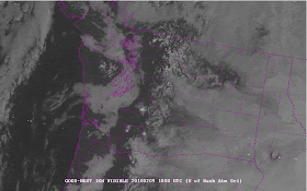
We can watch the fog burn off from space! Below are two high-resolution satellite pictures...one at 10 AM, before the fog burned off, and the other in mid-afternoon. Note how much of the Puget Sound lowlands became completely clear. Another beautiful winter afternoon in Seattle! By the way, as noted by one of the comments below, fog tends to burn off from the outside in...something we learned in the 70s after the advent of high frequency visible satellite pictures.


In the middle winter (December and January) the sun is sometimes so weak that the dense fog never burns off. But now that we are in February the increasing sun strength makes such a depressing situation less likely. But even during those super-foggy days of mid-winter another strategy is available to get your sun...go up! Get above the shallow, cold fog layer Even modest mountains (Tiger or Cougar Mts) are enough. On these days hiking in the foothills or the Cascades can be warm, sunny and glorious, while Seattle is in the murk.

I have a detailed explanation of the above in my book...with pictures of an ascent up Cougar Mt. during such a surface cooling event.

My next blog will be on the inside story of the local math "wars", including the Superior Court Decision telling Seattle to rethink its textbook selection, another court decision throwing out the Discovering Math publisher's lawsuit against the State of Washington, the cancellation of a Bellevue Math night to keep its citizens in the dark, and some very good books selected by Lake Washington School District. And the impact of the Obama administration's math education policies. And much, much more! This may take two blogs....

February 08, 2010

Humility and Forecast Busts

Weather Prediction is a Stern Master

Weather prediction is a business that promotes humility, and nothing brings one down to earth like a forecast failure--known as a "forecast bust" in the business. Major forecast failures are less frequent than even a decade ago...mainly due to a huge increase in satellite data and better computer models... but they still occur with discomforting frequency!

The most failure-prone forecasts are the most long-ranged ones...such as seasonal predictions done months in advance. Want a primo failure? In the fall of 2008, we were in a neutral ENSO (El Nino-Southern Oscillation) year and the long-range prediction was for a stormy, but normal winter. In December, there was an abrupt, unexpected turn to La Nina, with a change to cold and snow in the NW that took down our erstwhile mayor. Complete failure....embarrassing! (for both forecasters AND the mayor).

In contrast, this year everything went smoother. Moderate El Nino...with expectations in the NW for warmer and drier than normal conditions after January 1. Almost on schedule it turned warmer, but initially wetter. January was the warmest on record (much more than we expected). On the other hand the weather pattern of the last 3 weeks have been classic El Nino, with a split flow (jet stream going into AK and CA) and southern CA getting pummeled by strong storms. Passable grade?

Sometimes the most difficult forecasts are when there are weak systems floating around and the flow is modest. Like this weekend.

On Friday, both the NWS and I were going for essentially the same forecast. Mediocre Saturday as a weak system was coming in and a much better (dry, sun) on Sunday. The truth was almost reversed. Saturday became warm and sunny and Sunday was cloudy with rain in the morning.

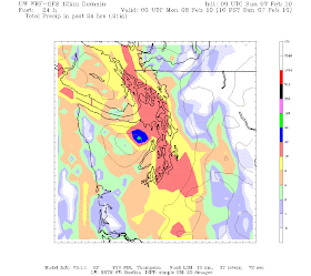
Below are three computer forecasts for 24-h precipitation ending 4 PM on Sunday.

The first was made Friday morning. No rain except for the coast!

The second was made Saturday morning. Rain much more extensive.

The third was made Saturday night. Even more rain.

So you can understand how we went wrong on Friday. And you can see how the forecasts tended to get better as we got closer in time.

But my forecast failure was completely unnecessary (and yes so was the NWS's)

There is another way of forecasting...the right way...using a collection of forecasts..called ensembles. Run and use many forecasts all starting a bit differently or with slighly different model physics. If ALL of them are dry, then you go dry. If half of them are wet, 50% might be a good forecast. Etc.

Well, I sheepishly looked at the UW emsemble forecast system Sunday and sure enough some of the ensemble members on Friday were much wetter (see the ensemble member based on the Canadian model). And putting 8 members together the probability of precipitation for the two 12-h periods covering 5 PM on Saturday to 5 PM on Sunday (see graphics) had significant probablities of rain (at least 50%). So I SHOULD have forecast a significant chance of rain on Sunday. No more rushed forecasts for me. Until next time.

So the moral of the story...don't look at a single forecast model output. Look at many! Think probabilistically. Even though this technology is under development here at the UW, old habits are slow to die!


February 05, 2010

Why was January so warm? A detective story.


As I mentioned in an earlier blog, January 2010 was the warmest on record in Seattle (back to 1891) and one of the warmest years at virtually every western Washington site with long records. This is a major record. The big question is why? What was so extraordinarily unusual last month?

Yes, it was an El Nino January and they tend to be warm...but why should this be the warmest of ALL of them?

Global warming? No way, the East Coast is having a cold year! And in any case, the West Coast is the place where global warming is weakest and most delayed in the U.S. (reason--our proximity to the slow to warm eastern Pacific).

No it is something else...the unusual alignment of several factors the provides the explanation. And the answer also explains why yesterday got to 57 and today 58F!

This is an interesting detective story. We start with a year with general El Nino conditions--one in which cold air is pushed way to our east. But it took something else--in fact two something elses.

Look at the temperature and precipitation records below you notice a few things. First, the temperatures often were higher than than the average maximum, and we NEVER dropped to the average minimum. The first half of the month was fairly warm and very wet. Clouds held in, preventing infrared nighttime cooling. Southwesterly flow brought in warm air (yes, sometimes we had pineapple express conditions). Hawaii came to you.

But then we dried out and then the temperatures got even WARMER. And is was this spike to April temperatures between January 15-21th that really threw us over. It was also during this time that low pressure records were set over much of the west. The jet stream was way south of us...over CA and northern Mexico. Normally, we are cold when the jet is that far south. What could have done it?

Red is temperature, light red straight line is average max, blue min

Red is cumulative precipitation, blue is climatological average precipitation.

The answer is revealed in the next two weather charts. They are both for 4 PM on January 17th (0000 GMT January 18). The first is for a level about 5000 ft above the surface (850 mb) and the second shows sea level pressure at the same time. The pattern they show was very persistent during period of the warmest temperature. You will notice a low to the southwest of Washington and strongest flow going into California. Wind flows roughly parallel to the solid lines, with southwesterly flow going into CA and southern Oregon, and southeasterly flow over us.

That was the secret! Warm air was moving into off the ocean, circling around to our south and east and then moving into western WA from the SE. As the air descended the Cascades, the air further warmed by compression. If the low had shifted south or north we wouldn't have the perfect combination of southerly flow that sank over us and warmed us further.


And as long as we are talking about heat, January 2010 was one of the warmest on record worldwide based on satellite sensors. Check out the figure:

Why so warm? A major factor is the moderate El Nino we are in. Plus, the earth is relatively warm from the global warming of the past several decades.

And another major item: the sunspots are back on the sun. There are now 22 of them. There was a lot of concern when sunspots didn't return on schedule, but belatedly the sunspot cycle has started.

February 03, 2010

Mis-communicating Global Warming

As many of you know from my previous blogs, I believe that anthropogenic global warming (AGW)--warming due to mankind's emissions of greenhouse gases--is a very serious issue. The world's climate will warm up substantially if we continue our current course. I also believe that there has been considerable hype of past and current effects of man-produced warming, and not a little exaggeration in some quarters) of the AGW effects during the next few decades. I believe my profession has not been clear enough about the mechanisms of climate change and have not provided sufficient information on the uncertainties in our predictions.

But sometimes I am driven to distraction by the crazy claims of some individuals and organizations who feel it is necessary to "enhance" the threat or to make dire threats without any scientific basis. Perhaps such individuals and groups do it out of some idealistic drive to "save the world," but in reality they are damaging the credibility of the scientific community. And the media who mindlessly repeat this fluff deserve particular opprobrium.

Want an example? A recent release by the National Wildlife Federation is a prime example of misinformation (http://www.nwf.org/Global-Warming/What-is-Global-Warming/Global-Warming-is-Causing-Extreme-Weather/~/media/PDFs/Global%20Warming/Reports/NWF_WinterWeather_Optimized.ashx).

In this wacky report they claim that global warming is causing "oddball" weather across North America. Check out this figure from their brochure:

Heavy rain in the Northwest. A sign of global warming!
Lack of snow in Colorado: Global warming!
Record snowfall back east: Global warming.
You get the message. These folks blame every type of extreme weather, cold or warm, dry or wet, snowy or not....on global warming produced by mankind.

Now as someone who is working on this very issue and has read the literature extensively, let me tell you that this is all nonsense. Furthermore, none of this has passed the review process to get into the refereed journals.

Now this would be worth a few chuckles if no one paid attention to such scarester material, but I am afraid the mainstream media picked it up and published it. Hard to believe, but true. The Washington Post ran it, plus dozens of newspapers around the U.S. Media outlets such as MSNBC gave it air time. This is not the first time that our national media picked up baseless press releases or scarester stories, and probably won't be the last. For example, there was an unreviewed article in 2007 that stated that Chinese pollution was making Pacific storms stronger. This one got on the front pages of newspapers throughout the U.S., including the Seattle Times. And a quick read revealed that work was baseless, and it never got into the refereed literature.

The U.S. mass media does not have the time or interest in carefully screening the material they print or show, so the unfortunate message is: don't believe everything you read and view. Check it out yourself if you have the time.

Finally, Global Warming hype is found on plenty of blogs. My recent favorite is one describing the recent major low off the West Coast as a "Frankenstorm"--the kind that will be more frequent as the earth warms due to mankind's influence:
http://climateprogress.org/2010/01/26/preparing-for-frankenstorms-the-most-powerful-low-pressure-system-in-140-years-of-record-keeping-slams-the-southwest/ It is completely without any basis in fact.

Now today's blog has taken on the global warming scaresters and hypers, but even more ridiculous are the claims of some organizations and websites that that GW is some plot by the liberals and leftists or that there is no science between the threat. But this is for another time.

Finally, let me recommend a wonderful lecture by one of the UW's premier scientists and public communicators, Peter Ward. Last week he gave a talk on what paleontology teaches us about the threat of CO2-induced climate change and at the end he provided a stirring call to arms regarding the need for more emphasis on public outreach by the scientific community. I highly recommend you view his presentation:
http://www.uwtv.org/programs/displayevent.aspx?rID=30829&fID=513

This guy is a local treasure and his books are wonderful.

February 01, 2010

Records Broken (UPDATED) and Alligators in the Duwamish


Its official!

JANUARY 2010 WAS THE WARMEST JANUARY ON RECORD IN SEATTLE INCLUDING THE RECORDS FROM THE FEDERAL BUILDING THAT GO BACK TO 1891. Yes, 1891.

This is a major new record.

Seattle had a mean temperature in January of 47.0F. The old record was 46.55F in January 2006. Take a look at this table of Seattle-Tacoma Airport observations. The fifth column has the daily deviation from normal. NOT ONE DAY WAS BELOW NORMAL. The warmth had a multiplicity of origins: southwest flow and clouds during the first half of the month, easterly flow with downslope warming in the second half, and a lack of cold air over the region. The latter half of the month was dominated by El Nino-like patterns with much of the precipitation going in south of the NW.


But there's more!

THE AVERAGE HIGH TEMPERATURE IN SEATTLE FOR
JANUARY WAS 51.5 DEGREES. THIS IS THE SECOND
WARMEST AVERAGE HIGH TEMPERATURE FOR THE
MONTH OF JANUARY. THE RECORD AVERAGE HIGH
TEMPERATURE FOR THE MONTH OF JANUARY
IS 52.0 DEGREES SET IN 1995.
So we were very close.

THE AVERAGE LOW TEMPERATURE FOR THE MONTH
OF JANUARY WAS 42.5 DEGREES. THIS IS THE
WARMEST AVERAGE LOW TEMPERATURE FOR THE
MONTH OF JANUARY BREAKING THE RECORD OF
42.3 DEGREES SET IN 2006. THE NORMAL AVERAGE
LOW TEMPERATURE FOR THE MONTH OF JANUARY
IS 35.9 DEGREES.

And UNBELIEVABLY SEA-TAC had a warmer average
temperature than Tallahassee, Florida. (thanks to climo man
for noting this).

Next thing we will have to be worrying about alligators in the
Duwamish waterway!
Salmon taste good! I like this place!

BELLINGHAM TIED THE RECORD FOR THE WARMEST JANUARY.


OLYMPIA WAS THE SECOND WARMEST SINCE 1948 (lost by .3F)
QUILLAYUTE WAS NUMBER TWO (Lost by .2F)
HOQUIAM WAS NUMBER TWO.

Eastern Washington was also quite warm, but generally didn't hit
too many records.

Spokane had the 8th warmest January out of 130 years
Moses Lake was the 5th warmest out of 48 years
Wenatchee had the 10th warmest out of 84 years.

Very little snow on the east side...and far less of the typical low clouds.

Today while walking through the UW campus I was surprised to see a
number of the cherry trees in full blossom and many daffodils in flower.
But no alligators ...yet.

Biking along the Sammamish River Trail in the Future?