November 30, 2010

Deciding on Weather Instruments

The Davis Vantage Pro is an example of a high quality instrument package at a reasonable price

One of the most frequent questions I get, particularly during the holiday season, is about purchasing weather instruments. Which are the good ones? How much should one pay?

The good news is that high quality weather instruments are available in all price ranges, with some amateur gear approaching professional quality. And the electronics of some are quite amazing.

There is no more entertaining and satisfying hobby than taking your own weather observations. You get tuned into the changing environment in a very different way than passively watching the TV weather segment. And it is for YOUR location, which is probably very different than Seattle-Tacoma Airport, Portland, or some other major city airport.

Did you know that the founding fathers--like Jefferson and Washington--were weather enthusiasts that took weather observations much of their lives? And look where it got them!George Washington took daily weather observations until the week before he died.

So lets say you are on a tight budget. Many of us are these days. No problem. My suggestion: get a really good rain gauge. A beautiful model used by a group of cooperative observers (CoCoRahs) is available for $25. plus shipping from http://www.weatheryourway.com/cocorahs/index.htmlVery accurate and durable. Or you could get a truly excellent cloud chart like this one for $5-10 dollars:Such charts are available from many online vendors and some local outlets and will help you learn the cloud types. And those inexpensive digital thermometers that are sold in many stores (e.g., Bartell's, Fred Meyer,Home Depot, etc.) for roughly $10-20 are really fairly accurate. Many are wireless .. making installation easy. I have three of them!
Remember, temperature sensors should be out of the rain on the northern side of your home or apartment. Temperature is ALWAYS measured in the shade. Rain gauges should be in the open AWAY from roofs and trees.

But what if you want to get a full-fledged weather station and even want to interface it to your computer and have the data available on the web? Systems that will give you wind speed and direction, temperature, humidity, pressure and rainfall. No problem...you can have this at a steeper, but still reasonable price.

Lets start with the best. If you want to invest in the very best, instrumentation that is near professional in quality and that will last for years, you can't go wrong with the Davis Vantage Pro series (see top picture). My colleagues and I have been impressed with the quality of this instrumentation and its ability to interface to computers and the internet. The cost? $350-$700 depending whether you get wireless or wired and the instrumentation options. If you have the cash get an aspirated (internal fan) temperature shelter/enclosure.

Davis has just come out with a cheaper (though not as good) line..Davis Vantage Vue. And then there is cheaper, less accurate gear from firms like Oregon Scientific, La Crosse, and Ambient. Sometimes these weather stations are even available in COSTCO for under $100! These would be good starter sets and perfectly serviceable if you don't care if your pressure is off by a few mb and the wind speed is in error by a few knots. They may also lack the interfaces to connect to your computer.

This complete weather station only costs $60 from Ambient Weather!

A company, Ambient Weather, sells many of these units (as does Amazon), and has a nice website, with comparisons of the quality of the various units:

http://www.ambientweather.com/
http://ambientweather.wikispaces.com/Weather+Station+Comparison+Guide

Nautical supply houses also sell weather instruments, but prices tend to be high.

And, of course, any of these weather stations would be enhanced with a certain book on northwest Weather, noted in the upper right of this blog, but it would be inappropriate for me to discuss that any further!

Finally, I should note that the availability of these great weather systems and software allowing access via personal computers has been a revolution for my field. THOUSANDS of such stations are online in real time and can be viewed at sites such as www.weatherunderground.com. The biggest problem is poor siting...many people are not careful where they place the sensors, resulting in bad data.

PS: We are going to have absolutely boring, benign weather during the next five days. Not much precipitation. No lowland snow. Little wind. No heavy rain...even some sun! Dull! Good time to install a weather station!

November 27, 2010

New Web Weather Applications

Now that the weather has calmed down a bit and nothing serious is on the weather horizon (except for some good snowfalls in the mountains), its a good time to talk about some new powerful local weather websites.

New UW Weather Radar Interface

The first is a new weather radar website hosted by the UW. Created by Harry Edmon (the atmospheric sciences dept computer guru) with lots of input from Dale Durran, the department chair, this new local radar website combines all the local weather radars...both U.S. National Weather Service and the Canadian Environment Canada radars...into one seamless package (see sample below):

And when the new Washington coast radar becomes available, it will be added. You have nice control of the loop length and the opacity of the radar echos, as well as the loop speed. And an online tutorial about radar imagery! This site, with some coffee and donuts, would make an entertaining diversion!

How to get to it? Here is the link (or click on the image above)

http://www.atmos.washington.edu/weather/radar.shtml

WINDWATCH

How about a site that accesses the latest UW high resolution model and National Weather Service local forecasts, looking for high wind situations and displaying the information with a nice interface. This is WINDWATCH. WINDWATCH was sponsored by Seattle City Light (SCL), who is interested in accurate high-wind guidance for obvious reason, and the idea came out of discussions with SCL staff (the now retired Wing Cheng played a major role, as did Karyn Grob). Take a look at the front page of WINDWATCH

Windwatch looks out 72 h. You can view a look of sustained winds or wind gusts, with the winds indicated by wind vectors and shading (for winds exceeding 30 mph). A close in city or larger regional view are available. The initial loops is for the UW high-res model, but you can easily change to the NWS human-based forecasts by using the tab. But the fund doesn't stop there...if there is a NWS wind warning a warning tab turns red...select it and you see what the warnings are. Or you can view the NWS local (zone) forecasts or the NWS discussion where you can understand the lead forecaster's thought process. Or try the alert tab, which will lay out all the periods...color-coded...for which the winds are predicted to exceed 30 mph.

Windwatch has another capability...when the forecast winds are predicted to be strong the software sends emails to Seattle City Light staff (or anyone else we want).

Finally, this site shows the winds above Seattle (the Profiler Tab). Although this site was designed with Seattle City Light staff in mind, it should be very useful for anyone worried about strong winds. We have considered adding a module that it will email local TV stations about the locations of the absolutely strongest winds so they can position their staff for maximum weather-hype effect.

Anyway, here is the link (or click on the windwatch image):
http://www.atmos.washington.edu/SCL/

November 25, 2010

Its Snowing


Sitting in Seattle right now, its 30F and big aggregate snow flakes are slowly drifting down outside of my window. That plus a nice cup of tea and a successful forecast--life doesn't get much better than that.

But it won't last unfortunately.

Right now a warm frontal zone is moving in overhead...that is producing the precipitation, but it is also producing warming aloft over the region. Here is the latest infrared satellite picture. You can see the main front offshore (band extending SW-NE) and the warm front is the stubby appendage extending NW-SE over us. It will only give us 3-6 hr of precipitation.
Here is the latest (6:42 AM) radar--in clear air mode, because the precipitation is light. You can see the precipitation (snow) and also an area just east of the Olympics is not getting anything. The reason--there is rainshadowing (really snowshadowing!) because the flow aloft is out of the northwest. So the folks on Kitsap with all the power outages are not getting much snow....there are balances to life evidently.
Temperatures are warming aloft. Here are the hourly temperatures soundings (temp plot in the vertical) here in Seattle from the profiler. These temperatures are really virtual temperatures (don't ask...just subtract about 1C for regular temperature, and yes they are in C). Height in meters. You are looking at plots starting at midnight (2508) to 6 AM (2514). The clear message is that temperatures are warming and we now have a layer near freezing in the lowest several hundred meters--this is a layer of precipitation melting. These are wet snowflakes.Here is a different view of the temperatures and winds above us from the profiler...called a time height cross section:You can see the warming southerly and southwesterly flow (look at the wind barbs) above us and warming is evident..yesterday above us the virtual temperature was -8C at 500 meters, now it is -1C (really -2C actual temperature). This snow is not going to last long..a few hours at most. Clearly, the warming is happening a few hours faster than expected by the models last night. So I would not give the snow much more time now...hour perhaps over Puget Sound. But it could hold in longer over NW Washington, where cooler flow exiting the gaps will maintain the snow for a few hours more.

This is good for DOTs and holiday travel around the west....temperatures are now climbing above freezing and wet snow will end in a few hours. Good for holiday travel. And the end to an early major cold snaps around here--one that will go into the record books like 1955 and 1985.

November 24, 2010

Snow Update

Yes..it looks like more snow..but only for a few hours...here is the latest WRF high resolution results for the 24-h snowfall ending 4 PM tomorrow. Snow over central Puget Sound (maybe an inch) and several inches over portions of NW Washington. The NWS concurs on this. Hopefully won't mess up this forecast! The mountains, particularly the north Cascades, will get lots of snow too. The lowland snow is mainly from roughly 6 AM through 10-11 AM and then it turns to rain. Could have transitional periods of sleet and freezing rain. If the latter, be really careful if you have to drive. The roads in Seattle are really much better now (I saw TWO SDOT trucks in short drive today, hitting the roads with lots of salt!)

Freezing rain occurs when rain falls into a subfreezing air level and cools below freezing. YES, you CAN have liquid water when temps get to freezing and below. It is called supercooled water. Clouds have lots of it! When freezing rain hits a cold surface it freezes on contact. By noon it all should be over....

The Thanksgiving Forecast

Major changes are going to happen in the next day and the end of the cold temperatures and icy grip are in sight....but there is much to get through first.

You can see the changes in the sky. Clouds moved in overhead accompanying warming aloft.

An interesting observation...temperatures warmed a bit in the middle of the night as the cloud spread overhead. The temps at Seattle-Tacoma Airport show this:
Nothing changed at the surface. Why? The reason is that clouds emit infrared radiation better than the clear air, so when clouds came in aloft there was more infrared radiation directed down to the surface...and thus warming.

There has been some snow flurries with the clouds aloft (you can see the light stuff in the radar below)
Ok, lets talk about the forecast. This is a MUCH easier forecast than Monday--fairly straightforward system coming off the Pacific without the coastal troughing/low generation that made the Monday forecast so uncertain.

First, what we are SURE about? It will warm up tomorrow afternoon. The ice and snow will rapidly melt late tomorrow and Friday. And rain is coming back.

So lets talk it through, including where the uncertainties lie.

Today the temps will stay in the 20s, and with little sun roads will not improve much. Keep in mind that ice is much less slippery in the lower 20s than in the upper 20s or near freezing. So in some sense conditions are much better now than on late Monday or what will occur as melting starts. And here in Seattle most of the major streets are in good condition.

Tonight the air will begin warming more rapidly aloft, but it will take time to scour out the cold dense air near the surface. Our computer models tend to mix the cool air out to quickly...and we know that. Anyway, warm- frontal precipitation should enter the region between 6 AM and 10 AM. It could well start as light snow. But by noon or early afternoon it should switch to rain and decrease in intensity. Good chance the precip will stop in the later afternoon and early evening. The main cold front comes in Friday morning.

There should be very strong winds over NW Washington and along the coast later on Thursday and Friday morning.

So the bottom line:

today...what you see is what you get.
tomorrow morning will have the potential for some light am snow and increasingly slippery conditions of melting ice.
By late Thursday the warming should improve conditions substantially.
Friday we will transition back to normal with rain,typical conditions, and wind in the normal locations.

Just in time to go shopping for black Friday. Hopefully METRO will turn its bus-tracker website back on (much more that in a future blog!)

November 23, 2010

Amazing Videos and the Latest Snow Totals

Last night there was blizzard-like conditions around our area...with the Hood Canal and environs being particularly hard hit. Check out this video from Silverdale on the Kitsap Peninsula courtesy of Dale Ireland. Their power is still out...


http://www.drdale.com/lapse/snow101122canon.mov

The conditions were treacherous last night on the city hills...and it didn't take a lot of snow/ice to make the roads impassable. This is one of the most amazing videos I have seen on this topic and the music really works:


http://www.youtube.com/watch?v=rhZCyQ3emQg

Multiply this by all the incidents across the city and the state for the entire winter and it is clear that roadway ice is the most serious meteorological threat of all!

I can help myself..this is from an earlier Portland storm and is beyond belief (provided by natchrl8r):
http://www.youtube.com/user/SuperVid4u#p/a/u/2/YmVh56_lz7w

Perhaps what we need is a law making it ILLEGAL to drive on inclined streets in dangerous conditions.

Tonight the temperatures will head down to the lower teens and even single digits in the western side of the state. And tomorrow will be sunny, but cold.

Thursday will be the transition day to warmer temperatures...but will we get snow as the warm air comes in? Will examine that tomorrow.

And finally, the NWS has released the latest snow totals from the storm. It really hard on the north side of the Olympics:

..SNOWFALL TOTALS THROUGH TUESDAY MORNING...

SNOWFALL TOTALS LESS THAN 1 INCH WERE GENERALLY NOT LISTED.
COCORAHS OBSERVATIONS ARE TAKEN ONCE A DAY...GENERALLY BETWEEN
5 AND 8 AM.

SNOWFALL DEPTH OBSERVATION
(IN) (IN) TYPE

CLALLAM COUNTY

SEQUIM 5.4 SW 13.0 15 CO
ELWHA 1 ENE 11.0 SP
PORT ANGELES 2.5 SSW 9.7 14 CO
SEQUIM 5.5 NNW 8.7 CO
MOUNT PLEASANT 4 WNW 7.6 SP
N COVILLE (THRU 12PM) 7.0 SP
FORKS 6.9 WSW 1.0 2 CO
_______________________________________________

KING COUNTY

NORTH BEND 3 ESE 13.0 SP
NORTH BEND 2.8 SE 9.5 12 CO
ENUMCLAW 4 WNW 7.0 SP
RENTON 3.2 E 7.0 7 CO
NORTH BEND 5.4 ESE 6.3 11 CO
ISSAQUAH (EL 300 FT) 6.0 7 CO
AUBURN 8.2 SE 5.5 8 CO
LAKEKLAND NORTH 5.1 CO
COVINGTON 1.1 NE 5.0 CO
NEWPORT HILLS 1.9SSE 5.0 CO
RENTON 3.6 SSE 4.7 CO
KENT 1.7 SSE 4.5 CO
ISSAQUAH 3 SSW (EL 1375 FT) 4.5 NW
AUBURN 1 S 3.5 4 SP
SEATTLE 3.0 WNW 3.0 CO
SEATTLE 5.1 SE 3.2 CO
BELLEVUE 0.8 S 3.0 CO
SEATTLE-TACOMA AIRPORT 2.7 MT
SAMMAMISH 1.7 NNE 2.5 CO
KIRKLAND 0.8 SW 2.4 CO
ISSAQUAH 3.6 NW 2.3 CO
FEDERAL WAY 2.5 NNE 2.3 CO
KENMORE 2.0 NW
MADISON PARK ( SEATTLE ) 2.0 NW
NWS SEATTLE 2.0 MT
SHORELINE 1.7 NW 1.5 CO
_______________________________________________

SNOHOMISH COUNTY

MARYSVILLE 4 N 5.0 SP
LYNNWOOD 3.0
CLEARVIEW 0.8 SW 3.0 CO
STANWOOD 0.7 N 2.5 CO
LAKE STEVENS 0.9 NW 2.3 CO
BOTHELL 4.9 NNW 2.0 CO
EVERETT 3.6 S 2.0 CO
ARLINGTON 1.7 NNE 2.0 CO
MILL CREEK 2.0 NW
EDMONDS 2.0
BOTHELL 4.9 NNW 2.0 NW
MONROE 1.8
BRIER 0.8 NE 1.5 CO
_______________________________________________

PIERCE COUNTY

EATONVILLE (EL 800 FT) 13.0 17 SP
EATONVILLE 7.4 NNW 9.8 12 CO
PUYALLUP 5 E 6.5 SP
FREDERICKSON 5 SE 6.0 SP
PUYALLUP 2.1 NW 4.0 CO
SUMMIT 1.1 WSW 4.0 CO
PARKLAND 0.9 NE 3.9 CO
STEILACOOM 0.4 NW 2.5 CO
PUYALLUP 2.1 ESE 2.5 4 CO
TACOMA 3.1 NW 1.0
_______________________________________________

LEWIS COUNTY

ELBE 5 SSE (MINERAL) 10.0 SP
CINEBAR 1.7 SW 5.5 8 CO
ONALASKA 2.8 NE 5.1 8 CO
WINLOCK 0.5 W 4.7 CO
MOSSYROCK 3 ESE 4.0 SP
_______________________________________________

MASON COUNTY

SHELTON 5.2 NNW 6.5 CO
SHELTON 6.1 E 5.0 CO
POTLATCH 2 N (THRU 1230) 4.0 SP
SHELTON 2.8 ESE 2.9 5 CO
_______________________________________________

KITSAP COUNTY

KINGSTON 2.7 SSE 6.0 CO
INDIANOLA 0.9 NNW 4.8 CO
BREMERTON 5 SSW (GOLD MTN) 5.0 SP
SUQUAMISH 4.0 CO
KINGSTON 1.7 WNW 3.7 CO
BETHEL 5 SSE 2.8 SP
BREMERTON 2.8 NE 2.5 CO
_______________________________________________

ISLAND COUNTY

LANGELY 4.1 NW 2.8 CO
COUPEVILLE 0.5 WNW 2.1 CO
FREELAND 1 WSW 2.0 SP
_______________________________________________

THURSTON COUNTY

ROCHESTER 1.3 NNE 4.0 5 CO
YELM 6.3 S 3.9 6 CO
OLYMPIA 1.3 S 3.2 CO
OLYMPIA 3.1 SSE 2.2 3 CO
OLYMPIA 7.0 NNE 1.8 CO
_______________________________________________

JEFFERSON COUNTY

CHIMACUM 1.8 SW 4.5 CO
PORT HADLOCK 0.7 NW 4.5 CO
PORT TOWNSEND NW 1(THRU 1PM) 4.5 SP
PORT TOWNSEND 2.2 W 4.1 CO
CHIMACUM 5.1 S 4.0 CO
PORT TOWNSEND 4.6 S 3.0 CO
_______________________________________________

SKAGIT COUNTY

ANACORTES 4.9 S 2.4 CO
CONCRETE 4.9 ESE 1.6 4 CO
MOUNT VERNON 1.1 E 0.8 CO
_______________________________________________

SAN JUAN COUNTY

LOPEZ ISLAND 2.2 WSW 1.0 CO
FRIDAY HARBOR 2.8 S 1.0 CO

_______________________________________________

GRAYS HARBOR COUNTY

ELMA 0.5 W 1.0 2 CO

MT = AUGMENTED ASOS OBSERVATION
CO = COCORAHS
SP = SKYWARN SPOTTER
NW = NWS EMPLOYEE

$$

DAMICO/FELTON
WEATHER.GOV/SEATTLE


November 22, 2010

Winds

The snow is still going on..although generally light--and will end during the next 4-5 hrs. The reason is that the circulation aloft is right above us.

The winds tonight have been extraordinary...particularly over the NW portion of the state and over Puget Sound. Gust have been as high as 40-55 mph at Bellingham, Friday Harbor and the East Strait Buoy, and with temperatures in the lower 20s, the wind chills are below zero. Here is the latest gusts from Friday Harbor...just amazing...over 50 mph.


There have been substantial number of trees and branches knocked down by the strong northerlies and several power outages have been reported (see example below from city light)


I biked home today and it was an intense experience--rarely bicycle in blizzard, and sometimes whiteout, conditions.

The big issue now is cold, wind, and icing. The northerlies pushed down late this afternoon and the associated cold temperatures rapidly froze up bridges, since there is little conduction of heat from below. With temperatures in the mid to low 20s and dry air the slush, snow, water mixture at the surface will completely freeze tonight, except where sufficient deicer has been applied.

Tomorrow should be clear and sunny...but cold. However, if the snow is removed from roads then the sun will finish the melting and the highways will improve rapidly.

Even more interesting


Thing are really getting interesting now. See the surface chart above at 2 PM. The low center is MUCH stronger than the model's predicted. Around 999 mb and is now located over the Olympic Peninsula...as a result southwesterly winds are picking up in the south Sound and the northerlies are strengthening to the north. The collided airstreams are causing enhanced vertical motion and precipitation. Look at the radar...a line of very heavy reflectivities...and snow intensities has formed south of Seattle. Strong northerly flow is now striking the northern portion of the Olympic Peninsula and very heavy snow is falling on its northern side (6-10 inches so far in some places!!!!)


The show is not over yet.

Here is a neat time-lapse of snow in Silverdale. Looking west across Hood Canal

http://www.drdale.com/lapse/lapse101122.mov

Courtesy of Dale Ireland

Humility

One thing you learn in this business fast is humility.

Clearly, our model forecasts have had some problems and now the situation is now becoming clearer. Precipitation has spread was more intense and spread farther north than predicted. But the biggest threat was never this morning... all the models had only a few flurries over us. The 1-3 inch NWS forecast was for this afternoon and that is what we have to watch now. And a power glitch took out the UW modeling system last night..bad timing.

This is when forecasters make mistakes for psychological reasons...miss one way and overcompensate the other.

The key feature is a low center along the coast. Last night's model either had it too weak or mispositioned. Here is the latest surface observations at 10 AM. Click on the image to expand. A low center (roughly 1004 mb) is along the NW coast. If it moves SE we could get the set up for big lowland snow...moisture off the ocean circulates inland, being met by cold air coming down from the north. This cold air is driven by the difference in pressure between the cold, high over BC and the low pressure center.The NWS is clearly worried about this scenario and have put out a heavy snow warning for the lowlands. The latest high-resolution run--which has the coastal low better but not perfect-- shows the following:We are talking about 2-4 inches south of the city, with roughly 1-2 inches on the north side. More as you head towards the Cascades and south.

Can you believe this short-term forecast? The coastal low is clearly stronger and farther north than predicted by ANY of the models. I really wish we had the coastal radar now...it would provide a clear view of what we are dealing with...would have made a huge difference now.

The 11 AM surface map...just available shows a 1002 mb low over the NW tip of the Olympic Peninsula and the latest visible image show VERY unstable air offshore. If the low goes south of us and draws some of that cold, unstable air in...and it meets the cold stream from the north, we are talking about serious snow (6-12 inches). Or if the low moves farther north we could get a Puget Sound convergence zone over the central Sound and a huge amount of snow in a narrow band (a la Dec 18, 1990). The system is moving slower than the models predicted and the real threat is the middle and latter parts of this afternoon.


In short, a major threat is there, but there is a lot of uncertainty. You can watch the radar imagery to see this unfold...and know whether there is any threat. Here is the NWS radar link:

http://radar.weather.gov/radar.php?rid=atx&product=N0R&overlay=11101111&loop=no


Or you can view the evolving surface observations and track the low! One think is sure...it will get much colder tonight. It is critical for all local DOTs to get as much of this stuff off the road as possible or hit it with deicer. All untreated slush and water will freeze solid tonight.

This AM

Some snow flurries and light snow are falling in much of the area south of Everett. This is associated with an upper short disturbance that moved in from the north and which will be moving out this morning (see image)The radar shows show scattered light precipitation (snow). (see graphic). Some locations south of Lynnwood have gotten around 1/4-1 inch of snow, others very little. It seems like the worst of it is in a narrow band over north Seattle.


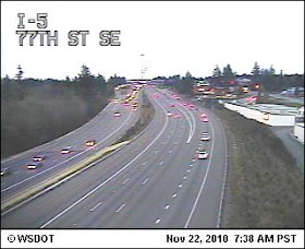
To show you how uneven this snow is, here are a few DOT cams:


Clearly, this was not a great success for the models--clearly more is getting farther north than forecast this morning. And the bigger snow threat--the one discussed by the NWS -- was always this afternoon. But I have to give credit to the National Weather Service, which did go for more snow in the face of many of the models doing otherwise, based on their experience with the models underplaying this situation. It is good that all the DOT pretreated last night...I drove to the airport and SDOT and WSDOT were out in force. This stuff will freeze solid tonight if not melted or removed.

The question right now...is there anything more serious in store this afternoon? I am trying to get the new model runs....too many people are hitting our system and there are problems...working on it...

November 21, 2010

How much snow?

First, here are the snow reports from the Seattle NWS office:

PUBLIC INFORMATION STATEMENT NATIONAL WEATHER SERVICE SEATTLE WA
610 PM PDT SUN NOV 21 2010 ..
SNOWFALL TOTALS THROUGH SUNDAY AFTERNOON...

KING COUNTY SNOWFALL(IN) TYPE

ENUMCLAW 6(MILES)NNE 3.5 SPOTTER
PIERCE COUNTY SNOWFALL TYPE
EATONVILLE 3.0 SPOTTER
PUYALLUP 5 WSW 1.1 SPOTTER

PUYALLUP 4 SSE 1.0 SPOTTER
LEWIS COUNTY SNOWFALL TYPE

ETHEL 4 SW 1.5 SPOTTER
THURSTON COUNTY SNOWFALL TYPE

GRAND MOUND 5 NNW 1.8 SPOTTER
CLALLAM COUNTY SNOWFALL TYPE

FORKS 2.0 CO-OP
PORT ANGELES 4W 1.9 SPOTTER

Most of region had a few flurries or some drizzle, with the heaviest snow concentrated near or just west of the foothills southwest of Seattle. Puyallup and Federal Way had some sticking light snow. Also some snow in the Shelton area and the northern Coast.

The weather service is going for a 70% chance of snow tomorrow...with 1-3 inches.
Seattle DOT is applying anti-icing substances on the roads tonight (a good precaution) and Metro is putting its vehicles on snow routes tomorrow morning (commendable perhaps but probably unnecessary).

The latest model runs are in and here it is (24h total ending 4 PM tomorrow).

Bottom line...NO ACCUMULATING SNOW in Seattle, but white stuff over SW Washington and Oregon. We could get a few flurries like today.

and here is the latest probcast probability of precipitation based on ensembles and statistics. Same story. Very low probability of precipitation in Seattle. Again, no accumulating snow.


The weather channel...which computes an independent forecast... is going for scattered snow showers and snow of less than an inch in Seattle.

Again, my conclusion....no accumulating snow in or north of Seattle. But if you are driving south, particularly south of Olympia, the chances go way up. Also snow in the mountains and foothills and along the coast. SDOT and Metro can probably rest easy.

But it will be cold..tonight the temps will dip into the 20s in many locations and the winds will pick up. Really strong NE winds over NW WA and northerlies pushing down the Sound. Temperatures dropping into the low 20s and teens on the west side of the State on Tuesday AM...it will be brutal. And east of the Cascades them combination of strong wind and temperatures in the single digits will produce extreme, dangerous conditions on Tuesday.

Finally, for users of probcast...it has a problem with minimum temperatures that will be fixed soon...don't take crazy low temps seriously (unless you work for some TV station weather hype dept!).

Sunday Afternoon

The National Weather Service's new forecast for the Puget Sound central area for tomorrow is now snow at times with accumulations of 1-3 inches. The weather channel is going for a few snow showers.

The high resolution models that I am looking at suggest virtually no snow from Seattle northward.

Everyone agrees on the cold air and strong northerly winds!

You think it is cold now? MUCH colder air is coming.

The models worked out pretty well today...not perfect...but highly useful. Lets see what tonight's forecasts suggests.... The disturbance is now entering an area with more data, so that should help.

Sunday AM Update

There is a very weak upper level disturbance passing over us this morning and will be through by noon. It has enhanced some clouds and is producing light snow showers. That is all it is going to do over the lowlands north of Seattle. The amounts will increase as you approach the foothills due terrain-induced upslope flow. South of Seattle there is the possibility of perhaps an inch or two. Lets be explicit.

Here is the latest high-res model output for the 24-h snow fallending 4 AM tomorrow. Seattle is being protected by Olympic rainshadowing---farther south the rainshadowing weakens..and thus there is light snow. Thus, the south sound will get some light snow as will foothills locations.

Tomorrow a stronger disturbance will approach, it will increase the flow out of the Fraser and other gaps, and deepen the cold flow so that some will go over the mountains (see graphic). The models indicate that the snow will head south of us (see graphic). But if the models are wrong...you know what can happen. This is close.

November 20, 2010

Forget the Snow over Seattle--Its Heading to Oregon

Last night there was a burst of light snow, accompanied by strong winds, in the Bellingham, Whatcom County, San Juan Island areas...and some snow reached Port Angeles. The explanation is simple: moisture from a small low circulation rotated into the opposing cold flow of the Fraser and other gaps in the Cascades. Here are some snowfall measurements provided by the National Weather Service:

WHATCOM COUNTY SNOWFALL (INCHES)

BELLINGHAM 1.5(MILES)SW 3.0
BELLINGHAM 2.4 SW 2.3
FERNDALE 2.1 NW 1.5
BELLINGHAM 9.8 NE 1.4

SAN JUAN COUNTY SNOWFALL

WALDRON 1.1 NNE 2.6
LOPEZ ISLAND 3.9 NNE 2.0
ORCAS 0.7 NNW 1.0
FRIDAY HARBOR 6.2 WNW 1.0

CLALLAM SNOWFALL

PORT ANGELES 8.1 SSW 2.2
PORT ANGELES 2.5 SSW 0.9


Today there was a dramatic transition in much of the lowlands of western Washington as cool, dry northerly flow pushed south. The air above the Puget Sound lowlands is now cold enough for snow. Alas, cold is not enough...we need moisture...and it looks like that will not be forthcoming.

I waited to write this blog until I saw this night's runs, and to look at the probabilistic predictions from National Weather Service and the UW ensembles, as well as the European Center Global Model (the gold standard).

My conclusion, if the models are correct, the central Puget Sound region, including Seattle, will get little or any snow. But we will get extraordinary cold--particularly on Tuesday morning. On the other hand, Portland and Willamette Valley, will see the white stuff.

Here are some graphics regarding the current situation. First the precipitation probabilities from probcast...which uses an ensemble (a collection) of forecasts and then applies sophisticated statistical post-processing. High probabilities of precip (snow) in the Cascades, southern WA, and Oregon. Not much over Seattle and north.


And here is the snow forecast from the high-resolution WRF model for the 24h ending 4 PM Sunday. The Cascades and SW Washington get some light snow.


And here is for the next 24h. Forget most of western Washington for snow.

The models would really have to be in error for Seattle and the northern lowlands to get significant snow..which has happened. And there is still some uncertainty to the solution. But lets be honest, snow lovers will probably be highly disappointed. The cold is serious business though...anytime it gets below 20F around here, there is trouble. I expect large areas of the lowlands away from the water to get below 25F and a number of colder spots in the teens.

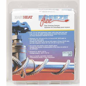
There is one group, of course, that likes supercold weather...plumbers. Freezing pipes are good for business. A few years ago, weather.com (the weather channel) was going for a crazy cold wave....a plumber called me up all excited...should he bring on more people to handle all the business? You can lessen their income by making sure your outside faucet don't freeze up and that you insure that pipes in crawl spaces are insulated or heated.

Finally, I should make things clear...making a good forecast is more than looking at a few model simulation plots. To do it right, takes not only a physical understanding of the situations that have produced snow, but judgment about which models are doing well, have done well in similar situations, the consistency in time of each model and between models, and today a careful study of the new technology of ensemble predictions. A good forecast takes quite a while to do.

November 19, 2010

Uncertainty

Tonight light snow and strong NE winds has spread from the Bellingham area, across the San Juans, to lower Vancouver Island....and the next to be hit is the northern Olympic peninsula. The model forecasts were quite good for this. Here is the current surface observations...you can clearly see the NE winds exiting the Fraser.
Saturday and Sunday is really going to be pretty dull around here...not much action, snow-wise or otherwise. And we know that cold is coming and Tuesday morning will be cold enough to produce a hard freeze. The question is snow late Sunday and Monday.

Until this morning, the models showed too little moisture on Monday for any real snow. But now there is some disagreement. The NAM model has a much stronger upper level wave moving down the northerly flow along the West Coast, compared to the GFS model (which is usually the better one). One has a few light snow showers, the other more serious snow. I would generally bet on the GFS model...but we have time to see which solution dominates. Want to see the difference? Here are the two:


Pretty subtle? But a world of difference. There disturbances are forming over the arctic where we don't have that much data. Sometimes we have to live with uncertainty in forecasts and this is one of those times. I expect by Sunday we will know what will happen...enough time to prepare. And I will start using and showing you some of new high-tech tools for dealing with uncertainty...ensembles forecasts with statistical postprocessing!

Brief Update

First, this is showtime for NW Washington as a band of precipitation overuns the cold air coming out of the Fraser. It is now snowing at Bellingham and Orcas Island. NE winds have strengthened...to 30 mph at Bellingham Airport.

The latest computer forecasts (initialized at 10 AM this morning) are more threatening for Monday...but lets view tonight's runs before we jump to conclusions. We will have cold enough air...the question is precipitation. The classic situation is to have a significant upper trough move southward in northerly flow...the new runs are suggesting this....but lets take some time to analyze the situation...and also look at the ensemble forecasts, which are becoming available for the time of potential lowland snow.

More later

November 18, 2010

Bellingham Fun, Fraser Outflow and an Admission


It's here.....

Cold, dry modified arctic air is now pushing through the Fraser River Valley into Bellingham and areas to the north.

Here are the latest observations at the Bellingham Airport. Look at the wind direction. It shifted from southeasterly (90 is E, 180 is S, etc) to northerly and then northeasterly (20-30)---air coming right out of the Fraser! As the wind direction shifted the temperature began to drop rapidly (now 35F) and the dewpoint dropped to 31F (which means the air is getting drier). Lower humidities HELP snow, since it facilitates evaporation and thus cooling.

Bottom line--it is probably now cold enough for snow in Bellingham...and that NE flow is going to strengthen and push over the San Juans and then to Vancouver Island and then head down to the Olympics. And these folks are probably going to see some light snow before this is all over. And yes, some strong winds for Bellingham and the San Juans. Believe me...it will get fiercely windy at the top of Mt. Constitution on Orcas before this over. And I expect Jim Forman and the rest of the TV folks to be stationed at Bellis Fair Mall in N. Bellinghan as they always do...with the flags waving in the background.

Below is the 24-h snowfall ending 4 PM on Saturday. Snow from north Bellingham across the north San Juans..and then southern Vancouver Is. And the northern part of the Olympic Peninsula just back from the water.

There is another focus of snow...SE of the Olympics around the Hood Canal...their snow will be from SE flow that will ascend those Olympics slopes. Heavy precip pushes the freezing level down...bringing snow with it. Otherwise...no snow on Saturday for the lowlands--but some light snow in the mountains.


There really is very limited moisture with this event...and that is working against any significant snow. Most of the area will get nothing.

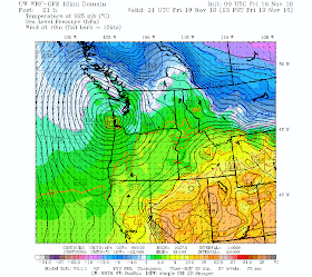
Finally, let me admit something...there are a lot of very nervous meteorologists in town. We look at the forecast pressures and temperatures for tomorrow at 1 PM (below) and see a low over SW WA and cold air over BC, ready to be sucked down towards the low. Cooler air is already moving into the Fraser Valley and out into Bellingham. This is close to a pattern that brings snow...but the models are emphatic that it is too warm over most of the lowlands for snow. The freezing level is at around 2000 ft and the snow level is around 1000 ft. This is close. If our models are wrong....well, you know what I am worried about. It won't be the first snow mistake we've made.


PS: Tuesday AM looks VERY COLD