Here is the latest radar (8:30 AM)....in fact, we have two convergence zones right now...one in the lee of the Olympics and the other in the lee of the mountains of Vancouver Island.
The latest Seattle Profiler data shows the decline of the freezing level to roughly 1500 ft, and thus the snow level to 500 ft (or even a bit lower in heavier precipitation.
 |
| This is virtual temperatures, subtract about 1 degree for regular temperature. |
There are reports of 3-5 inches in Woodinville and Duvall. This morning I saw a car with 2-3 inches on it, coming down from the north.
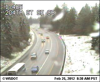
Little of this snow is sticking on highways since the road surface temps are pretty warm, but the air temperatures are falling to freezing where the precip intensities are large enough to drive the freezing level to the surface.
Why does falling precipitation cool down the air below? First, there is evaporation (like when you get out of the shower), but that ends quickly as the air layer below becomes saturated. Then there is melting, which draws heat out of the air below and cools it. More intensity of precipitation provides more melting and cooling.
The effects of the precipitation cooling are shown by the latest Seattle SNOWWATCH surface temperature map. The square boxes show roadway temperatures (36 in bothel, 42 near southcenter). No worries about travel.
The latest forecast model runs suggest less of a chance for significant lowland snow tomorrow. However, the mountains are getting hit hard today. About a foot since yesterday and there will be closures for avalanche work.
Reminder: The NW Weather Workshop starts next Friday and it open to all. See information and link on right hand panel.


We have almost four inches on the ground and snowing hard here in Woodinville (near Bear Creek Country Club).
ReplyDeleteI went to sleep, woke up and it's all covered in snow!
ReplyDelete5" in Duvall right now. Was coming down hard an hour ago.
ReplyDeleteA couple of inches at 1000 feet on Mount Constitution on Orcas Island this morning (Sunday). Very pretty! Looks like sea level here either didn't get any snow or it's all melted.
ReplyDeleteHad some very light flakes coming down on Bainbridge Island this morning (Sunday). Very much in the spirit of the "chilly hilly" bike ride.
ReplyDelete