Then just a regular El Nino.
And now they just don't talk about it anymore.
Good reason... the famed El Nino has flamed out, and its impact on NW weather is minimal at best.
El Ninos are associated with substantially warmer than normal water in the eastern tropical Pacific. Meteorologists pay particular attention to the sea surface temperatures (SST) in the Nino 3.4 area (see map below)
Here is the plot of the SST anomalies (difference from climatology--or normal). After peaking to a modest 1C, it is dropped to about .5.
NOAA has put a lot of buoys out in the tropical Pacific that are capable of measuring water temperatures below the surface. As shown by the following plot, cooler water has become established under the eastern Pacific. (The figures has depth on the y-axis and longitude on the x-axis, crossing the Pacific from west to east). Not suggestive of an El Nino.
The latest NOAA probabilistic El Nino forecast give a probability for El Nino of around 55% now and that declines over time, with a nearly equal chance of experiencing a neutral year, when SSTs are near normal
With a no-show El Nino this year, the associated atmospheric circulation patterns have not occurred, like a weakened equatorial trade wind and heavy rains over southern CA.
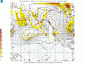
Instead of an El Nino pattern, high pressure has locked on the west coast and that will certainly be the case this weekend as a huge ridge will redevelopment, configured in the classic "omega" pattern:


Any chance the warm water drifted northeast instead and formed the anomalous "warm blob" of water off our coast? And can that be inducing these high pressure ridges to form?
ReplyDeleteNice piece. and the most recent data from yesterday suggests an even less probability of ElNino (45%)
ReplyDeletehttp://iri.columbia.edu/our-expertise/climate/forecasts/enso/current/
It's about to get cooler and wetter for the month of March. The recent data from yeaterday indicates less of an elnino probability at 45%
ReplyDeletehttp://iri.columbia.edu/our-expertise/climate/forecasts/enso/current/
Excellent question about "the blob".
ReplyDeleteAre the Blob and Sub Tropical Surface Temperatures related?
Agreed that the full scale tropical SST pattern and associated wind fields never locked into El Nino with the associated positive feedbacks that maintain the event. But, the recurrent downwelling kelvin waves and warmer than normal equatorial waters almost certainly have had an El Nino-like effect on NH circulation. El Nino interacts strongly with the PNA teleconnection pattern with positive PNA index values typically associated with warm ENSO events. Lo and behold, this winter's geopotential anomalies reflect positive PNA with index values almost as large as those in the 2010 El Nino. So, while the criteria for El Nino haven't been met in terms of SSTs, the atmospheric circulation impacting us has been decidedly El Nino like.
ReplyDeleteGood call, Cliff. I remember you being the first expert to cast doubt on the super-duper El Nino that was going to fry us all.
ReplyDelete