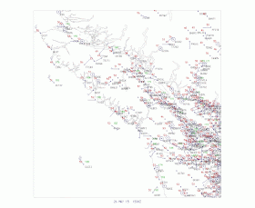
There were several contributors to this beautiful swirl. There was moderate northerly flow in the lower atmosphere (see sounding at Quillayute, on the north Washington coast), resulting in what is called lee troughing (low pressure) on the lee (downstream) side of the terrain. There was also a large amount of horizontal wind shear (change of wind over some horizontal distance) in that region, with strong northerly flow offshore and weak winds near the coast (see weather map plot at 8 AM on Tuesday).
There is inherent rotation with wind shear. If you want to prove this to yourself, imagine putting a pinwheel into a flow with northerly flow on one side and southerly flow on the other...it would spin! Such spin distorts the clouds into a swirl.
And if you like swirling low pressure, we have had persistent circulations over eastern Washington that have been associated with lots of thunderstorms there the last week. Here is an infrared image for Tuesday afternoon at 4:15 PM--do you see the swirl of thunderstorms over eastern Washington?
Lots of rain over eastern Washington yesterday and today from this circulation. Here are the totals for the last 24h.... substantial amounts, particularly along the fire-prone eastern slopes of the Cascades.
But the real wet story may be coming....here is the forecast 72h precipitation total ending 4 AM next Wednesday....a very wet pattern, indeed, particularly west of the Cascade crest. Stay tuned.
NEWS BULLETIN (courtesy of UW's Mark Albright)
The winter snowpack at
Paradise Mt Rainier melted out today (27 May 2015), which is about 6
weeks earlier than normal. This year experienced the 2nd earliest melt-out of the past 99 years. The earliest melt-out date occurred 74 years ago on 24 May 1941. Here are the 5 earliest melt-out dates at Paradise Mt Rainier over the past 99 years from 1917-2015:
1) 24 May 1941
2) 27 May 2015
3) 30 May 2005
4) 1 June 1926
4) 1 June 1934
---------------------
Announcement: On June 3, I will be on the Seattle Channel's Civic Cocktail with Governor Inslee. If you would like to be in the audience, you can get tickets at: http://www.seattlechannel.org/CivicCocktail. They charge, but you get appetizers with their no-host bar.


Cliff--
ReplyDeleteHere are some forecasts for Olympia I saw on the NWS site tonight that seem really strange to me and there is nothing about this in the NWS forecast discussions. Can you explain these strange temperatures?
Thanks.
Overnight
Areas of fog before 3am. Otherwise, partly cloudy, with a low around 50. Calm wind.
Thursday
Mostly sunny, with a temperature rising to near 79 by 8am, then falling to around 56 during the remainder of the day. Calm wind becoming northwest 5 to 8 mph in the morning.
Thursday Night
Patchy fog between 9pm and 3am. Otherwise, mostly cloudy, with a temperature falling to near 52 by 10pm, then rising to around 75 during the remainder of the night. South wind around 5 mph becoming calm after midnight.
Love your blog! Huge weather enthusiast who just moved from Delaware to Seattle. Really hoping that rain estimate is spot on for early next week.
ReplyDeleteThank you for the update on the early melt out at Mount Rainier. Knowing how much you like to site news articles about NW climate and weather, there are already suggestions for climbing Mt Rainier early this summer, due to the low snow cover. However, I would assume that snow conditions above 10000 feet look rather normal since we had an average precipitation year and freezing levels remained at that altitude. Are you aware of snow fall data at or above Camp Muir? Or is there a chance to model it from freezing level data and precipitation?
ReplyDelete