Southern California is about to be hit hard with heavy rain of 3-9 inches and powerful winds. Flooding and slides are inevitable. But it will have a silver lining: any talk of drought in California should be ended as the last below-normal reservoirs are filled.
Let's start with the 2-day precipitation totals (ending 4 PM Sunday) from the wonderful NCAR high-resolution ensembles (the ensemble mean--the average of the ten ensemble members are shown). Totals exceeding 3 inches covers a wide area from LA north, with some locations in mountains north of Santa Barbara getting 7-9 inches. That amount of rain would be huge anywhere, but in dry southern CA that is immense. For a number of locations, this will be the greatest rain event in years.
The reason southern CA is so wet, while the Northwest is relatively dry, is because the jet stream has been deflected way to the south. This is illustrated by an upper level forecast map for 4 PM Friday, with the sold lines presenting the heights of the 500 hPa pressure surface (around 18,000 ft). A deep trough of low heights (pressures) is found along the west coast, with the jet stream/strong winds heading into southern CA.
Equally impressive is the latest infrared satellite image (Friday AM). A extremely moist frontal band is headed right into the LA Basin, which will bring both heavy rain and strong winds. There is clearly instability (convection/thunderstorms) embedded in the cloud mass.
The latest radar image from Vandenberg AFB shows extensive moderate rain over the region, with the yellow/orange areas being the most intense.
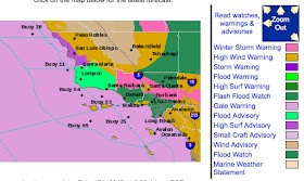
And now we have the problem--southern CA is ringed by high terrain and as the moist flow climbs the barriers, precipitation intensity is greatly increased (by 5-10 times is not unusual). This air is relatively unstable, so there is also the risk of thunderstorms with locally intense rainfall. The result is the potential for flash flooding and slides, with debris-laden regions that have recently burned of particularly concern. The National Weather Service has a flood warning out for the Santa Barbara area and a flash flood watch extending down the coast. It is not going to be pretty down there.


I hope a lot of that rain makes it as far as the Rockies. Lake Mead is still hovering just barely above record low levels.
ReplyDeleteThank you for this report.
ReplyDeleteSure hope that damn holds - and what will happen when the massive snowmelt begins to thaw in the Spring/early Summer?
ReplyDeleteOh yes, precip in SO CAL coastal mountains can really increase with elevation. I lived at 6100 ft. near Cajon Pass and my rain gauge held 6 inches measured, and another 3 in the top funnel. In two days, I came out to find it overflowing FOUR times. So, all I know is that we had a MINIMUM of 36 inches of precip in those 2 days! I lived a bit less than 1 hour from downtown LA, which averages less than 10 inches per YEAR, but owned a snowplow! Ya gotta love it.
ReplyDeletePretty impressive forecast for Southern California, Cliff. The Weather Service nailed it. Los Angeles was forecast to have heavy rain in the afternoon and voila, at 2:00 PM, the heavy rain moved in. Santa Barbara has been absolutely hammered most of today. Great job!
ReplyDeleteAfter living in Seattle for the past decade I'm spending some time in the SoCal deserts. What a wet month January was. I'm eagerly awaiting this storm to move in to see what it does here. But after several 1"+ storms already, this one may be no worse than those in this part of the state. I just noticed what looked like a triplet of mini bow echoes on the Santa Ana radar. I've never seen anything like it before. I saved an image if you happen to want it.
ReplyDeleteThe five seasons of California: drought, fire, rain, mudslide, and earthquake.
ReplyDelete:-)
DeleteSuper Bloom in the Mojave this spring! Go see the last of spring training in Az and hit the wildflowers on the way back.
ReplyDeleteCould they be heading toward an ARkStorm, like 1861-62?
ReplyDeletehttps://fabiusmaximus.com/2017/02/14/california-past-floods-the-coming-arkstorm/
Here are some critical questions:
ReplyDelete1. How much precipitation will fall in the Oroville watershed, and when?
2. Will this precipitation fall as rain, or will it fall as snow?
3. If it falls as rain, how much snow will it melt and send to the reservoir along with the rain?
In light of the damage to both the main and emergency spillways at Oroville dam, which has limited the ability to draw down the reservoir, the timing, extent, and nature of the storm heading their way will be critical.
The CA Dept of Water Resources didn't cover themselves with glory last weekend when they first assured everyone that everything was okay, only to reverse themselves an hour later and tell 200,000 people to evacuate immediately.
Following the situation at Oroville Dam, there seem to be bulls eyes of high rainfall in the reservoir's drainage based. Here is a link to a string of info and techincal comments about the hydrologic aspects of the situation: https://www.metabunk.org/oroville-watershed-weather-forecast-lake-level-and-inflow-calculations.t8406/page-2
ReplyDelete