- Extreme differences in temperature in the vertical
- Extreme changes during the day
- Large variations in the horizontal
- Some amazingly warm temperatures in favored surface locations
- Unusually warm temperatures aloft
The high temperatures on Wednesday ranged from the low to mid-60s on the southwest side of the Olympics to low-mid 50s over Puget Sound, and 30s east of the Cascade crest.
And today was toasty around the southern and western sides of the Olympic (up to mid-60s), with around 60F on the western slopes of the Cascades.
The key issue yesterday, today, and the immediate future is the high pressure aloft over the region. With the typical westward tilt with height of weather systems, the surface high pressure is to our east (see pressure map at 10 AM today--solid lines are pressure and colors give lower atmosphere temperatures, blue is cold).
Cold, high pressure is east of the Cascade crest with a very large pressure gradient over the Cascades (around 11 hPa between Yakima and Seattle...that is large). The result is easterly flow that is descending the eastern slopes of the Cascades and Olympics, warming by compression as it descends.
The surface temperature forecast for 1 PM yesterday (below), clearly shows the warm temperatures on the western downslope sides of the terrain.
The high pressure overhead, with its sinking and warming air has pushed the freezing level about 11,000 ft, and with warming aloft, and good radiational cooling to space under clear skies, an amazing inversion has formed. Here is the plot of temperatures (red lines) and dew point (blue line) this morning at Quillayute, on the Washington Coast. Temperatures rise from 4C to 16C over a thousand feet.
And a strong inversion was apparent this morning (black line) and yesterday (red line) at Seattle.
Clear skies have allowed both good solar heating during the day and strong radiational cooling at night, giving us mild afternoon temperatures and frosty mornings (with lots of frost in lower locations). The situation at Sat Tac is shown below.
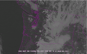
Finally, with cold air and high pressure, eastern Washington has fogged over, a major issue this time of the year (see below).


Is the Ridiculously Resilient Ridge back? Is it caused by "The unprecedented magnitude and persistence of recent West Coast ridging can be traced (at least in part) to regionally-accentuated warming of the lower atmosphere"?
ReplyDeletehttp://weatherwest.com/archives/5982
Wow, just looked at the NWAC site for temps, Baker and Crystal in the 50's, but Stevens and Snoqualmie in the 20's.
ReplyDeleteAlpental showed a 30 degree difference @ 10am in temperature with only 1100' of elevation gain mid-mountain to the top.