Middle spring is a very unstable time for the atmosphere over the Pacific Northwest.
What do we mean by unstable? It means that parcels of air displaced upwards will tend to accelerate skyward for a time, resulting in the production of cumulus clouds...and even thunderstorms (see pictures below taken on Tuesday in Seattle to see what this looks like).


Instability is related to the decline in temperature with height, with larger temperature decreases with height producing a more unstable atmosphere. Spring, when the surface is being warmed by a rapidly stronger sun while the atmosphere above is still cool from winter, is the time of largest instability.
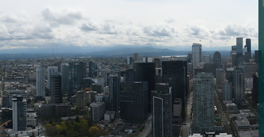
The atmosphere is already starting to percolate this morning with small cumulus clouds forming around Puget Sound (see Seattle PanoCam below)
And a visible satellite image earlier this morning shows some impressive cumulus/cumulonimbus development approaching the northern Oregon coast:


That's great information for understanding. But when will it be "normal" spring, i.e. 60's, showers every 3rd or 4th day; not every day? The La Nina effect needs to move on. ;)
ReplyDeleteI have read, that in the Puget Sound/Seattle area, we experience lightning and thunderstorms only seven times a year, on average...so far this year, in S. Everett, I have seen a few ominous thunderheads, but no action!
ReplyDeleteCurbozer, how long have you lived here? A really good t-storm is rare- and I think that is unfortunate. I am from the East where they are fairly common in summer. The last big ones we had here were in Sept. 2019, which I missed because I was in Port Townsend, and in May 2017, which I got to see- a set of 3 of them. When they say seven a year, one clap of thunder or distant rumbling counts, according to my information.
DeleteLived here for 75 years...and counting ( hope!)...Yeah, lightning is rare for sure...I do remember a weird situation--I think it was in the mid-90s, wherein a huge, lingering blast of the "Pineapple Express" lingered over Seattle for over 24 hours...there were around 2000+ strikes in the area...I remember driving south from Everett, to Tukwila. where I worked...strikes were happening every 30 seconds or so, and I really was worried that my car would be zapped!...I guess that particular storm was just an outlier...I have not seen such an event since that one situation.
DeleteI'm rooting for T-storms, but I'll believe it when I see it.
ReplyDeleteOtherwise, hoping for a sunny weekend- Spring is behind schedule.