We enjoyed an unusually dry, temperate mid-November, and Thanksgiving Day was a pleasure, but now the brass knuckles of a La Nina winter are about to be revealed.
Cold air and a hard freeze will hit the entire state next week, with massive mountain snowfalls that will delight the ski community.
All of us should take steps to deal with the upcoming cold, from unscrewing outdoor hoses, and protecting pets, to ensuring that the region's large homeless population is brought inside or protected.
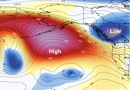
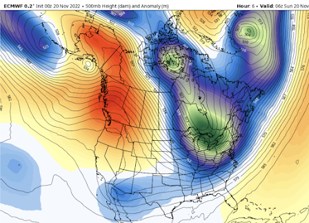
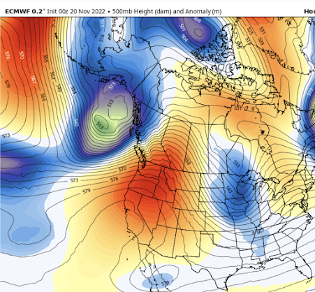
The upcoming situation is a classic for a La Nina winter, in which the central and eastern tropical Pacific is colder than normal. During such winters, we typically observed a large ridge of high pressure developing over the northeast Pacific, with cool, northerly (from the north) flow on its eastern side (see the forecast upper-level map for Saturday at 10 PM as an illustration).
If there are disturbances in that northerly flow, moving south out of Alaska, we can get bouts of mountain snow, and if these troughs are positioned just right, then lowland snow is possible.As in any good drama, the action can be separated into several acts.
Act 1: Initial Cooldown and Mountain Snow.
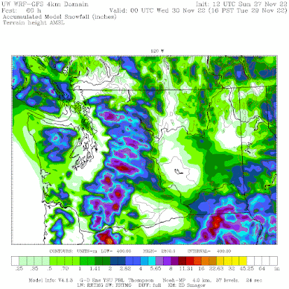
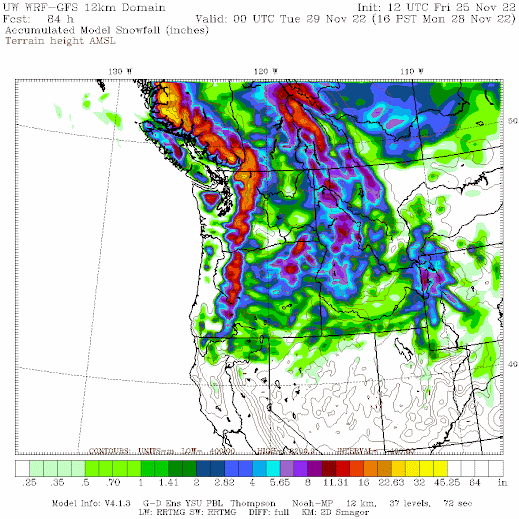
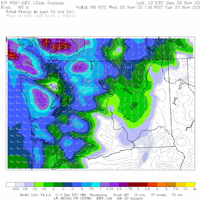
Today (Friday), a cold front is moving through bringing plenty of rain to the region and snow at higher elevations. On Saturday night and Sunday, a trough of low pressure will move in, producing further cooling and lots of mountain snow. Take a look at the totals through Monday at 4 PM. Several feet in the mountains!
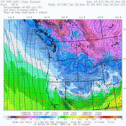
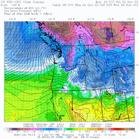
By Tuesday morning, cool air behind the upper-level trough will move into the area (see forecast map for 4 AM Tuesday). The colors indicate air temperature around 2500 ft. Blue indicates air cold enough to snow, and purple show frigid, arctic air. This arctic air is associated with high pressure, resulting in low-level northeasterly winds in the Fraser River valley that will start moving into Bellingham and its vicinity.
Act 2: A Second Trough, Colder Air, and Potential Lowland Snow
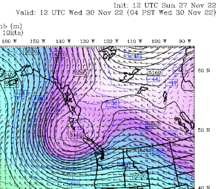
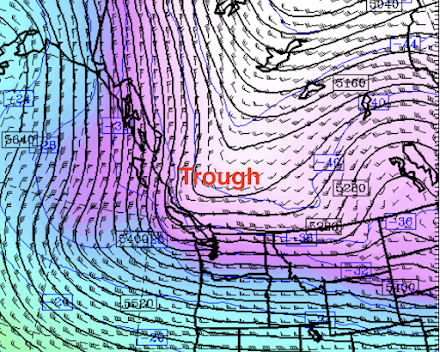
On Wednesday, a second trough will move southward out of SE Alaska (see upper level (500hPa pressure level) forecast below for 10 AM Wednesday). Not perfect for lowland snow west of the Cascades, but close.
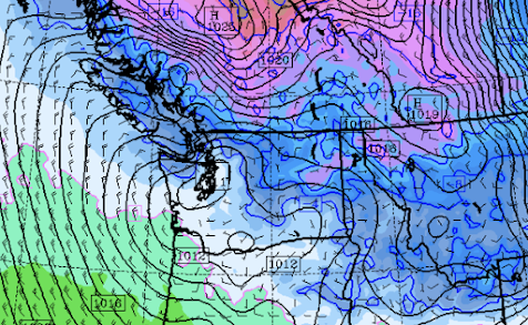
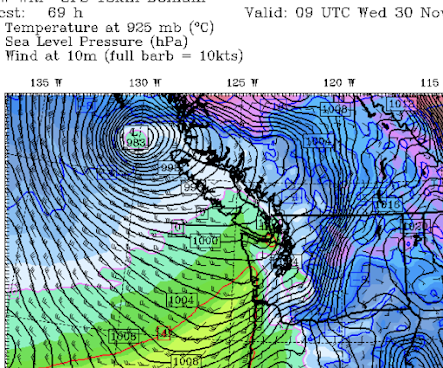
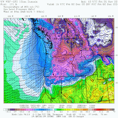
This upper-level trough produces upward motion and precipitation, and will be associated with a surface low center that will move across the central WA coast on Wednesday afternoon (see sea level pressure forecasts, with low-level temperatures below).This pattern will also draw cold air into northwest WA.
This cold air will then move southward and by Friday morning, the entire region will be cold. VERY cold east of the Cascade crest. CRAZY cold east of the Rockies of Montana.
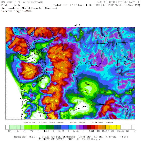
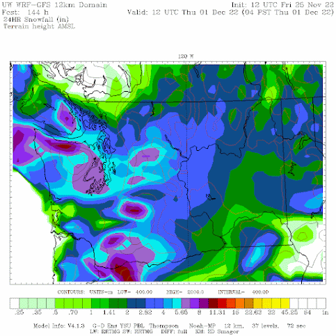
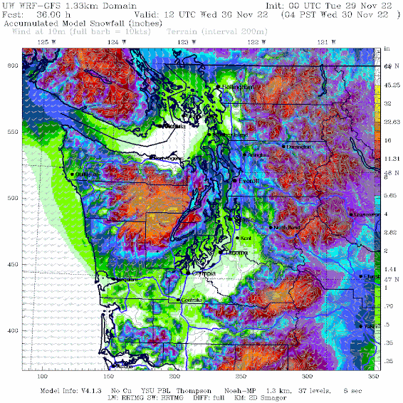
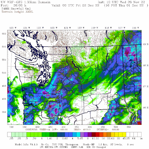
The question will be about precipitation, and thus snow. The latest UW WRF forecast is producing some lowland snow. To illustrate here are the 24-h snowfall totals ending at 4 AM Thursday. Much of the lowlands get several inches.
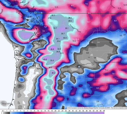
What about the European Center high-resolution model snow forecast? It has lowland snow, but about 12-h earlier and further north.
For an extended forecast with uncertainty, it is wise to look at ensembles of many forecast runs. Below is the European Center ensemble forecast for snow at SeaTac Airport. The top panel shows the snow forecasts of each of the 51 different model runs, while the bottom panel shows the snow forecast of the high-resolution forecast (blue line) and the average of the ensemble.
Both high resolution and ensemble prediction are for going for several inches. But beware of an issue of such ensembles: the model resolution is low, which tends to increase snow near sea level (since you are smearing the higher snow predictions at greater elevations over the lowlands).
The bottom line: you can be confident about lots of mountain snow and a major cold period next week. There is a significant chance of lowland snow in western Washington but substantial uncertainty at this time. By Monday we should have a very good idea of what will happen.
_______________
No Podcast today...taking a Thanksgiving Break!

.gif)




.gif)
.gif)
.gif)
.gif)
.gif)

