I don't want to hype the situation, but I do think some snowflakes will descend on portions of the western lowlands next Tuesday and Wednesday.
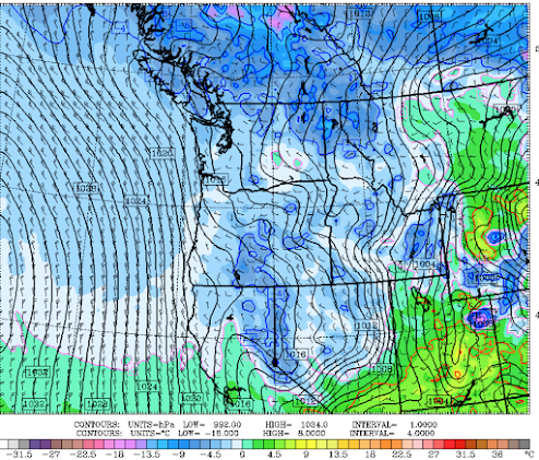
To illustrate, below you find the sea level pressure and temperature (925 hPa, about 800 m aloft) for Tuesday at 4AM. Blue colors are cold enough for snow---and such chilly air extends over much of the region.
The daily highs and lows in Seattle for the next week from the National Weather Service National Blend of Models, shows the cooling trend down to highs in the mid-40s. Not nearly as cold as in December, but Tuesday and Wednesday mornings will be cold enough for snow.
But will there be moisture?
A front will move through tonight, bringing rain to the western lowlands and light snow in the mountains. In fact, the latest radar imagery clearly shows the rain, which soon reaches Puget Sound.
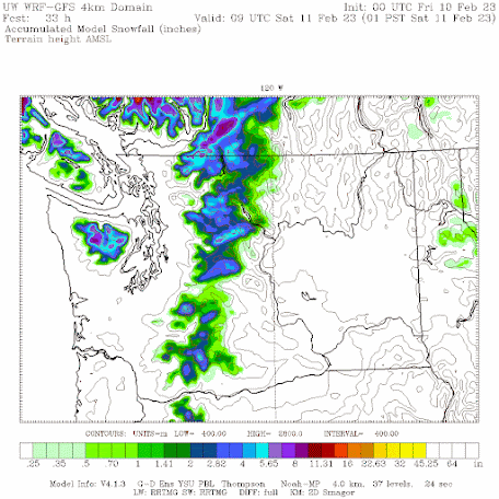
The amount of snow in the mountains tonigth will be relatively modest (see total through 1 AM Saturday below). Only a few inches.
The second half of Friday, Saturday, and most of Sunday should be relatively dry, with highs in the lowlands around 50F. Reasonable for a walk, run, or cleaning up the garden.
But then on late Sunday and Monday morning, a fairly strong upper-level trough will move in (see below), which will bring in cooler air and some precipitation on Monday and early Tuesday.
Will there be any precipitation around when it becomes cold enough to snow on Tuesday morning?
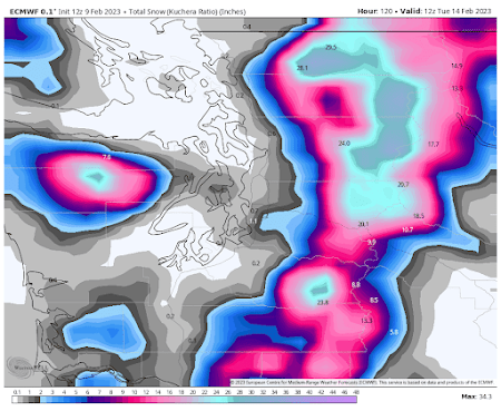
The snowfall total through Tuesday morning from the European Center model suggests plenty of snow in the mountain, and yes, a band of light snow near SeaTac, and more snow over SW Washington (see below).
Stay tuned. More details as we get closer in time.


No comments:
Post a Comment
Please make sure your comments are civil. Name calling and personal attacks are not appropriate.