The last week has been a bit boring for West Coast meteorologists.
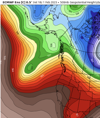
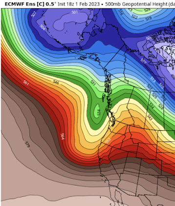
The reason? A persistent upper-level ridge of high pressure over the eastern Pacific, something illustrated by the upper-level (500-hPa) chart this morning (see below). Red and brown indicate areas of high pressure/high heights. This pattern has been "locked in", something known as a "blocking pattern" in the weather biz.
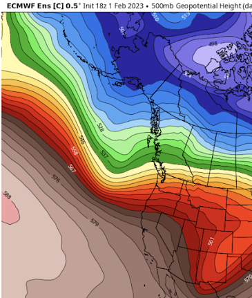
The forecasts you are about to see are based on the truly excellent Europe Cener ensemble system of many forecasts. The average or mean of the many (51) runs is shown.
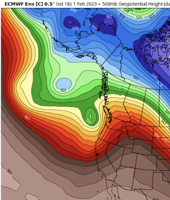
By Friday morning, the protecting ridge will move inland, and an energetic trough of lower pressure (green color) will be approaching our coast (see below).
This upper trough will be associated with a nice low center, which will bring strong winds to the Oregon/Washington coast (see sea level pressure forecast for Friday AM below).
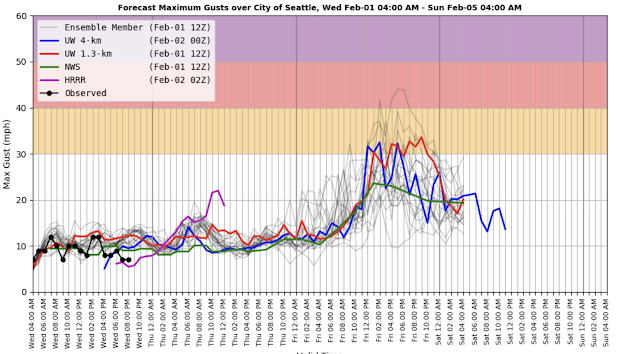
The latest Seattle WindWatch wind forecast for Seattle, which includes both the high-resolution prediction and a collection (ensemble) of many other forecasts suggests a modest blow Friday afternoon, with gusts exceeding 30 mph. Not the end of the world. And yes, there will be rain with this system.
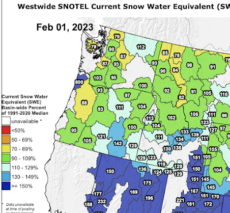
On Sunday morning, another trough moves in...one that will influence the entire West Coast. More refill for California.
And then fast forwarding to Monday, another trough approaches, with a strong jet stream following.
Nothing particularly severe this week, but it will be nice to get a little rain and wind again. This IS the Pacific Northwest!

Cliff, have you done a post on averaging multiple model runs before? I'm curious how multi-modal outcomes are dealt with. If 50 runs say a storm will hit to the north, and 50 say to the south, the simple average says it will hit somewhere in the middle, which is guaranteed to be wrong.
ReplyDeleteMother nature doesn't play with Models.
ReplyDeleteExactly. And that's why the "models" use for what is called the "existential threat" of global climate disaster within the next 15, 20, 1000.... years (take your pick) from now are even less believable.
Deletefrom the ST today: "The city experienced its driest January in 22 years, with 3.09 inches of rainfall last month — that’s 53% of the normal 5.78 inches, according to the National Weather Service.
ReplyDeleteFor context, 7.75 inches of precipitation fell in Seattle in December, with 3.36 inches just between Dec. 24 and 27, said Carly Kovacik, a meteorologist with the weather service in Seattle."
Will we get any nights below freezing? Required for sap production (making maple syrup here in Kingston)
ReplyDeleteshould stay above freezing for a while...sorry
DeletePerhaps, just maybe, Dr. Mass's work is finally leading to some much - needed sanity from the MSM:
ReplyDeletehttps://www.msn.com/en-us/weather/topstories/after-pummeling-scientists-say-california-storms-were-more-hype-than-climate-change/ar-AA16vSoi?ocid=msedgntp&cvid=385bdf0d517d434da3f3718c63968cd6
Let's hope this new (and accurate) narrative takes root across the country.