June 30, 2024

Summer Starts on Tuesday: My New Podcast is Out

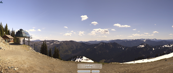
This year is pretty typical:   a relatively cool and moist June, followed by a transition to consistent warm/dry days in early July.

Weather perfection is ahead and my blog describes the shift from June Gloom to Summer Sun.

Check out the latest NWS National Blend of Models Forecast for Seattle (see below).  After Tuesday, a steady climb into the lower 80s, with no rain and plenty of sun


So why the transition to perfection?

During the past month, a series of upper-level troughs of low pressure have moved through, bringing periodic showers and cooler temperatures.   The upper-level map at around 18,000 ft (500 hPa) for today at 2 PM is shown below.  Trough over the Northwest and a ridge offshore.   Not a warm pattern!


But by Thursday, the trough has moved inland and the ridge is developing offshore.  Not too strong (which would bring a heatwave) but just right.


And four days later the ridge is still there, extending northwest towards Alaska.

So you should have perfect weather for enjoying the fireworks,  having a barbecue, or going on that long-planned hike.  A good time for meteorologists to go on vacation.

In my podcast, I talk about fireworks...please be careful.   We have enjoyed fewer wildfires than normal this year...let's keep it that way.

You can listen to the podcast below or through your favorite podcast server.


Some major podcast servers:

 HTML tutorial HTML tutorial

June 27, 2024

Huge June Precipitation Contrasts Across the Region

If you think rainfall at your location is representative of the region....think again.

This June there were huge precipitation contrasts.

Consider the accumulated rainfall from June 1 to yesterday (June 26 is shown below).

Wow.   The windward (western) side of the Olympics received 5-7 inches so far in June.  In contrast,  only 1-1.5 inches fell over Puget Sound and under a half-inch dampened Sequim, northwest of the Olympics.  

Over TEN INCHES at some locations on the western slopes of the Cascades, declining to under a half inch along the eastern slopes of the Cascade and into the Columbia Basin.


A closer look at the contrasts from Seattle to the Cascades is shown below.  From 0.79 inches over western Seattle to 11.30 inches in the terrain.   


The bounty of western Cascade rain has not only dampened some hikes but have led to healthy river levels.  Below is the latest USGS river level plots.  Most western Washington rivers are near normal (light green) and some above normal (dark blue).   In contrast, some rivers on the eastern Cascade slopes are below normal.


The western side of Washington and particularly the western slopes have been wetter than normal while the eastern slopes of the Cascades have been relatively dry.   Why?

This month the winds approaching the region have been stronger than normal.  Stronger-than-normal winds from the west.  Such a wind field enhances upslope flow and thus precipitation on the western sides of mountain.

In contrast, enhanced winds from the west produce stronger descent and rain shadowing on the eastern side of barriers---producing a strong rainshadow.  
What set up the strong westerly flow this this month?   

Below are the heights at 850 hPa, which you can think of as pressure around 5000 ft.  Lower values over the Gulf of Alaska and higher values to the south.  This pressure pattern produces west-southwesterly winds approaching our coast (white arrow).

How was the situation this month different from normal?  That is shown below (the anomaly of 850 hPa height--think pressure at 5000 ft) .    This month we have had a stronger than normal low over the Gulf of Alaska, which helped enhance the southwesterly flow and brings more moisture into the region.

June 25, 2024

A Benign Wildfire Year and Upcoming Rain

 So far this year we have enjoyed a below-normal wildfire season in the Northwest due to a relatively cool and wet June, among other reasons.

Below is the typical distribution of fire frequency over Washington State by day of the year. Today is indicated by the purple line.   

We are now in the fire ramp-up period, with the highest frequency of the year on July 4th, when many folks start fires with fireworks.


Today, there are only four fires going in WA and northern Oregon, and they are all predominantly grass fires ignited by humans.  Keep in mind that only a few days of dry weather are more than enough to dry grass enough to burn.

The grass was particularly bountiful this year east of the Cascade crest due to the favorable growing conditions this spring.  The latest USDA Fuelcast estimates of fuel load in eastern Washington is quite high (see below).

And it looks like our low fire situation is not going away soon.   The latest UW WRF accumulated precipitation forecast for the next 72h shows the results of a wet system coming in Wednesday night and Thursday (see below).


And with that rain, surface fuels should be moistened, working against wildfire.  Below is the latest 7-day fire potential forecast produced by the Northwest Wildfire Coordinating Center.   Low fire potential for the next week (green colors).


What about the extended  precipitation forecast from the European Center ensemble system? Though July 10th above-normal precipitation in much of BC and western WA and near normal in eastern WA.


No red flags for an enhanced wildfire danger.  No heat waves forecast either.

There will be wildfires this summer  but at this point we seem to be following a normal weather trajectory.


June 23, 2024

The Chemtrails Conspiracy Theory

I get several emails each week from those interested in weather-related topics.  I enjoy those interactions.

But there have been an increasing number of messages from those promoting a chemtrails conspiracy, suggesting that aviation contrails in the sky are really the result of a clandestine, top-secret government program to spray chemicals in the atmosphere to control the climate or worse (biological and chemical warfare).


Let me say it clearly:  this chemtrails business is total nonsense and can easily be proven to be total nonsense.

The lines in the sky are contrails and are the result of the water vapor and particles ejected from jet engines (and in the past, internal combustion engines).

The air aloft is cold and can not hold much water vapor.  The combustion in jet aircraft releases significant amounts of water vapor, that condenses into cloud droplets and then later freezes into ice particles.

These cloud droplets produce long, linear lines of cloud--contrails.

Now one chemtrails advocate told me that he had PROOF that it had to be a government secret program.

He argues that some days there are lots of contrails while other days have few.  What was different on the clear days?   No government secret emissions of chemicals!

Do you want to see an example?  Here are visible satellite images over Oregon for two days this week.  The first image has lots of contrails (the thin white lines).  The second image had none.


It turns out that some days have more favorable conditions for contrail development than others.  

When the upper troposphere, where jet aircraft generally fly, has a higher relative humidity, then it is easier to saturate the atmosphere from jet water vapor and thus produce clouds (contrails).  Days in which there is upward motion in the atmosphere tend to have higher relative humidity aloft. 

A particularly favorable situation is when this is so much water vapor and upward motion that there are already some clouds, generally cirrus or cirrostratus.  The first picture above (June 21st) was a good example of that.

Contrails are well understood and there is no reason to turn to conspiracy theories to explain them.  


June 21, 2024

Rain without Clouds, the Upcoming Cooling, and Strong Leeside Winds: All in My New Podcast

The radar image this morning at 5:30 AM showed rain...some heavy... offshore.


As shown in the satellite image at the same time, much of that area was clear while the clouds that were observed closer to the shore were stratus that would have some drizzle at most.


What is going on?    In my podcast, I give the answer:  cool air near the surface and warm air aloft produced an atmosphere "lens" that caused the radar beam to be deflected down to the ocean surface.  Thus, the "target" was not raindrops but the ocean's surface!

I also provide the forecast, which suggests a substantial cool down on Sunday (see predictions for next week at Seattle below), as cool marine air surges into western Washington.


Finally, in the podcast I also describe the potential for strong winds over the eastern slopes of the Cascades as cool, dense marine air moves into western Washington, increasing pressure there and resulting in more of a pressure difference across the mountain barrier.    Pressure differences drive winds.

The predicted wind gusts on Sunday evening are shown below.    Plenty of wind energy will be available.  But worried about wildfire.

You can listen to the podcast below or through your favorite podcast server.


Some major podcast servers:

 HTML tutorial HTML tutorial


June 19, 2024

Mountain-Top Instability

Over the lowlands of Washington State,  today was sunny and generally clear.  Not a drop fell out of the sky.

But something very different happened in the mountains, where the atmosphere became unstable, resulting in cumulus clouds and showers.  Even some lightning!

Let me show you and explain.

To begin, here are two visible satellite images:  one at 6:30 AM and the other at 5:30 PM today.

The morning image had little clouds with snow visible at higher elevations


But the story is different at 5:30 PM.

The lowlands are still clear, but many clouds are over the mountains.  Cumulus clouds, including some tall cumulonimbus.

You can see the changes from ground level from the wonderful Crystal Mountain cam.

At 6:20 AM it was clear looking to the east.

But by 10:40 AM, shallow cumulus clouds were forming over the peaks.


By 1:20 PM, the clouds had become more widespread and deeper.


The 6:10 PM shot shows deep cumulus that were precipitating.  You can see the rain under the cloud base (called virga).


In fact, there was measurable precipitation at several mountain and downstream sites during the past 12-h (see plot below).


So why cumulus clouds and precipitation in the mountains (also known as convection) and not over the lowlands?

Cumulus clouds are associated with atmospheric instability, in which the atmosphere convects with up and down motions, not unlike what occurs in your hot cereal saucepan or in a lava lamp (see below).

Convection breaks out when the temperature decrease with height gets sufficiently large.  Normally this is due to heating near the surface but it also can occur when there is cooling aloft.

Mountains act like high-elevation heat sources, particularly after the high-elevation snowpack has melted.  That results in a larger temperature change with height above the mountains than over the lowlands.  The air over the mountains becomes unstable, leading to cumulus clouds (see schematic below).

This effect is largest in the afternoon when solar heating is the greatest.

But wait!  There's more!   During the day, there is upward motion on the heated slopes of terrain, resulting in strongly enhanced upward motion over the mountain tops.  Upward motion contributes to cloud formation and the development of instability over the mountain crest.

Both of these effects were occurring today, resulting in lots of cumulus clouds and some rain over the higher elevations of the Cascades and other regional mountains.

June 17, 2024

Is Mid-June Getting Warmer or Colder?

 As I will demonstrate below, this past week has been unusually cool around the region.

But that leads to another question....is mid-June getting warmer or colder?   

A strange question when there is so much talk about global warming.  But as you will learn below, the truth will be stranger still 😀

Let's start is an image this morning at the Paradise Visitor Center on Mount Rainier (about 5000 ft up). They had a mixture of rain and snow showers with fog.  Yuck.   Not my choice for hiking!

Next, consider the differences in daily average local temperatures from normal for the past week (below). Green, blue, and purple colors are below normal.

No wonder I have been wearing my sweatshirts!  Most of Washington State has been cooler than normal and much of western Washington has been 3-5F below normal.    My tomato plants have been struggling for a reason.


But you didn't need me to tell you it has been cool and drippy.  

But now something interesting:  is mid-June getting cooler or warmer in our region?   

Below I have plotted the trends of temperatures for the past week (June 9-16th) at Hoquiam, on the central WA coast.   This was the FIFTH COOLEST mid-June since 1953 (roughly 70 years!)  And there is little long-term trend (brown line)


At Olympia, there was not only a colder than-normal mid-June, but mid-June is getting COOLER over time.

At Bellingham, mid-June temps this year were in the top-ten cold years, and there is no trend up or down in mid-June temperatures.


I am not showing SeaTac Airport because the site is useless for any climatological work with the addition of a third runway, greatly increased aircraft operations, and a large amount of development around the airport.

What about Wenatchee in eastern Washington, located in prime tree-fruit country? (see below)

OMG!   Not only was this a cold mid-June, but the long-term trend is for cooling.


Can this REALLY be true?   Consider Yakima, also in prime agricultural land.  There is NO trend in temperatures in mid-June.


A similar lack of mid-June temperature trend is also true in Spokane.

So how can this be?  With all the global warming talk, how could our mid-June temperatures be unchanging or cooling?

The key reason is our location near the cool Pacific Ocean.  During mid-June, we still have a vigorous onshore flow of cool ocean air that isolates much of our region from the warming of the interior.

In fact, enhanced warming of the interior can cause pressure to fall more there, which creates MORE of an onshore pressure difference (high offshore and low pressure over the interior).

We have global warming protection this time of year!

Such climate subtleties are important but unfortunately missing in most media coverage.

______________________________________
Notice

A Steve Pool memorial undergraduate scholarship has been established in his honor (see below)

Once funded by contributions, this new undergraduate scholarship will provide financial assistance to promising Atmospheric Sciences students, fostering the training of the next generation of meteorologists and atmospheric scientists.

If you want to contribute or learn more about Steve, check out the webpage below.   Thanks so much....cliff


June 15, 2024

New Podcast: Showers, Warm Up and Winds on the Eastern Cascades Slopes

 Cold, moist unstable air has been moving into the region on Saturday, with the showers obvious on the high-resolution visible satellite imagery (see below).

If hiking on Mount Rainier you would have "enjoyed" a mixture of rain and snow with very little visibility (see below).


Here in Puget Sound country, a strong Puget Sound Convergence Zone is laying down a band of heavy rainfall across the Sound (see radar)


The cool air around western Washington is pushing strong winds down the eastern slopes of the Cascades (see max winds today below).  Good for wind energy, bad for fires.


All is explained in my podcast!

You can listen to the podcast below or through your favorite podcast server.


Some major podcast servers:

 HTML tutorial HTML tutorial