I have been watching the predicted development and path of a small low center and the trend of the runs has been ominous.
The predicted path is nearly optimal for producing strong winds from Seattle to Olympia, with a near certainty of power outages. So if you live in this region...get ready. Quite a blow is now only 6-15 hr away.
Here is the situation.
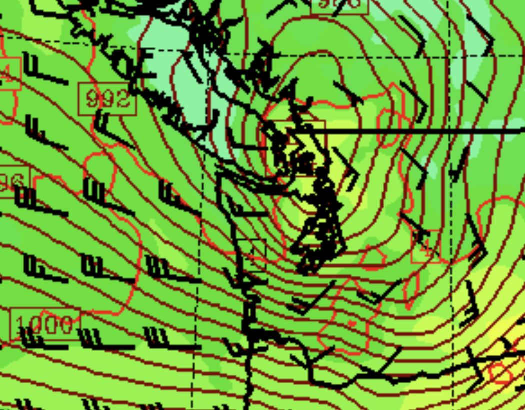
By 4 AM Thursday morning, a 981 hPa low center will be positioned over the NE side of the Olympics
Three hours later it will move over NW Washington, with an intense pressure gradient over southern Puget Sound. This means very strong winds there.
The low then moves northeastward into southern BC. This is a near-optimal path for strong winds over Puget Sound.

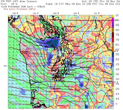
Now let me show you the predicted wind gusts. At 7 AM, there are gusts of 40 kt and more over the south Sound.
One hour later things are getting crazy in the Strait of Juan de Fuca, and over Seattle and the south Sound (blue colors).
Seattle WindWatch shows the multiple predictions of strong winds over Seattle.
Bottom line: if you are in the vulnerable areas, prepare. Charge your electronics, etc.


Thank you for the late night update Cliff. This looks very impressive on water vapor imagery as it's intensifying now. The bent back occlusion looks beastly. I wonder if the NWS will upgrade to High Wind Warning for South Sound. ICON model gets it down to 977. This will.be fun!!
ReplyDeleteLooks like kitsap will be spard Bremerton area
ReplyDeleteThis is what the CBC says
ReplyDelete"The storm affecting B.C.'s coast is the second in a series of three weather systems hitting the province this week.
Kelly Greene, the province's emergency management minister, said the storms are much stronger than they used to be, due to climate change."
But offers no evidence whatsoever.
Had the mariners of a hundred-twenty years ago who had a habit of getting too close to a lee shore in a big blow known that CO2 and climate change controls the weather, they might have resisted the transition from sail to steam and therefore might have lost fewer vessels to the vagaries of the Northwest's late fall and winter storms.
DeleteYep, it's too bad those guys didn't have Kelly's wisdom to help guide them along back then. A real shame..
DeleteLooks like we got spared. At 8 AM Thursday it is quite calm at Alki.
ReplyDeletehttps://www.ndbc.noaa.gov/show_plot.php?station=wpow1&meas=wdpr&uom=E&time_diff=-8&time_label=PST
ReplyDeleteKelly, bless her heart, is too young to know.
https://604now.com/worst-weather-disasters-bc-history/
Seems like a big nothingburger here in Seattle.
ReplyDeleteRandom question, but do you think the constant storms have disrupted the duck migration? We usually get ducks in our pond by now….. but no sign of them.
ReplyDeleteIt seems like only a few forecasters mentioned the possibility that the low would come ashore more south and that would reduce the winds. I'd say most were a little too hyped on this one lol.
ReplyDeleteWere there any power outages?
ReplyDeleteOur weather often exhibits behavior that defies prediction, as apparently happened in this case, but understandably in my opinion owing to the complexity of the varied elements that contribute to, construct, and determine the course of any given system. As it turned out, we had wind in NE Seattle, but nothing above average, and our barometer never was below 997 hPa. The rain conformed to Cliff's prediction, falling, but not heavily as one would expect when we're shadowed by the Olympics. I look forward to the next storm, and may that one come right on up the Puget Sound Lowlands.
ReplyDelete