Here are some amazing shots of a relatively unusual phenomenon around here (this may not be Oklahoma, but every year we get a few). In the first, you can clearly see a beautiful waterspout that is sucking up water off the surface.
 |
| Courtesy Sharon Wandler and KING-5 |
Look at these extraordinary images from Chris Evans (you can view and access pictures at his website:
 |
| Courtesy Chris Evans |
 |
| Courtesy Chris Evans |
These funnels were associated with a fairly strong convective cell that was apparent in the Camano Island radar. The funnels were seen between 4 and 4:15 PM (2300 and 2315 GMT). The radar reflectively shows some very strong echos (yellow and reds) near the location in question.
A closer in view. Wow..the red dot looks like the position of the funnel!
The radar provides the tops of the convective cell...looks around 20,000 feet (see image). High for around here, a joke in Oklahoma.
The atmosphere was modestly unstable today, with small amounts of CAPE (convective available potential energy)--the measure of how much energy a rising parcel can acquired from buoyancy. Here is the plot for around 2 PM--perhaps a few hundred. Decent for western Washington, comical in Oklahoma. Lot of instability offshore as the colder air moves in aloft.
There was no real boundary which could cause horizontal rotation (like a front or shear line), so vertical wind shear (winds increased rapidly aloft), must have led to rotation around a horizontal axis that was redirected into the vertical by the strong updraft in the convective cell. Sounds complicated I know, but one of the great insights meteorologists gained during the past 30 years was how horizontal rotation (rotation around a vertical axis) can result from wind shear in the vertical.
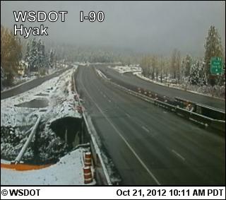
And look what's back in the mountains:


I would have thought that horizontal to vertical wind association would have been second nature. A perfume bulb pushes air horizontally across a tube that then creates a vacuum and vertical movement of the liquid inside. Since the atmosphere behaves the same way wouldn't you guys have put that kind of thing together ages ago? Makes sense to my ignorant mind.
ReplyDeleteWe got a bit of pea shaped hail at the same time (more of less) near Westwood Village/West Seatle.
ReplyDeleteI was flying out of Port Townsend back to my home airport of Arlington at the time. There was a wall of virga that extended from La Conner all the way South along Whidbey Island, but over the sound there was smooth air and almost clear skies.
ReplyDeleteI had to fly to Everett to find a clear path back and passed Hat island around 4PM.
I have a few pictures of Hat Island at about 3:50PM and a photo of the the virga that was just North of it.
Ahhh Winter, How I've missed you so,welcome back.
ReplyDeleteHuh. I always thought that was Gedney island.
ReplyDeleteI was looking through the KATX level II radial velocity radar earlier and I noticed the circulation associated with the funnel. I'm pretty sure I was not actually seeing the funnel itself, although KATX is nearby. Whatever it is I saw, I estimate at least a 60kt difference between the two sides of the circulation.
ReplyDeleteLooks like possibly another funnel tried to form just north of Sultan this evening. http://youtu.be/NNmpRqEOLQc What do you think?
ReplyDeleteOn Sunday 10/21 around 6:00 Driving across the I-90 bridge I saw a distinct wall cloud (vertical column distinctly descending from the regional cumulonimbus floor) off to the south around Renton or Kent. The video in the above post resembled. No funnel formed, but I was sure looking for one! I've never seen anything like that in Western Washington before. The cloud was just to the SE of a torrential rainstorm that was tracking NE.
ReplyDeleteMy wife and I were walking down the hill to the cabin at the right time. It was an amazing site!
ReplyDeletehttp://i1311.photobucket.com/albums/s674/chris_jensen4/photo_zpsbc76086a.jpg