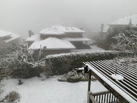
Dr. Peter Benda's Home Around 1100 ft in Bellevue
The 6 PM surface map show strong, cold northeasterly winds moving down through the Fraser River Valley into Northwest Washington, and temperatures in the 30sF and northerly winds pushing southward into Puget Sound Sound. Cold northerly winds are also surging into eastern Washington.
By tomorrow morning at 8 AM, unseasonably cold air will cover Washington (blue colors below), with a low center along the Oregon coast. As a result, light snow will extend from Portland to Olympia in the west.
The predicted snowfall totals through 5 PM tomorrow, shows very light snow from the the south Sound to Portland, and a half foot or so over the Cascades, including the eastern slopes.
Temperatures will be dropping to around 20F around Yakima on Sunday and Monday mornings, threatening cherries and some other crops. The good news is that temperatures should warm back to normal by mid-week, as suggested by the latest National Weather Service ensemble of many forecast runs (see below).


Thank you for including Eastern Washington. :)
ReplyDeleteThe maximum temperature at my location in NW Bellingham today was 37.7F. This is the coldest daily maximum temperature since 02/04 and the coldest daily maximum temperature that I have recorded during any March.
ReplyDelete