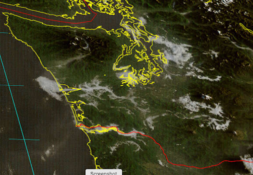
The high-resolution visible satellite this morning around 7 AM was striking. Few clouds overhead at higher elevations, but lots of sinuous clouds in river and mountain valleys.
As I will explain, this is a very typical situation this time of the year.
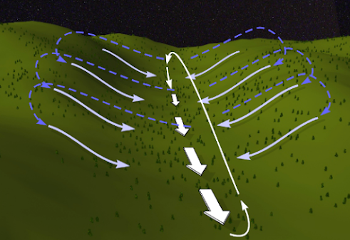
During the late summer and early fall, nights are getting much longer, but the extensive cloudiness of winter has not yet begun. Thus, the ground is able to radiate infrared radiation to space and to effectively cool. The cold ground cools the air near the surface. Cool air is denser and thus is heavier than warm air and tends to sink down the slopes of valleys (see figure below).
Cool air pools at lower elevations of the valley, and then slides down the valley towards lower elevations.
If the air has sufficient moisture, the cooling along the valley slopes can cool the air sufficiently so that the moisture condenses into small water droplets--thus producing shallow valley fog.
This is why many of Washington's river valleys filled with fog and low clouds this morning.
Let's take a look in more detail!
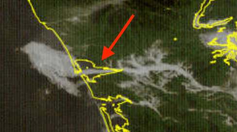
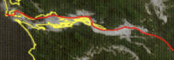
First, consider the Chehalis River Valley (below). The valley was filled with fog and amazingly a "fog jet" pushed into Willapa Bay and then appeared to contribute to a cloud bank along the shore.
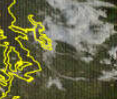
Near Seattle, the Green and White River Valleys had fog.
And the great Columbia River had a wide valley fog area.
But fog is not the only thing that can drain into valleys. So can smoke!
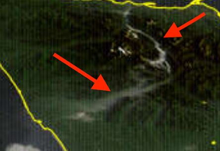
There are some smoldering, dying fires at higher elevations in the Olympics, and their smoke has descended into some river valleys draining to lower elevations. This morning's visible satellite image showed some of that valley smoke action! (see below).
Finally, you might ask whether modern weather prediction models can predict such valley fog.
It is a very, very difficult forecast: you need very high resolution and the ability to handle the complex physics near the surface.
Most weather prediction models do not have the resolution to deal with such valley fog, but the UW uber-high resolution WRF forecast system (with a grid spacing of 1.3 km) has a chance.
Below is the prediction of low-level cloud at 5 AM this morning from the UW WRF model. We got a good piece of the low-level clouds in the Chehalis Valle--and even the coastal clouds!-- but underplayed the clouds in the Columbia River Valley.
_____________________________________
Announcement: Portland American Meteorological Society Meeting on Saturday, September 30.
When: Saturday, September 30th 2023 @
10AM
Where: OMSI (Oregon Museum of Science and Industry) in
Portland. Main auditorium. 1945 S.E. Water Ave. in Portland.
Driving
directions to OMSI: http://tinyurl.com/6rrz8em
Meeting:
This meeting is free and open to all ages of the general
public.
Overnight Accommodations: For overnight
accommodations in Portland, please see: http://tinyurl.com/7boqrsf
Subject:
The Portland office of the National Weather Service and Dr. Cliff Mass (U of W)
will reconstruct and dissect the record-setting February 2023 Portland snowstorm
in this technical meeting. Maui wildfires will also be discussed.

Every year my mother would look out over the orchard in front of our house in Olalla and say, "Fog in the valley. Fall is here." It's right up there with turning leaves for me.
ReplyDeleteLake Washington had some great clouds spinning off the surface this morning. Thanks!
ReplyDeleteSo cool, thank you for this explainer! I remember in the past you had posted some of the smoke satellite imagery and it was interesting to see how nicely it traced along the i90 corridor. And helped me understand the "wind tunnel" effect of easterly winds through that area.
ReplyDeleteI love this time of year when you wake up early and it's foggy out there before it burns off, often by 9 or so. Sometimes the fog lasts much of the day too.
ReplyDeleteIn fact, Tacoma had some fog I think one morning last week and temps at night are dropping into the 40's, at times mid 40's. As you predicted I think last week, we some days didn't get out of thee 60's. Looks like we hit 76 today. The low tonight is 52 and I have the heat in the living room and kitchen on low, mostly to reduce the chill in those rooms in the mornings now.
Great post, thanks. With longer nights and clear skies the overnight lows have begun to tank into the 30's here. I'm seeing red leaves on maples, and yellows (alder, etc). These chilly nights and valley breezes have resulted in lots of morning dew. The wild birds are emptying the feeders; and with all that dew grass is still growing. Love the illustrations today! Hat tip
ReplyDeletewent for a bike ride from Bellevue to Maple Valley yesterday around sunset and once I got on the Cedar River trail the temp dropped at least 5 degrees immediately. Riding further to Issaquah, once out of the river valley the temp rebounded.
ReplyDeleteCliff, wondering if you might comment in a future blog about all of the talk of a statewide drought, and water rationing in Seattle. Do you think this is being overblown, or is it legitimate? The reservoirs in upper Kittitas County are extremely low right now, seems as if that could be problematic going into next year with the predicted El Nino winter. Thanks.
ReplyDeleteThanks, I'd wondered why the temperature difference between my valley and ridge is greatest at this time of year, despite overall temperatures being warm!
ReplyDelete