It is a real meteorological curiosity. Our Septembers are marvelous, and the first two weeks of October are often splendid, with low clouds in the morning and lots of sun in the afternoon. The trees turn flaming colors and our sunsets are often magnificent. A view above the fog yesterday, supplied by Greg Johnson of Skunk Bay Weather takes your breath away (below). We are living in Paradise.

But then, generally in the third week of October, a meteorological switch is pulled and the weather changes. The storm track, which had been happy to savage southern Alaska, moves southward into our region, shifted by the development of a broad area of low pressure over the Gulf of Alaska. Rain and clouds move into the Pacific Northwest, 60s and 70s become fond memories, and Northwest residents hunker down for roughly four months of moisture and inadequate sun.
It is the price we pay for the bounty of water that gives us massive hydropower, great agricultural productivity, our fisheries, and more. It is also protection from a major northward onslaught of Californians.
This morning is a typical mid-October day, with low clouds over the lower elevations but bright sunshine aloft (see the 9 AM visible satellite image Saturday morning). If you want sun now, get above roughly 1500 ft or head eastward. Sun should reach the lowlands later today.

Our nice fall weather will end later on Tuesday, as the circulation over the Pacific moves towards its winter arrangement. One way to see this transition is from a very nice graphic found in the Seattle RainWatch website that shows the precipitation forecasts from the NAEFS ensemble prediction system for Seattle.
Remember that an ensemble systems runs many forecasts, each slightly different, that helps one get a measure of the uncertainty of the forecast. In this graphic, the median of all the forecasts (of 6-h precipitation) is shown by the horizontal red line and 50% of the forecasts are within the boxes. The extremes are indicated by thus plus signs.
The message is stunningly clear. Dry until Tuesday, followed by two wet events, and then we settle into a period of light precipitation. Very typical for this time of the year.


Today at 2 PM, there is a low-amplitude ridge of high pressure over us and a weak jet stream is across southern Alaska and Canada.

But by Wednesday at 11 AM the situation is radically different. A tough of low pressure has pushed south of the Aleutians and a MUCH strong jet stream has set up due west of us. The meteorological hose will be directed right at us. Be ready.

Seattle Times Recommends a No on I-1631: click here.
My next blog will be: Initiative I-1631: At Odds with Democratic Values


Contrary to some folks, I love the wet Fall and Winters here. Spending over five decades in the Midwest wore me out with the constant (and often bitter) cold and gray skies, not to mention having to shovel snow constantly to clear my parking space and chipping the ice off of my car every morning just to get out of my parking space and drive to work.
ReplyDeleteI agree Eric. I grew up in the Midwest. The frigid winter temperatures found there are much harder to take than the damp winters out here. When everything outside is frozen solid, what can you get done? Nothing.
ReplyDeleteFolks back there come from a tough stock of people - and it shows. Of course, in a certain way, you have to admire them for that toughness.
Yes the transition at this time of year is remarkable. This afternoon I sitting on a bench on Camano Island and it was hot. A month later it can be full on winter - the best example came in November 1985.
ReplyDeleteI grew up in the Northeast, yes we had bitter cold and snows that lasted until March, yes we were hearty stock, but we also had sun. We skated on frozen ponds, built snow forts and had epic snowball fights that lasted hours. Winters here are a different kind of animal all together, weeks of grey, sideways rain, and a damp chill that creeps into the bones. After 38 years of living here, I am convinced the folks out here are more hardy than those back home.
ReplyDeleteQuestion about trip planning during winter Cliffs: I’m going to be chartering a powerboat out of Anacortes for a week in January or February, and the charter company has agreed to let me specify the dates with 5 days notice. Ideally, I’d try to choose a week with insignificant winds, and hope for a little sun with those calm conditions. What would be the best resources for me to monitor on the midterm forecast that would help me select a good weather window? I tried the link in your post to the week long precip forecast, but I couldn’t find that particular page where model results are aggregated. Thanks very Cliff for your guidance on this issue. (My email = stevensugarman@hotmail.com)
ReplyDeleteFrom another boater, I would monitor the NOAA 7-day forecast and a large region forecast (model based, thru say Windy.com).
DeleteIf you're going to the San Juans from Anacortes the good thing is they're said to get more rain shadow effect than Seattle does. January often seems to be better than February.
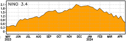
Forecasts up in the southern interior of BC certainly indicate a progression toward seasonals, cooler weather with rain in the forecast after 3 weeks of very little rain and balmy temperatures. Not cold enough for much in the way of mountain snow around here but we're getting closer. September here brought well below average temps, a lot of low elevation rain and a lot of snow in the mountains. October countered that and the snow is pretty much all melted. Hopefully the cooler, wetter seasonally trend sticks around throughout Nov! I fear the blob el nino combo
ReplyDeleteSadly the rain is drawing many Calis to my part of Cascadia after the big fires. And they are bringing more money than locals can compete with in our tight housing market, not to mention the impact on jobs & infrastructure. Nothing gold can stay...
ReplyDelete