August 31, 2021

Hurricane Ida and Global Warming: Unsupported Claims

It didn't take long before the media "connected the dots" and made full-throated claims that Hurricane Ida was the stepchild of global warming.    

Even well-known TV weather personality Al Roker (who I very much admire) got into the act:

"We are looking at the results of climate change ... that's what created this monster storm"

But it is easy to demonstrate that real data shows that these claims are without basis, and that National Public Radio, the Seattle Times, and others are publishing stories that are contradictory to the best science and observations.


The hypothesis in all these stories is that human-caused climate change warmed the temperatures of the sea surface (e.g., the Gulf of Mexico, tropical Atlantic) and thus "supercharged" Hurricane Ida.

Now the first thing that a responsible journalist would do regarding Ida would be to determine whether the Gulf of Mexico, where Ida developed, had significantly above-normal temperatures last week.

If that was true, then a reasonable journalist would check whether the warming was the result of a long-term trend--something required if human-caused global warming was significant. 

Apparently (as demonstrated below), most journalists did not take these basic steps before they wrote the stories.    But I will do so here!

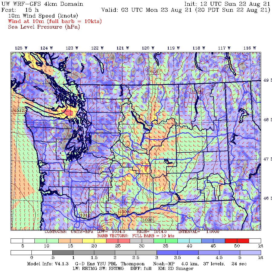
Temperatures of the Gulf of Mexico

Keep in mind the track of Hurricane Ida, as illustrated by the official NOAA track information below.  The shading shows you the locations of tropical storm and hurricane-force winds.  The storm revved up to hurricane strength south of Cuba and really started to rev up north of 25N.


To get hurricane formation, one needs sea surface temperatures of at least approximately 27 °C, and virtually the whole Gulf of Mexico was at that level, which is typical for this time of the year.  

Below are the sea surface temperatures for the seven days immediately before Ida revved up and made landfall.  Temperatures of the whole route of the storm were way above the necessary threshold.  Warm water was no problem for the development of Ida (29C and more pretty much the whole way).


Now, the million-dollar question:
  

How unusual were the Gulf sea surface temperatures during the strengthening of Hurricane Ida?   The figure below shows you the anomaly (or difference) from climatology (normal)  of the sea surface temperatures before Ida strengthened (Courtesy of Ryan Maue, previously NOAA Chief Scientist).

Wow.   The water temperatures were actually COOLER than normal where Ida started to intensify (south of Cuba).  Interestingly, this is due to the vertical mixing due to previous Hurricane Grace.   And for much the route north of Cuba, where Ida rapidly strengthened, temperatures were normal or slightly above normal (less than 1°C above normal).  Only near the coast, for the shallow waters of the Gulf shelf, did the temperatures climbed more than 1°C above normal.


The bottom line:  warmer than normal water was not the key to the development and intensification of Hurricane Ida.   The Gulf of Mexico is pretty much always warm enough to support the rapid strengthening of tropical disturbances.   

For Ida, there were some very favorable elements:  little vertical wind shear (which tears the storms apart) and a plume of very moist air that got ingested into the storm (see a map of integrated water vapor transport, IVT, below).


Sea Surface Temperature Trends

Even though the sea surface temperatures were not significantly warmer than normal for Ida, one might ask, has there been a significant upward trend in sea surface temperatures in the Gulf, one that might be indicative of a major global warming trend?

To give you some insight into this issue, here is a plot of August sea surface temperatures over the Gulf from 1983 to this year (click to expand).   Yes, there has been some warming over nearly 40 years....and yes, human-caused global warming could have been the cause.... but the warming is quite small--less than 1°C.

 I independently secured some NOAA sea surface temperature data over the Gulf of Mexico for a longer period (1948 to now) for the month of July and plotted it up below.  Not much a trend, with July 2021 being RELATIVELY COOL.  


A responsible journalist investigating the potential impact of global warming on Hurricane Ida SHOULD have examined the information noted above and would have found that the connection was very weak:  the sea surface temperatures were not very anomalous (warmer than normal) along the path of the hurricane and that there has been only a very minor upward trend in sea surface temperatures in the Gulf of Mexico.

And a competent journalist should have also asked:  is there much evidence of an increasing trend of hurricanes reaching U.S. shores?  Something that should have occurred if global warming was significant.

Below is a plot of the number of landfilling hurricanes that have struck the continental U.S. (Courtesy Roger Pielke Jr).  The trendline is down.


Major hurricanes  (category 4 and 5)...the same thing.  No increase.


What a responsible journalist would conclude

A competent journalist doing a story on the relationship of global warming and Hurricane Ida would quickly have learned that:
  • Hurricane Ida did not develop over unusually warm water.
  • That the Gulf of Mexico is always warm enough to support major hurricanes in late summer.
  • There is only a very small warming trend of the Gulf of Mexico over the past half-century
  • There is no upward trend in the number of hurricanes striking the U.S.
  • There is no upward trend in the number of major hurricanes striking the U.S.
And the clear conclusion that would have been reached:  there is little reason to expect that global warming had much to do with the rapid intensification of the hurricane over the Gulf of Mexico.

Unfortunately, journalists at major media outlets from the NY Times, to the Washington Post, to the Seattle Times did not take the time to do the research needed to determine the truth.  And they published stories that seriously misinformed their readership.

Global warming is now used by incurious, politically oriented media to explain almost everything.  Don't believe me?  Check out this recent headline in the Seattle Times, based on a NY Times article.  Profoundly disappointing.


August 29, 2021

The Landfall of Category Four Hurricane Ida

A major hurricane is hitting the Gulf at just the wrong place for New Orleans and environs.

Hurricane Ida, a category four hurricane with winds gusting to 150 mph is now making landfall.

The latest weather radar image (showing intensity of precipitation) clearly shows the eye of the storm (letter E!), just making landfall on the Lousiana coast (below).  


Ida has a compact eye, with the eyewall apparent in the precipitation band indicated by the blue arrow.   A secondary eyewall appears to be forming (red arrow), which is temporarily weakening the storm (it might have become a category five storm if the second eyewall did not start to form.

The infrared satellite picture (which is essentially providing the temperature of the clouds and surface) is impressive-- the eye is small, but well defined, with high clouds (red colors) surrounding it.

The small size of the eye is a very good thing because the strongest winds are limited to the area in the eyewall of the storm.   Here are the latest wind reports (10AM), with the gusts shown in red (click on image to expand).  Gusts to 89 mph.   Note the strong easterly (from the east) winds moving towards Lake Pontchartrain and New Orleans.   Not good...pushes water onto land in the form of a storm surge.


Maximum winds gusts so far (see below) have ranged as high as 128 mph

The storm will weaken as it moves over land, but extremely heavy precipitation can be expected, with totals reaching 15-20 inches in southern Lousiana and large rainfall totals extending into the Northeast U.S. (see NOAA/NWS forecast below)


Predictability of the Storm

The forecast of Hurricane Ida is classic:  extremely good forecasts for the storm track many days out, but the forecast of the storm intensity (central pressure and maximum winds) underplayed the storm.

The forecast tracks of major U.S. and Canadian models on Friday morning were quite good, but were slightly too much to the west.  (black line shows the observed track).

By yesterday morning, the track forecast was excellent.

But what about the intensity forecast on Friday?  One measure of intensity is the central pressure of the storm (the lower the pressure, the more intense).    The latest observations indicate the low center is down to 930 hPa (hPa is a unit of pressure).  Here are the forecasts from yesterday morning (black line indicates the observed).  None of the forecasts got the storm deep enough.  As a result, their winds forecasts have been too low.

As shown by this graphic by Dr. Brian Tang, University of Albany, the winds were about 25 knots too slow for the 47 hr forecast and about 50 knots too slow for the 72 h forecast.


Why are our models frequently unable to get the intensification right?  One reason is the lack of resolution.  To simulate such storms one needs to simulate the hurricanes with model grid spacing of approximately one kilometer or better, but the National Weather Service lacks the computer resources to do so.

Then there are deficiencies in model physics, such as how sea spray humidifies the air above the breaking waves.  Or how cooler water mixes vertically in the upper ocean surface.

And then this the need for model data to describe hurricane structure offshore.

An apparently significant issue for Hurricane Ida was a patch of deep warm water over the Gulf of Mexico, directly on the track of the storm (see below).  Such warm water greatly helps a storm to intensify.


Finally, one thing to keep in mind:  our ability to predict the tracks, and to a less extent the intensity of hurricanes, is a potent tool for reducing damage and casualties from tropical storms and hurricanes.

It is why tropical storm deaths are far fewer today than 50-100 years ago, even with many more people on the planet.


August 27, 2021

This is the Season For Large Westside Wildfires. Why? And the Latest Forecast. All in My New Podcast.

We are now in the season of large, catastrophic wildfires west of the Cascade crest.  Mid-August to mid-September is ground zero for historic fires over the western slopes of the Cascades and coastal mountains of our region.

Picture courtesy of Bureau of Land Management

But why are major westside wildfires limited to this season?  

This podcast will explain why and describe the essential requirements for major fires west of the Cascade crest.

I will also touch on the impacts of global warming....and my conclusions, based on considerable research, may surprise you.

Finally, I start the podcast with the forecast, which promises no major heatwaves, but near-perfect conditions over the weekend.

You can listen to the podcast here:


Or access the podcast on all major services.

 HTML tutorial HTML tutorial

Like the podcast? Support on Patreon Become a Patron!

August 26, 2021

A Pacific Cold Front Moves Through, With Near-Perfect Weather Ahead

It feels like fall like now, as a Pacific cold front moves through the region.  

The winds have started to gust, temperatures have fallen into the mid to low 60s, and leaves are blowing around outside.

The front was apparent in the forecast this morning, as an area of lower pressure and a sharp wind shift (see surface map for 8 AM).  I have indicated the front with a blue line.


And as it passed through this afternoon, there was a band of light rain, clouds increased, and the winds strengthened.   Here is the radar around 1 PM..you can see the rain.


And by 5 PM, the front had reached the Cascades, with increased westerly winds behind it.  

Winds that wrapped around the Olympics and converged over Puget Sound, producing a Puget Sound convergence zone (see surface weather map at 7 PM).  Northwesterly flow north of Seattle, southwesterly flow to the south.


The air converging a low levels forces air to rise, producing clouds and precipitation, something you can see in the latest radar imagery.  Gentle to moderate rain is falling now in the north Sound.


I rode my bicycle down to Magnuson Park and took this picture around 7:30 PM looking northward.  The ominous clouds of the convergence zone were evident.  Look closely and you can see rain falling.


As our region has cooled, wildfires have declined.  And with onshore flow, air quality at the surface is generally good, except for downstream of the remaining fires (like the Schneider springs)

HRRR surface smoke forecast for 8 PM Thursday.

If you are worried about heatwaves and smoke, the forecast is very favorable.    A ridge of high pressure will build again over the weekend and temperatures will be nearly perfect...mid-70s.

And then a trough will build over the region on Monday and Tuesday, bringing temperatures only reaching the upper 60s (see upper-level map for Tuesday morning)


So a summer that started much warmer than normal, has a much cooler than normal ending.  Yin and Yang of the meteorological world.


August 24, 2021

Evening Northwest Winds Descend the Eastern Slopes of the Cascades

One of the most interesting aspects of warm-season weather of our region is the northwest winds that descend the eastern slopes of the Cascades during the summer.

During the mid to late afternoon, the northwesterly winds (from the northwest) tend to increase, peaking during the evening and weakening during the early morning hours. Sometimes the winds can gust to 30-40 mph, so this zephyr can be a significant blow.

Impressively, these downslope winds can push well into the Columbia Basin, often reaching the Tri-Cities.

Picture by minniemouseaunt

Such evening winds are important for many reasons.
  • They provide substantial and reliable power for the wind turbines that have been positioned over and downwind of the eastern slopes of the Cascades.
  • Such winds can really rev up wildfires over the eastern Cascades slopes and provide a substantial danger to the community and firefighters.   There is a good reason that many eastside fires make major runs during the evening!
This important local weather feature was first described by Doran and Zhang (1994) and I also looked at it, with co-authors, in a few studies.  And this phenomenon has been in action during the past several days, as I will show you now.

Let's begin by viewing the winds at Ellensburg, just to the east of the Cascade slopes, during the past three days.  Each day, the winds would increase to 20-30 knots during the late afternoon and early evening, followed by a decline around midnight.

Wind direction? From the northwest!


High-resolution weather prediction models can simulate and forecast this feature quite well.

 To demonstrate, below is a  surface wind speed forecast from the UW model, with yellow, orange, and red indicating the strongest winds.   The first image is at 8 AM Sunday and the second is for 8 PM that day.  

Can you see the difference between the images?  Much stronger winds east of the Cascade crest in the later image.  You can also see increasing winds in the eastern Strait of Juan De Fuca!


So why do the winds over the eastern slopes of Cascades and immediately downstream increasing during the afternoon and evening?

It is all about pressure.

During the summer, the typical large-scale pressure pattern is to have high pressure over the eastern Pacific and lower pressure over the heated interior away from the coast, something that is shown below (a sea-level pressure map at 5 PM Sunday, the colors are temperature, red and brown are warm).

With high pressure offshore and lower pressure inland, there is a tendency to get weak onshore flow (from the west).

But as in late-night TV commercials, there is more!  During the day, as the interior, less affected by the cool coastal waters, heats up, the pressure falls substantially (warm air is less dense than cool air). Thus we end up with lesser low-level pressure east of the Cascade in the afternoon and early evening.  This is something illustrated by the pressures at Pasco over the last three days (see below).  Look closely and you can see substantial pressure falls during the day as temperatures warm.

In contrast, atmospheric pressure west of the Cascade crest, where temperatures changes are muted, varies far less, except for the last day as higher pressure built over the region (see below).

So during the day, as temperatures rose much more in eastern Washington, pressures fell there more than in the west, producing an enhanced east-west pressure difference, with lower pressure to the east.

This increasing pressure difference drives westerly/northwesterly winds east of the Cascades crest.  It also contributes to increasing westerly flow in the Strait of Juan de Fuca, something that was evident above.


August 22, 2021

Another Major Northwest Heatwave? Looks Unlikely for the Rest of the Summer.

After one extreme heatwave and one minor one, folks are heatwave concerned, so I thought I would provide some good news.  

The chances of a major warm spell, with temperatures over 90F west of the Cascades and over 100F in eastern WA, is become increasingly unlikely, based on the latest forecasts.

And then consider the time of the year.  The sun is rapidly weakening now and nights are lengthening quickly.  And in addition, the atmosphere has switched into what I call a La Nina pattern, with a big ridge of high pressure offshore, with cooler northerly flow over the West Coast.

But first some climatology.

Here is a plot of the climatology of extreme high temperatures for Seattle (yellow lines).  Heatwave central is in late July and early August.  The record highs decline in August, have occasionally risen to the mid-90s in early September, but never have gotten above 95F after mid-September and just reacj 90F by late September.  The bottom drops out in October.


Our forecast models have some skill to roughly 1.5 to 2 weeks out, with small skill for big pattern changes after that.

The latest European Center Ensemble Forecast, the gold standard for one-week forecasting, predicts temperatures below 80F for the rest of the month at Seattle, with today being the coldest of the bunch.  Mainly 80s in eastern Washington (not shown)


Another valuable tool is the NOAA/NWS National Blend of Models (NBM), which combines a number of different forecast models statistically.   Very skillful.    Its forecast for Seattle through early September is similarly temperate.  Just perfect really.

I could show you other forecasting systems, but they all basically suggest the same thing, with high confidence:  mild temperatures with no significant heat waves ahead.

And there is NO hint of the crazy easterly winds that hit early last September, producing the terrible wildfires.  We are now entering the danger season for major wildfires west of the Cascade crest (late August through Sept 15).  I know about this because I am actively researching this issue.  All major western WA and NW Oregon fires have resulted from strong east winds.  Trust me...I will let you know if I see it set up.

Why has the weather been mild without heatwaves lately?  

Because of a persistent ridge of high pressure offshore.   To show this, below is a plot of the difference from normal of the height of the 500 hPa pressure surface (think of it as the difference from normal of the pressure at 18,000 ft).  Yellow and orange indicate above normal...you can see the potent ridge offshore. That is the feature I am talking about.


High-pressure offshore results in cool, northerly winds over our region and onshore flow at low levels--hard to get a heatwave with that.   The latest forecast of the 500hPa heights/pressures for 5 PM on Thursday shows that the pattern is continuing.


So enjoy the weather the next week or two.....it won't last forever.


August 20, 2021

June Gloom in August and the Upcoming La Nina: My New Podcast is Out!

While June was sunny and warm, August is turning cool and cloudy--and that will be the story during the next 4-5 days I am afraid.

Today will barely get to 70F in western Washington....and forget 90s in most of eastern Washington.

Low clouds have spread across western Washington and they aren't moving out very fast.  Smoke is found east of the Cascade crest.


Saturday will be a bit warmer....low 70s in the west and there could well be some sprinkles, particularly over the western slopes of the Cascades.  A weak disturbance moving south out of BC will rev up the clouds on Sunday, followed by an improving trend on Monday.

The big weather action will be on the east coast where Hurricane Henri may hit eastern Long Island on Sunday morning!  The NOAA HWRF forecast is shown below for 5 AM PDT Sunday.  Wow.


My podcast will talk about the forecast, but more importantly, I will review the upcoming La Nina situation in some depth.  Really good news for water resources in the Northwest, bad news for California.

You can listen to the podcast here:


 HTML tutorial HTML tutorial

Like the podcast? Support on Patreon Become a Patron!


Should I Let AI Write My Blogs?

I spend a lot of time thinking about and writing my blogs.   Could AI apps do the work for me?   Could any of you tell the difference? Well,...