March 31, 2021

A Cold Spring That Won't Go Away

 Today, was the first day this spring in which the temperatures got above normal in Seattle (see below, average highs and lows are shown by the purple and cyan colors).  

Yes, temperatures rose to an unimaginable 61F.  It felt very good, particularly since the last few mornings have been MUCH cooler than normal, with lows in the mid-30s.

The recent cool weather has not been limited to Puget Sound but extended over the entire West Coast, something illustrated by the figure below, which shows the difference from normal of the daily average temperatures for the past two weeks.  

Most of western Washington, Oregon, California, and the southwest states were more than 2F cooler than normal.   Chilling statistics

The cause of this icy reign?    La Nina and the associated and very persistent atmospheric circulation pattern it sets up.   This pattern is illustrated by the upper level (500 hPa--about 18,000 ft) weather map for 2 PM last Wednesday (March 24th).  

A high amplitude ridge of high pressure is offshore (the H is the graphic) and this produces strong (and cold!) northerly flow, chilling the West Coast.


To show how persistent this pattern has been, here is a map of the difference from normal (the anomaly) over the last week of the heights at 500 hPa pressure--think of it as the difference in pressure from normal at 18,000 ft).    Much higher than normal pressures (red colors) over the eastern Pacific and lower than normal over the continent.  That implies cool, northerly flow.  Very typical of La Nina years.


So what does the next month look like?  Below is the forecast from the European Center of the temperature difference from normal over the next month.

Yikes!  Colder than normal over the Northwest.


This cold air will foster late-season snowfall.     

We start with much above normal snowpack, with much of the Washington State 140% or more compared to normal.

With this base, the European Center snowfall forecast for the next month shows bountiful snow in the mountains


Late season skiing.  Check.  Plenty of water from snowmelt this summer. Check.  Lower wildfire threat at the upper elevations. Check.

The only negative will be a delay in the higher elevation hiking season.

_______________
Announcement

The Northwest Weather Workshop, the annual gathering to talk about Northwest weather, climate, and major meteorological events, will take place on May 1, 2021. This year we will have a special session on the meteorology of the September 2020 regional wildfires. The meeting will be online. More information, the agenda, and registration information is found here: https://atmos.uw.edu/pnww/
____________________________________


March 29, 2021

143 mph in the Cascades, Snowflakes in the Lowlands, and Strong Winds: A Very Powerful Cold Front Crosses the Region

_______________
Announcement

The Northwest Weather Workshop, the annual gathering to talk about Northwest weather, climate, and major meteorological events, will take place on May 1, 2021. This year we will have a special session on the meteorology of the September 2020 regional wildfires. The meeting will be online. More information, the agenda, and registration information is found here: https://atmos.uw.edu/pnww/
____________________________________

A powerful cold front moved through the region yesterday.

At Camp Muir at 10,000 ft winds gusted to 143 mph, with winds over 100 mph for 15 hours.  Amazing.


But the front, with its intense horizontal pressure gradients, also brought strong winds to the surface, as shown by the maximum gust map on Sunday (shown below--click on the map to expand).  50-60 mph over Northwest Washington and the coast, and 55-80 mph along the eastern slopes of the Cascades and stretching into southeast WA.    The strong flow accelerated as it descended down the Cascade slopes or pushed through the Columbia River Gorge.


One of the most fascinating aspects of the event was the strong westerly (from the west) surge of strong winds in the Strait of Juan de Fuca.  At Smith Island, just off of northern Whidbey Island, the winds rapidly shifted from southerly to westerly, increasing in strength to 40 knots (46 mph)


The leading edge of the westerly wind surge was met by strong southerly winds, resulting in strong low-level convergence (air coming together at low levels).  The map below illustrates the situation at 2 PM Sunday.  Such low-level convergence produces upward motion that can produce clouds and precipitation.


In this case, the potential for precipitation was enhanced by the unstable nature of the air mass (cold air moving in aloft).    Thus, the radar image at 2 PM shows an intense band of precipitation entering the northern Sound  (see below, red is VERY heavy precipitation).   There was lightning associated with some of the more intense convective cells within this feature.


Mary Clemons and her husband decided to take a walk along the shore of Whidbey Island right before this line went through.  Here is her description of what happened:

My husband and I went for a walk on the bluff up at Fort Casey in Coupeville today around 1:30.  There were sinister-looking clouds to the north/northwest around Ft. Ebey (and it looked to be raining heavily there) but the wind was blowing incredibly hard from the south so we weren't concerned we would be affected by that weather - we thought it had already passed our location.  We set out on our walk heading south - into the wind.

Maybe 5 minutes later (or less) there was an abrupt change in weather with seemingly no warning like I have never experienced before.

We were caught in a very intense hail storm with even stronger winds from the north/northwest than we were already having from the south.  We ran for the car (probably a 1.5 minute trek that seemed like it took 1/2 hour) and it was all I could do to open the north facing car door (had to use both hands) to get in and take shelter.

And if you want a more visual impression of what happened, watch a video of the line passage on the northern Kitsap Peninsula from Greg Johnson's Skunk Bay Weather site:

The air temperatures dropped 10-15F behind this front and the combination of heavy precipitation and cooling aloft resulted in both small hail and some snow flakes reaching the surface yesterday afternoon and early evening.  In some locations, the white stuff accumulated leading to dangerous driving (see below on Redmond Way)

And minimum temperatures last night dropped into the lower 30s and even below freezing in many locations away from the water in western Washington (see map below)


Milder temperatures are expected this week as high pressure builds over the eastern Pacific.


March 27, 2021

A Powerful Front Will Cross Washington Bringing Strong Winds and Snow in the Mountains (A Perhaps Some Flakes to the Lowlands)

A powerful Pacific front is bearing down on Washington State, reaching the coast tomorrow morning.

Behind the front is unusually cool air for late March, cold enough to bring snowflakes to the higher hills of the region, and bountiful snow in the mountains.  And there will be winds.

The predicted surface weather maps provide the story (below).  These maps show sea level pressure, temperature (color shading, blue is cold, yellow is warmer), and near-surface winds.

The first weather map, valid for 8 AM Sunday morning, shows the front (red line) offshore.  That front is in a region lower pressure (a pressure trough) and you will note much cooler (bluer) air behind.  Also, note the large north-south pressure difference across western Washington...that means winds.


By 11 PM Sunday night, quite cold air pushes across western WA and Oregon, and is well into eastern WA.


And the forecast for 11 AM Monday, literally brings chills down my back, with primo cold air in BC and the whole Northwest under unseasonably frigid flow.  Protect your outside plants on Monday morning, particularly anything new you had just put outside.


As the front approaches, the winds will greatly accelerate.  Here is the latest guidance from the UW/City of Seattle WindWatch website showing the predicted wind gusts over Seattle over the next few days.  The red color shows the winds from the UW high-resolution system and the green is the National Weather Service forecast.

We are talking about gusts getting to around 40 mph....enough to promote some loss of branches and scattered power outages.


But the real wind action will be in the Strait of Juan de Fuca and northwest Washington....and it will be a play of two acts.  

First, Sunday morning, before the front makes landfall, powerful southeasterly winds, gusting to around 40 mph, will hit northern Whidbey Islands into the San Juans.

But the second act will be even more dramatic, as a powerful westerly (from the west) wind surge moves down the Strait behind the front (see predicted surface winds and pressure at 5 PM Sunday).


At the leading edge of this surge there will be a line of convective clouds and most likely thunderstorms, something shown by the predicted simulated radar image at 1 PM on Sunday.  The red arrow shows the heavy precipitation at the leading edge of the surge through the Strait.  The yellow arrow points to the front moving in off the ocean.  Note how the front is weakened by the Olympics.

My recommendation.....don't hand around outside tomorrow afternoon....it will be intense.


As the front goes by, the snow level will plummet to around 1000 ft Sunday night and Monday morning...with a good chance of some flakes reaching the high hills of western Washington.

But the real snow action will be in the mountains, as cold, unstable air brings Cascade snow, with amounts as much as 1-1.5 ft possible (see snow accumulation through 2 PM Monday)


La Nina springs....you got to love them.

_______________

Announcement

The Northwest Weather Workshop, the annual gathering to talk about Northwest weather, climate, and major meteorological events, will take place on May 1, 2021.  This year we will have a special session on the meteorology of the September 2020 regional wildfires.   The meeting will be online.  More information, the agenda, and registration information is found here: https://atmos.uw.edu/pnww/

Public Radio Station KNKX and Cancel Culture:  What Happens When a Public Radio Station Rejects Viewpoint Diversity and Goes Political.

March 26, 2021

New Podcast: Can Human's Alter the Weather? And the Weekend Weather Forecast

It is an age-old hope of mankind:  to control the weather.


And in this podcast, I will answer the question:  can mankind alter the weather?   

Can we weaken or strengthen storms?   And much more.

My podcast also includes the weekend weather forecast for the region, promising a favorable Saturday, a strong front on Sunday, and unusually cool air on Monday.  And some good news for skiers!

Here is my podcast:

Click the play button to listen or use your favorite streaming service (see below)

You can stream my podcast from your favorite services:

March 25, 2021

Secret Rocket Launch. Alien Visitation, or Meteorology?

Important Message: The strange lights Thursday night were the debris from a Falcon-9 launch vehicle that were re-entering the atmosphere.
____________________

One of the most enjoyable aspects of this blog is that readers send me cloud pictures for identification or discussion.

Most can be readily explained and others require some detective work.

But every once in a while I get a picture that stumps me, and today I will show you such an image.

I received this photo from a well-known photographer, Steve Mullensky of Port Townsend (his Facebook page is here and a story about him here.)   

So this image is from a reputable individual and is not some photoshopped wonder.

You got to admit this object looks like a missile with a trailing smoke plume.

But you need more information.  The image was taken at 7:11 AM on Tuesday, March 16th using a telephoto lens (2000 mm).  The picture was taken from Port Townsend looking east (he estimated 98 degrees from north, somewhere between Glacier and Del Campo peaks in the image below.


And he subjectively estimated that the image was roughly 100 miles away, but that could not be precise.

Thus, on a map the "object" would be roughly in the direction indicated (and I note 100 miles).  This direction does not pass over Whidbey Island Naval Air Station and runs north of the Everett Homeport.


Mr. Mullensky provided some additional photos that seem to suggest that the object appeared to curve into more level flight (but one has to be careful with perspective here). 

The "cloud" does appear to be below the level of some cirrostratus clouds above.


He also digitally enhanced an image that appears to show some solid object leading the strange cloud.  Does look like some kind of alien craft.


Trying to get some more information, I took a look at the first visible satellite available after the (7:36 AM) sighting (see below).  Some low clouds banked against the western side of the Cascades and lots of cirrostratus ice clouds aloft (the thin veil), with obvious aircraft contrails.


The image looking north from the Kitsap Peninsula supplied by Greg Johnson of Skunk Bay Weather shows the high clouds.  But no sign of the rocket cloud in any of his images.


An important issue for producing clouds is the degree of air saturation, something that can be estimated by the vertical sounding of a balloon-lofted radiosonde at Forks, on the Washington Coast (see below).   The nominal time is 5 AM March 16.

Temperature is in red, dew point is the blue dashed line.   When the two are close together, there is saturation--which means clouds.   You can see a layer in which they nearly touch, around 30,000 to 35,000 ft.  That is probably associated with the high ice clouds I mentioned.  But the air is reasonably close to saturation below, down to around 18,000 ft.


OK, so what could be the explanation of all this?

1.   There was a secret rocket launch.   Not my favorite.
2.  Some kind of alien craft.  Even less of a favorite
3.   A high-performance military aircraft from Whidbey accelerated vertically and caused the air to become saturated, producing a contrail.   My top choice at this point.
4.  A commercial aircraft rising to cruise altitude....but from where?  Paine Field?

One thing in support of (3, 4) is the suggestion of two smoke/contrail plumes coming off the object (see below).


Anyway, this one is a mystery and if anyone has some ideas or information, I would be very interested to hear your thoughts.


Courtesy of Joe Wos

March 23, 2021

The Little Saildrone Survives and A Weak Tornado Hits Our Coast

Several of you asked whether the drone sailboat, Saildrone 1054, survived its rendevous with a vigorous Pacific storm.

The answer is yes.   35-40 mph winds and 25-30 ft waves did not appear to cause any problems.


The small autonomous weather station is now returning to port and will be deployed around a hurricane next year.   That will be a more severe test.  

The saildrone also had another unmanned vehicle for company during the last few weeks, an underwater glider (see picture).   NOAA has a fleet of these, capable of diving as much as 1000 meters beneath the surface while taking oceanographic observations.

The combination of these two sensor systems may be a potent way to sample the environment in advance of and behind tropical storms.

And now about the tornado.

A weak twister struck near the town of Ilwaco on the southwest Washington coast around 8 PM on Friday, March 19th.    

The National Weather Service produced a map of the tornado path (see below) and they estimated that the tornado only had winds reaching 65 mph.  This is EFO on the enhanced Fujita scale--the weakest twister category.


Damage was minimal, with some tree and roof damage and a few damaged fences.  There was little warning.

This tornado was associated with unstable air coming off the Pacific, a situation that is quite typical time of the year.    

Let's take a look at the radar at the time of tornado touch down using the Langley Hill radar near Hoquiam, with a black dashed oval around Ilwaco.  Oranges and reds indicate heavier precipitation

There was a modestly strong line of showers, oriented southwest to northeast, that were just passing through Ilwaco at 8 PM.   The twister was embedded in this line of convective showers.


Some of the embedded cumulonimbus towers got to around 20,000 ft, as shown by the echo top product available from the radar (see below).  Decent around here but a real yawner in the Midwest.


The Doppler radar imagery, which shows wind speed towards or away from the radar, did not suggest any large-scale rotation, commonly called a mesocyclone.

So why a weak tornado?   Let's investigate further by plotting the winds at the time of the tornado occurrence (below).  The star indicates the tornado location.

The winds at Clatsop Spit, just to the south of Ilwaco were quite strong, with gusts to 46 mph.  But winds weakened rapidly over land, reaching only 12 mph just to the north of the tornado.  A rapid change of winds can produce a lot of horizontal wind shear (wind change with distance), and wind shear has inherent rotation around a vertical axis.

An illustration of shear producing rotation is shown below (but this figure shows vertical wind shear, but the idea is the same).


In any case, the inherent rotation associated with horizontal wind shear can be enhanced by the vertical motion associated with the strong convective line, revving things up enough to get a weak tornado.  Check out my Northwest weather book for a more detailed explanation of this process.

Such weak tornados are annual affairs in western Washington and frequently are associated with Puget Sound convergence zones, where both wind shear and thunderstorms are often found.


March 21, 2021

The Northwest Snowpack Trend of the Past Fifty Years: The Truth May Surprise You

The media is full of stories suggesting that global warming has greatly reduced the mountain snowpack in the Pacific Northwest.

Activist "climate justice" groups like 350Seattle have taken the snowpack loss claims even further, suggesting the current snowpack is "half what it should be":


But the truth, backed by observations, contradicts such apocalyptic descriptions, as I will show you in the blog.

Recently, the Office of the Washington State Climatologist (who is Dr. Nick Bond of UW JISAO) put online a wonderful tool for visualizing snowpack at some major locations in Washington State.  Plotting up the actual snowpack trend proves to be highly educational.

I am going to show you the change of snowpack for over the past fifty years.  

Why fifty years?  Because that is the period when human emissions of greenhouse gases have gone up rapidly and when GLOBAL temperatures have risen more quickly (see plot below).  If you are looking for a period to see changes in Northwest snowpack driven by greenhouse gas increases, the last fifty-year period is the time to look for it.


So using the OWSC website, let me show you the fifty-year trends of snow depth on March 15th each year.   I chose this date because it is close to the date of maximum snow depth in the Cascades and I have the data for this year.

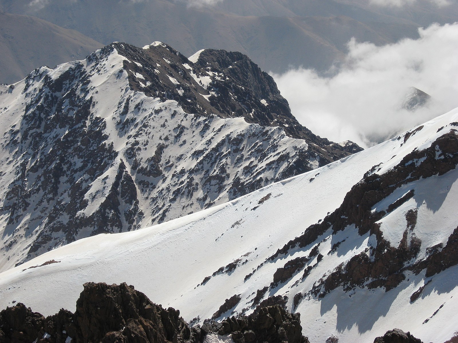
Let's start with the higher elevation Crystal Mountain ski area (around 6000 ft).  An increase from 1990 to 2000 and then relatively steady.


Next, lower elevation (~3000 ft) Snoqualmie Pass. Not much trend in snow depth.


Intermediate height Mount Baker?   No real trend.

Or Paradise Ranger Station (around 5500 ft).   Hard to see a trend.


Yes, there are some random, low snow-depth years (like 2015), but no trend is apparent during the period when global warming has been greatest.

Another measure of the amount of frozen water in a snowpack is called snow water equivalent (SWE).  The OWSC website has a nice tool to plot the change in SWE, and I have done so for 1980 to 2019 (see below).  

None of the changes are significant (small circles), and when there are trends, most of them are green (increasing snowpack).  And such increasing snowpack is true at varied elevations.

Finally,  University of Washington research scientist, Mark Albright, took over 200 USDA Snotel locations over the Northwest and plotted up the snow water equivalents (blue lines) since 1984 (when the data became available) as shown below (the red line is a smoothed running average).  Lots of ups and downs, but no long-term trend.
So the inescapable conclusion based upon snowpack observations is that there has been little trend in the amount of snow in the mountains of the Pacific Northwest during a period in which CO2 has been rising fairly rapidly and when global temperatures are going up.

How can this be?

It can and the reason is the Pacific Ocean.

Let me show you a plot of the trend (change) in surface air and sea surface winter (December-February) temperatures for 1980-2019 from the NASA Goddard (GISS) website (see below).  The Arctic is warming more than anyplace else and, in general, the continents are warming more rapidly than the oceans.  We expect this from basic physical principles and modeling.

Oceans warm up more slowly because of their tremendous heat capacity.


But look closely: the eastern Pacific is warming more slowly than the western Pacific.   Look very closely and you will note that the eastern Pacific has essentially not warmed at all.

The temperature of the eastern Pacific has a very powerful impact on the winter temperatures of the Pacific Northwest, since air is coming off the Pacific virtually the entire winter.

So it makes sense that our winter snowpack has not changed because the sea surface temperature of the eastern Pacific has not changed.  This consistency provides us with more confidence in our understanding.

And there are further lines of supporting evidence.  For example, the melt-out days in major Cascade snow measuring sites have not gotten earlier.  In fact, many are getting later, which suggests more snow.  To illustrate,  here are the trends of melt-out date at Mount Hood and Stevens Pass....both are getting later.

Finally, if we plot the actual monthly surface temperatures during winter over the western slopes of the Cascades from the NOAA Climate Division data set, one finds lots of ups and downs but little trend from 1980 through 2020:


What about the future?  If we continue to pump greenhouse gases into the atmosphere, the Pacific will eventually warm and that WILL reduce the snowpack.

My group, in concert with Eri Salathe of UW Bothell, has been running many high-resolution climate simulations over the region (much of it supported by Amazon by the way).  This is the gold standard for regional climate predictions.

We assumed a very large increase of greenhouse gases (RCP 8.5), which is not realistic, but shows you the worst case (probably about twice a realistic value of greenhouse gas concentration by the end of the century).  It assumes mankind ignores the threat of global warming and revs up fossil fuel use.

Below is the forecast of snow water equivalent for this century at Stevens Pass (roughly 4000 ft) for simulations started in 1970.   The black dots are observations.

Not much change through 2018 in the model and observations, followed by a slow slide through 2050 and a more rapid decline through 2100.   


So even with unrealistically high CO2 emissions (assuming major increases in coal use through the entire century and little use of renewables), there are only modest declines through 2050 (about 25%).    A more realistic simulation would probably move the 2050 values to 2100.

I believe the above is the best estimate regarding Cascade mountain snowpack change available and consistent with the peer-reviewed literature (including papers I have authored on the subject).    I am sure that the activist crowd (e.g. 350Seattle, Charles Mudede at The Stranger) will start calling me names--like "climate denier" for providing it to you.   These folks can be very destructive.  For example, 350 Seattle and the climate justice crowd were able to pressure a fearful KNKX management team into removing my weather segment because the activists wanted the truth suppressed.

But no matter where you are on the political spectrum, you deserve the truth and society needs truth to make the best decisions and plan for the future.

PS;  There are several comments/questions about retreating glaciers.  Glaciers respond to a much longer time scale of climate change than annual snow.  Most of the retreating glaciers in our region have been retreating since the early 20th century, well before human emissions of greenhouse gases were significant.  Most are responding to the end of the Little Ice Age, a period of cooler temperatures and more that ended in the late 1800s.


Should I Let AI Write My Blogs?

I spend a lot of time thinking about and writing my blogs.   Could AI apps do the work for me?   Could any of you tell the difference? Well,...