July 31, 2021

Monsoon Moisture Reaches Washington and Oregon

When one thinks of the Northwest during the summer, the word monsoon is not the first thing that comes to mind.  But during the last day, Southwest Monsoon moisture has spread from the southwest U.S. into our region.

It has already rained at Sea-Tac Airport and clouds have spread over western Washington.  

The water vapor channel of the NOAA GOES satellite clearly shows the plume of moisture heading directly over the Northwest.


And the visible satellite image this morning highlights the associated clouds over western Washington and northern Oregon


The radar image around 7AM indicates some showers moving up into our region.   My newspaper was a bit soggy this morning.


This moist air will be around this weekend and the air is unstable enough for more showers this afternoon, particularly over and east of the Cascade crest.

Over the 24h ending 5 AM Sunday, most of the showers will be over eastern Oregon (see 24-h accumulated rainfall below.  And some of these showers will be associated with thunderstorms. A few light showers could hit western Washington.


But Sunday is a different story, with northeast Washington and southern BC getting more moisture. Serious rain over some of the wildfires near Winthrop.


After today, there will be four warm days before the bottom drops out of our weather.   

Below are the forecasts for the NOAA GFS ensemble system showing the temperature at Seattle.  In an ensemble system, the model is run many times, each slightly differently.  

Today gets to around 80F, and the next four days are slightly warmer.  But then comes Thursday and BOOM...a big decline (the black line shows the average of the many forecasts).   There is some uncertainty in the forecasts, with a range of solutions, but most are MUCH cooler.   Same for Friday and Saturday.

Rain?  Chance of some very light errant showers over the weekend, but the rain chance really revs up on Thursday onwards, with many of the simulations showing rain.


As I noted early, this is quite a vigorous cool/wet event for midsummer, but I suspect it will be welcomed by many.  And it will reduce the wildfire threat for a while, assuming we don't get many lightning starts.


July 30, 2021

New Podcast: Weather Whiplash Week. From Heatwave to Thunderstorms to the Big Cool

My podcast today will review the major shift in our weather that will occur this week.   And in the second segment, I will talk about Northwest thunderstorms.

We start with a minor heatwave today with temperatures zooming to around 90F in western Washington away from the water and into the upper 90s in the Willamette Valley.

But at the same time, a major plume of moisture will move northward into eastern Washington and Oregon, bringing thunderstorms (the image below shows the predicted rainfall through 5 PM Sunday).


Wildfire smoke will move in overhead during the weekend but not reach the surface in western Washington, so you can breathe easily.  But the plot of total smoke above us on Sunday night is scary:


Finally, there is the BIG change at the end of the week.  Clouds, precipitation, cooler temperatures.  Way earlier than normal.  The 48h total rain ending at 5 PM Friday is shockingly wet.


My podcast will not only describe this forecast but give you an essential background regarding Northwest thunderstorms.

To hear the full story, listen to my podcast below or select your preferred streaming service


 HTML tutorial HTML tutorial


July 29, 2021

Super Moisture Plume Headed for the Northwest.

Many of you will need umbrellas during the next week.   And perhaps a lightning rod.  

The cause? 

A dramatic plume of moisture will be heading into the Northwest from the south.  

Southwest Monsoon moisture will be entering our region, and our chances of breaking any dry spell records are dimming fast.

The latest water vapor satellite image shows the impressive moisture plume over the Southwest---and it is heading our way.


Let me start by showing you the latest precipitation forecasts from the UW WRF model.  For the 72 hours ending 5 PM Tuesday, the interior gets wetted down well, with some favored locations enjoying over an inch of rain.  This precipitation is from the plume of moisture from the southwest U.S.  


But our wet bounty is not over: during the next 48 h the first Pacific disturbance of the season moves in from the west and provides precipitation for western Washington and southwest BC. This system is a bit earlier than normal (normally the first wet system occurs during the third or fourth week of August), but no one is going to complain.


Now back to the superplume of moisture coming up into our region.  

Below is the forecast total moisture in the atmosphere predicted by the European Center model for Sunday evening. Known as precipitable water, it represents the depth of water that would occur if all water vapor was condensed out of the atmosphere.  The colors represent the percent of normal.  Blue is high (over 160% of normal, gray is VERY high (over 250% of normal).  Lots of moisture moving northward east of the Cascade crest.


How unusual is this moisture plume?  The predicted values over eastern WA and southern BC on Monday morning will be up to FIVE standard deviations from normal for that date (see image below, dark gray).  A standard decision is a measure of deviation from the mean.  Five standard deviations indicate essentially unprecedented conditions over the past several decades.

So we will go from extreme heat to extreme moisture in a little over a month!

This moist air will be relatively unstable, which means a good chance of thunderstorms east of the Cascade crest.   The simulated infrared satellite image on Saturday night suggests a number of storms in eastern Oregon (see below).  Thunderstorms can bring needed rain, but they can also start wildfires.


With the lack of thunderstorms and wind, wildfire activity has actually declined in recent days.  So this situation will be one to watch carefully.

Reminder:  new podcast tomorrow morning.  Perhaps it is time to talk about Northwest thunderstorms!


July 27, 2021

The Most Perfect Weather Month in Western Washington History

One can make a pretty compelling argument that July 2021 will go down in the record books as the most perfect weather month in western Washington history.

Perfect in every way

Moderate, but warm temperatures.  Cool enough at night for sleep.  Lots of sun. No wildfire smoke.  Good air quality.  No rain.

Picture today over Puget Sound, courtesy of Ben Slivka

Temperature:

Consider Boeing Field in Seattle.  Every day has had maximum temperatures between 69 and 84F.    Never too cool or too hot! And enough variation to keep it interesting.  But wonderful for outdoor recreation.


Cool enough to sleep at night?  You bet!   

Every day at Boeing Field had low temperatures below 65F and most days dropped to around 60F or the upper 50s.  And that is in the middle of the urban heat island.  Most folks enjoyed even cooler nighttime minimum.    You could sleep well without AC!

What about sticky conditions?  Humidity that can make life so unpleasant in much of the U.S.?

Not here in western Washington!  A very good measure of unpleasantly "sticky" conditions is when the dew point gets above 63-65F.    Remember that the dew point is the temperature at which the relative humidity gets to 100% when the air is cooled.   

Look at the dew point this month at SeaTac Airport (below).  Never above 59F and for much of the month it has been less than 55F.   No wonder it has felt so comfortable!


What about wind?   A little wind is a good thing, making conditions more pleasant.  And as shown by the winds at the UW Atmospheric Sciences Building, most days had just around the right amount, with sustained winds during the afternoon getting up to around 12 knots...and sometimes a bit more.

Many afternoons have brought a highly pleasant Sound Breeze to Puget Sound, with excellent conditions for those with sailboats.  Just ideal

Sunshine?   Most days were at nearly full sun, which means few clouds and NO SMOKE (see solar radiation at Seattle below).


And let's talk about smoke, which is both depressing when it hazes the sky and which is unhealthy when it reaches the surface.

Basically, western Washington has escaped smoke this summer as onshore, westerly flow has pushed any smoke away from western Washington.   A visible satellite image from yesterday illustrates this smoke-free boon:


Air quality at the surface has been excellent in July around western Washington, as illustrated by today's evaluation by the excellent Puget Sound Clean Air Agency (see below).


But what about Tacoma?  Low particulate levels (under 15 micrograms per cubic meter), except for the July 4th fireworks.   Excellent air quality.  No smoke.


 Finally, what about rain, which can dampen outdoor activities and ruin that trip to the mountains.  

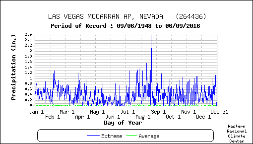
Little rain...just a few hundredths in the interior and a quarter inch on the coast.  Much drier than normal.  The monthly totals are below (click to expand).


 I have gone back many decades into the meteorological records of the region and no July or ANY OTHER MONTH has offered such consistent meteorological perfection.

But Some Have Another View

Now in the current psychological state of the world, the media, social media, and politicians are totally obsessed with the negative, particularly in environmental matters.

During the last month, major media has been obsessed with meteorological disasters from floods and heatwaves to wildfire smoke and drought...to name only a few.  Just one front-page disaster after another.

So where are the banner headlines about our wonderful weather:  the envy of the world?  

In fact, the Seattle Times, with a tendency for apocalyptic (and generally ill-founded) global warming stories, had a front-page story about THE BIG DARK.   About how miserable we will all be in the upcoming period of darkness.  I thought it was a Seattle Times joke when I first saw it, but they were serious (see sample below).  All in the middle of meteorological nirvana.


Western Washington generally has the best summer's in the nation and this month was off the charts wonderful.   Time to recognize it.


July 25, 2021

The Southwest Monsoon Brings Thunderstorms and Wildfires to the Northwest: Will This Change Under Global Warming?

Every summer starting around mid-June and ending by the beginning of September, moisture streams northward out of the Gulf of California into Arizona, Nevada, and the eastern portions of the Pacific Northwest.

Known as the Southwest Monsoon or the North American Monsoon, this phenomenon is associated with the river of moist unstable air that brings thunderstorms into the southwest U.S. and occasionally into eastern Oregon and Washington.


This moist current, with an origin over the warm Gulf of Mexico, is the result of high pressure that develops during the summer over the Southwest U.S. When this high shifts to near the Four Corners area of the SW (where AZ, NM, CO, and UT meet), the moisture can surge into the eastern portion of the Pacific Northwest.  This should happen later this week.

To see an example, lightning moved into eastern Oregon on July 20th (see below)


This was associated with the Southwest Monsoon and the Four Corners high, bringing moisture in from the south and southwest ( see upper level (500 hPa, 18,000 ft) weather map below for mid-day on July 29th.:


A plume of moisture associated with the Southwest Monsoon will move northward later this week out of the desert southwest.  To illustrate, this image shows you the atmospheric moisture pattern on Saturday, with blue, white, and red being the highest values (in that order.)


The 24-total precipitation ending late Sunday shows a typical SW Monsoon distribution, with precipitation extending northward into southeastern Oregon.


More on the weekend precipitation (which will include lots of thunderstorms) will be found in a future blog.

The importance of the mid-summer thunderstorms from the Southwest Monsoon is evident in the climatology of many stations in the southwest U.S.  Here are record daily precipitation totals in Phoenix, AZ...the biggest amounts are in July through September...that is the Monsoon.


You can see a weakened, but similar, effect at Las Vegas.


Thunderstorms associated with the Southwest Monsoons are potent sources of wildfires east of the Cascade crest.   Some of these thunderstorms are high-based and little precipitation reaches the surface.  Thus, a lightning stroke can start a fire if the vegetation is dry, as it usually is by midsummer.  Even if there is substantial rain, the lightning stroke can initiate a smoldering fire, that bursts out when the weather subsequently improves.

What about global warming?  Will it bring more or less Southwest Monsoon precipitation to our region?

I am, in fact, working on this problem with Professor Eric Salathe of UW Bothell, using very high-resolution regional climate simulations.

The answer appears to be that there will be more summer precipitation from the monsoon reaching eastern Washington (see a map showing you the difference between the end of the 20th and 21st centuries assuming very rapid increases in greenhouse gases).  Green indicates a wetter summer under global warming.  There is a number of reasons why global warming might stoke eastside thunderstorms, such as greater availability of water vapor.

But there is a dark side to a wetter summer:  more lightning, which can ignite wildfires.   
Stay tuned....we have a lot more work to do on it.


July 23, 2021

What Controls the Movement of Wildfire Smoke? And a Perfect Forecast for the Next Week.

 We are now in wildfire season and the resulting smoke is on everyone's mind.  And the dramatic transcontinental movement of West Coast smoke has gotten national attention.

What controls the movement of wildfire smoke?   What conditions produce dense smoke in western Washington and Oregon?   How can smoke pass above us aloft, but our air quality remains good?

All of these questions will be answered in my new podcast.

And I start the podcast with the weather forecast, with our weather being near perfection in western Washington if you like clean air, sunny skies, no rain, and temperatures around 80F.

To hear the full story, listen to my podcast below or select your preferred streaming service


 HTML tutorial HTML tutorial


July 21, 2021

Miscommunication in Recent Climate Attribution Studies

Whether one calls it an artful statistical sleight of hand or poor scientific communication, several non-peer-reviewed climate attribution reports have provided misleading information that poorly informs society.

The most recent, of course, is the World Weather Attribution (WWA) report on the Northwest heatwave, which provoked stark headlines throughout the planet (see below for a sample).   Yes, even the Seattle Times featured it.


This attribution report, and most media stories that covered it, suggested a central role for global warming for the heatwave.   As demonstrated in my previous blog, their narrative simply does not hold up to careful examination.

This blog will explain why their basic framing and approach is problematic, leading readers (and most of the media) to incorrect conclusions.

Sometimes it takes a magician to reveal the methods of another practitioner of the "dark arts", and I will do so here.

A Revealing Analogy

Consider a dam that protects a city (see below). Before global warming, the water averaged one foot high behind the dam.

But global warming puts more moisture into the air and results in more annual rainfall (this will happen here in the Northwest!), resulting in the water behind the dam increasing to two feet (see below).  The city council was wise in building the dam much higher than typical water levels!

Sometimes there are storms, resulting from natural variability, that push the water level briefly to around five feet. Well below the dam top and the city remains safe; after the storms, the water level rapidly returns to 2 ft.  The city managers felt secure because the highest water level on record over the past half-century was 11 feet.

But one day there was an extreme storm, a black swan event, in which an extraordinary concurrence of weather features came together to produce a huge influx of water that drove the water level behind the dam to 24 ft, overtopping the dam and doing immense damage to the city (see below)

This freak event, which increased the water level by 22 feet above normal was the expression of natural variability of the weather.   Natural variability can produce very extreme events.


Now we get to the contentious part and where the sleight of hand is going on.

The Physically Meaningful Interpretation

One interpretation is that although global warming made a small contribution to this event, the essential event (overtopping the dam, damaging the city, exceeding the previous record by a large margin) would have happened anyway.  The overwhelming origin of this event (22-foot increase!) was natural variability.

This situation is a good example of the golden rule of climate attribution:  the more unusual and extreme the event, the greater the proportion of the event is due to natural variability rather than global warming.

The "Headline" Interpretation

Another interpretation of this event is being communicated by some climate attribution groups that produce "rapid response" reports.

They ignore the physical situation and the actual impacts.  They ignore the fact that natural variability is dominating the situation.  They only look at the top of the water column in my analog above....the 24 feet crest of the storm-swollen waters.   

They ask:  would the water have risen to 24 feet without global warming?  And they provide the answer: no.    The water would never have gotten to 24 feet without global warming.    That is true.  It would only have crested at 22 feet.


And you know the headline resulting from their analysis:  "the extreme water level over the dam of 24 feet was virtually impossible without climate change."    

Most folks reading that headline would inevitably conclude that without global warming, the big flood would not have happened.  But that is not true.

Don't believe me?  Ask some people whether natural variability or global warming was dominant in the recent heatwave.  I did so among laypeople, and everyone I queried had the wrong impression.  And I don't think this miscommunication is an accident.

More Magic

But these climate assessment people don't stop there with their magic.  They do statistical analyses using model output to appraise how global warming changes the odds of extreme events, in my analog above, in water getting to 24 feet.  They don't look at the odds of water just cresting the dam (18 feet) and causing the damaging event. Just like magicians, they have you look somewhere else while they make the illusion occur.

For the heatwave, the attribution folks only examine the statistics of temperatures hitting the record highs (108F in Seattle), but avoid looking at the statistics of temperature exceeding 100F, or even the record highs  (like 103F in Seattle).  There is a reason they don't do that.  It would tell a dramatically different (and less persuasive) story.

In the attribution studies, the main technology for determining changed odds of extreme weather is to use global climate models.  First, they run the models with greenhouse gas forcing (which produces more extreme precipitation and temperature), and then they run the models again without increased greenhouse gases concentrations.  By comparing the statistics of the two sets of simulations, they attempt to determine how the odds of extreme precipitation or temperature change.


Unfortunately, there are serious flaws in their approach
:  climate models fail to produce sufficient natural variability (they underplay the black swans) and their global climate models don't have enough resolution to correctly simulate critical intense, local precipitation features (from mountain enhancement to thunderstorms).  On top of that, they generally use unrealistic greenhouse gas emissions in their models (too much, often using the RCP8.5 extreme emissions scenario)  And there is more, but you get the message.   ( I am weather/climate modeler, by the way, and know the model deficiencies intimately.)

But the problems with the climate attribution studies don't end with poor models: there are essential deficiencies with their use of statistics and distributions, something I discussed in a previous blog.

In their problematic approach, they get HUGE, unrealistic changes in the odds of extreme events, with their identified events going from once in thousands of years to every year or every five years.  But their" findings" are the result of problematic models, careful selection and definition of extreme events, and deficient statistics.

For the dam situation noted above, their model situations, even with their deficiencies, would indicate that global warming would produce a huge increase of probability of getting to 24 ft, but a far lesser influence on water getting to the critical 18 feet.   The selection of the threshold used for the analysis has a huge impact on the results.


The bottom line

Many of the climate attribution studies are resulting in headlines that are deceptive and result in people coming to incorrect conclusions about the relative roles of global warming and natural variability in current extreme weather.  Scary headlines and apocalyptic attribution studies needlessly provoke fear.  Furthermore, incorrect and hyped information results in poor decision-making.   

Here in Washington State, several politicians fixate on climate change as the cause of current environmental events, while neglecting key actions needed to ensure we are adapted to the current climate (such as restoring our forests, dealing with problematic power infrastructure, improving water quality).  And some media outlets (like a certain major newspaper in Seattle) are aiding such ineffective leaders by pushing an often uninformed and exaggerated climate-change narrative.

There is little doubt that the Earth is warming and that human emissions are a contributing factor, but many of the extreme events being blamed on global warming are predominantly the result of natural or other causes (such as changes in land use).   If the Earth continues to warm, by the end of the century the impacts of global warming on extremes will increase substantially, something I have shown in my own research.  

We need to worry about climate change and take steps in both mitigation (reduce greenhouse gas emissions) and adaptation.  But hype and exaggeration of its impacts only undermine the potential for effective action.

Should I Let AI Write My Blogs?

I spend a lot of time thinking about and writing my blogs.   Could AI apps do the work for me?   Could any of you tell the difference? Well,...