Knowing the highs and lows for the first 26 days of February, and with reliable forecasts for the next two, it is now evident how February temperatures will rank at Sea-Tac Airport on an historical basis:
It will be the third coldest February in a record going back to the late 1940s.
The average temperature this month at Sea-Tac I calculated was 36.46 F.
The coldest Februaries at Sea Tac were 35.64F in 1956 and 35.88F in 1989.
2019 is next in line, followed by 37.3F in 1949. I can't imagine this rank changing no matter what the temperature is the next two days.
This February is particularly cold considering all the construction (and thus warming) in the area around Sea-Tac Airport since 1989. So meteorologically we really we in a league with the top two.
A plot of Sea-Tac Airport temperatures, with the normal highs and lows, is, well, chilling. We had a week where the average high barely hit the average low, and in no day since Feb 4th has the our high temperature even approached the normal high. The last few days have even cooled.
An interesting question is whether there are been much of a trend in February temperatures over Puget Sound.
Using the wonderful NOAA ESRL website, here is a plot of the February mean temperatures over the Puget Sound lowlands from 1950 to 2018. A lot of variability but little trend over the past 70 years. Interestingly, there is a big cold spell in February roughly every 30 years: 1956, 1989, and 2019 (not shown, but there will be another major spike down this year).
The whole state? Pretty much the same story (see below). Little evidence of long-term warming, but several degrees of variability (up and down excursions). Later in the century, we would expect some warming due to increasing greenhouse gases, but warming is slowed here in the Northwest by the slow to warm eastern Pacific.
Finally, there is a chance of snow showers later today, particularly east and north of Seattle. A weak disturbance is moving through and temperatures are marginal here in Seattle for snow. The total precipitation forecast through 11 PM is shown below...very light over the lowlands, but heavier towards the Cascades.
The expected snowfall in that period is essentially zero near the water, but ramps up towards the Cascades. Portland gets some light snow. Nothing to rush to the food store for. But more good news for the Cascade snowpack.
It is now snowing from Vancouver, Washington down to southern Oregon, as a low center moves across the southern part of the state. The infrared satellite picture around 7 AM Monday shows the situation, with a plume of moisture moving northeastward across Oregon and then into southeast Washington.
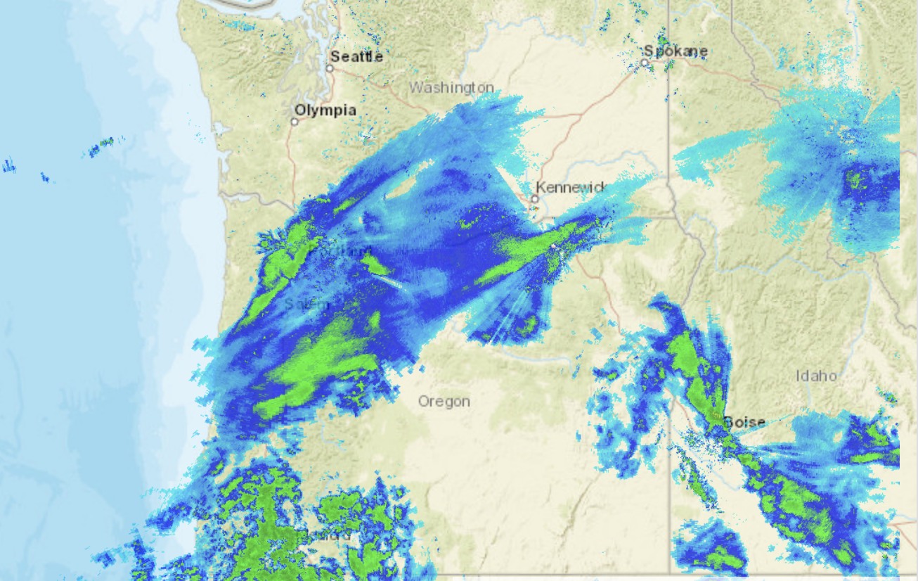
The latest weather radar imagery shows the snow, but this is probably not an accurate rendition of the true state of affairs.
Why? First, snow does not show on radar as well as rain (ice does not scatter microwave radiation as readily as liquid water). But more important, Oregon has terrible radar coverage. I mean bad. They don't have a weather radar on the coast and much of eastern Oregon has zero radar coverage in the lower atmosphere. The eastern slopes of the WA Cascades are not much better.
The folks in Oregon should be up in arms about this--and they need someone like our Senator Cantwell, who pushed for the Langley Hill radar on our coast.
A six-hour forecast of sea level pressure and low-level (2500 ft) temperatures for 10 AM today predicts the low center will be over the southern Oregon Cascades at 10 AM ( see below). Very cold air is over BC and eastern WA, with simply cold air over western WA and NW Oregon. Extremely cold air is found over central and eastern Montana, illustrating how the Rockies protects us from the really primo cold stuff.
Snow will not get near Puget Sound, but central Oregon will be buried. Here is last nights UW WRF model forecast for total snowfall for the 48 h ending 4 PM Tuesday. In Washington, Walla Walla will get a piece of it, but the real action will be south of Salem. You will not want to go to Eugene, which will resemble Siberia before this over.
This snowfall is really a gift from the weather gods for Oregon. A month ago, there was substantially below-normal snow pack over the Oregon Cascades. By the time it is over, Oregon will have a normal snowpack. Very good news for water resources, fish, and the ski industry..
Here in western WA the weather story the next few days will be dry, cold and windy. Cold, dry northeasterly flow is now pushing through the Fraser River valley into NW WA, with gusts to 30 mph and more as I write this (see surface map below). With a strong pressure difference across the Cascades, gusty easterly flow is now descending into the Cascade foothills from Enumclaw to North Bend.
A high-resolution model prediction for the surface (10-m) wind gusts at 4 AM this morning shows the wind action, including the acceleration of easterly winds down the Strait of Juan de Fuca.
A dry, partly sunny, but cool week is ahead. Will we end up with the coldest February on record at Sea-Tac? It will be soon time to run the numbers!
The ingredients for lowland snow, somewhere in the region, are now evident: cold air will be moving in aloft during the next days, an upper level trough is approaching, and a low pressure center will be approaching the Northwest coast.
How these pieces will come together is the issue and I will give you may take based on the latest forecast models. Either Portland or Seattle is going to get a lot of snow, and I suspect it will be the former.
This will be a performance in four acts.
First Act: Showers Coming Today
There is a band of showers moving in this morning and afternoon, as illustrated by the radar image at 10:40 AM
But at this point, the freezing level is relatively high (around 1400 ft), which means the snow level (the level where all the snow is melted), is around 400 ft (see observed temperatures below, from the Seattle SnowWatch website). So most lowland residents will only see rain, perfects with a few flakes mixed in during the heavy showers).
There will be snow showers in the mountains, near the Hood Canal, and for those of you living at higher elevations. The UW forecast snow totals ending 4 AM Sunday, tells the story.
Act 2: Cold Air Moves in As an Upper Trough Approaches
As in any good play, some of the protagonists reveal themselves in the second act. An upper level trough will be building and moving south into our region (see upper level-500hPa-- map for Sunday at 4 AM). Such a trough results in upward motion (which can produce clouds and precipitation) and can push cold air southward at low levels.
In fact, the forecast surface chart at 10 AM Sunday shows cool air moving into our region (blue colors) and a weak low center of SW Washington.
The predicted configuration is close but not quite right to give a substantial snow event over western Washington. The trough is extending too far offshore, the upward motions over us is weak, and the low center is not very strong. But small differences in the trough position and shape could make a huge difference. So let's try to tease out the uncertainty by looking at the total accumulated snowfall at Sea Tac Airport using the NWS GEFS multi-run ensemble. There is some variability, but the average is about .5 inches. Accumulation on the ground would be less. And remember this is at Sea-Tac, which is relatively high (452 ft). (Note...time is in UTC, with 12Z/24 being 4 AM Sunday)
The UW has another, and higher resolution ensemble (run by my group). There is a lot of uncertainty, but the average is about .8 inches.
So the bottom line of the second act, is that some light snow is possible tomorrow, but it won't add up to much. Perhaps .5-.75 inches falling out of the sky, with relatively little accumulation.
Third Act: The Real Threat Emerges
In my plays, the real action occurs in the third act, and this weather situation is no different. The tension is palpable. The villain (or whatever you want to call it), will be modest low pressure system that will approach our coast from off the Pacific. The U.S. GFS model and the UW model that is driven by it, takes the low center into southern Oregon (see below), leaving Puget Sound in dry, cold conditions (4 AM Monday is shown).
As shown by the 48-hr snowfall totals ending 4 AM Tuesday, this forecast produces little snow north of Olympia, but Portland gets several inches, and central/southern Oregon gets huge amounts of the white stuff.
The vaunted European Center models brings the system a bit further northward--see below.
And the resulting 48-hr snow total from the European Model brings very light snow to Puget Sound and notably more to Portland (6 inches or more). Salem and Eugene would be snowbound.
There is substantial uncertainty for Puget Sound snowfall, but it looks like we will get little, with Portland "enjoying' the brunt of the action in the third act.
Fourth Act: More Snow Later This Week?
In a typical fourth act, there is a denouement, where all the plot twists are resolved. But not in this play. The European Center Ensemble prediction of accumulated snowfall, shows the potential next week on Tuesday and later. The fuel and matches are around and our forecasts would not have to be off much to bring significant snow back into western WA. But this blog is long enough, and this dramatist has to go outside and clean up debris in his yard.
For never-resting time leads summer on To hideous winter and confounds him there, Sap checked with frost and lusty leaves quite gone, Beauty o'er-snowed and bareness every where ...William Shakespeare
I will have an update at noon on Saturday
______________________
When you have gasoline and matches laying about, there is always the chance the two might join forces to produce a fire.
During the next week, two critical ingredients for lowland snow will be in our neighborhood: cold air and occasional weather disturbances coming from a variety of directions. Will they combine to provide some low-level snow?
THAT is the question. And I believe the probability of at least some light snow is becoming more probable, particularly away from the water.
But we are running out of time for a significant lowland snow event. As shown below for Sea Tac Airport, extreme daily snowfall (blue lines) really declines after the first week of March. Average temperatures are slowly warming now and the sun is rapidly gaining strength.
The latest European Center ensemble forecast (51 separate forecasts!) for accumulated Sea Tac Airport snowfall, is suggesting a real chance of modest snow during the next several days, with very light snow sometime after 4 PM Friday (23/00), increasing snow on Sunday, with accumulations to several inches by Monday evening.
The US GEFS ensembles (only 21 members) for accumulated snowfall at SeaTac is also going for light snow late Friday, with increasing snow late Sunday. The ensemble average is around 5 inches, but there is plenty of uncertainty
What about accumulated snowfall in the latest high-resolution UW WRF model? Between now and 4 PM Saturday, not very much near sea level, with perhaps a bit of wet snow mixing in with the rain tomorrow. But plenty of snow in the mountains.
By the next 24 hr (ending 4 PM Sunday) brings an inch or two to the lowlands, with less right near the water. The reason? Because the temperatures will be marginal for snow.
The European Center higher resolution model snow forecast through 10 AM Sunday shows a few inches of snow over portions of the western WA lowlands, and as with the UW model, it is more spotty near the water.
The longer-term accumulated snow through 10 AM Wednesday indicates serious snow, with huge snow dumps over the Oregon Cascades and east of the Cascade crest.
We will be back in the freezer early next week, with much cooler air over us. Below is the forecast for 10 AM Tuesday--blues and purples are cold air. A very strong pressure difference will be found over the Cascades, with very strong easterly winds in the Columbia Gorge. However, we will lack precipitation at that time due to strong easterly flow crossing the Cascades--thus, not much chance of snow then.
So the bottom line of all this is that tomorrow an approaching weather system will bring rain to the lowlands and snow to the mountains.
On Saturday, expect showers, with considerable snow showers across the region. Some accumulation is possible away from the water. Snow showers will continue into Sunday morning, followed by drying Sunday afternoon. But Sunday afternoon, a new snow event threatens, with the potential for several inches. Stay tuned.
_____________________________ Announcement
The Northwest Weather Workshop, the annual gathering to talk about
Northwest weather, climate, and major meteorological events, will take
place on May 3-4, 2019 at the NOAA SandPoint facility, and all of your
are invited. We will start around 1 PM on that Friday and continue
through mid-afternoon on Saturday, with a banquet and special speaker on
Friday evening. This meeting generally brings together about 150
people and is a wonderful place to interaction with the regional
meteorological community. More information and registration information
is here: https://atmos.uw.edu/pnww/
If you would like to give a talk, please send us an abstract
(directions are on the web site). An agenda will be posted roughly 3
weeks before the meeting.
We have just gotten though a snowy period that severely affected Seattle for days, resulting in closed businesses, shuttered schools, severely reduced bus service, weeks of no garbage/recycling service for many, and an inability to travel in many of the residential neighborhoods. The University of Washington Seattle campus, with over 50, 000 students, staff and faculty, was totally or partially closed for seven days.
This blog examines the costs of snow/ice events for Seattle and suggests that the purchase of snowplows would be an extraordinarily good investment that could rapidly open up the city, save lives, lessen injuries, and save businesses millions of dollars per day.
Meteorological Background
Sea-Tac Airport typically gets about 7-8 inches a year, usually in 2-3 minor events, with major snow winters (20 inches or more) roughly once a decade (see figure below). This year was a big one, with the last major "snow apocalypse" in 2008 (the one with two weeks of ice and snow that closed down the city and ended the career of Mayor Nickels). The higher hills of north Seattle usually get even more than Sea Tac.
The December 2008 disaster not only led to the removal of Mayor Nickels, but resulted in major improvements in how Seattle dealt with snow. Mayor McGinn hired a snow savvy head of SDOT (Peter Hahn), secured more plows (with steel edges), started using salt and aggressive pre-treatment, and developed a coherent plan of action, triaging the key arterials. He also worked with my group at the UW to secure better weather forecasts, added road temperature sensors, and supported the Seattle/UW SnowWatch site.
Seattle mastered the key elements of dealing with our snow, including pre-treatment with deicers, immediate removal of snow to prevent the inevitable ice-layer formation, and post-treatment with salt. Even the Salt Institute applauded their measures (see below)
The impacts of this snow-wise approach were highly positive, preventing the build up of ice and snow on the main arterials and downtown during subsequent snow events. Mayor Durkan has wisely kept the McGinn snow approach in place, and many key arterials were in decent shape during our February Snowmageddon, or whatever you like to call it. Mayor Durkan will escape Nickel's fate.
But Seattle Needs to Do More, Much More
But there IS a problem: most of the city remained snow bound, with many of the hilly neighborhoods inaccessible by normal vehicles. The essential fact is that the city simply does not have enough equipment to clear more than a small proportion of the streets. Seattle has only 36 plows, which is only enough to clear central downtown and a handful of arterials,
Seattle has done considerable planning for snow removal and has a strategic plan for dealing with snow, including pretreatment, plowing, and prioritizing roadways. As shown in their map below, priority is given to "gold" roads (downtown, Aurora, Lake City Way, etc.) that are given total treatment and when they have time they hit the Emerald routes, doing one lane in each direction.
The trouble is that they don't get to the Emerald routes for hours, if at all, something shown by their road plowing status map during the end of the last snow event. Most of NE Seattle and Magnolia had no plowing at all.
Now I am not blaming any of the SDOT personnel doing snow removal. They were clearly working as hard as they could with the equipment they have. It's just that they didn't have enough equipment.
The Modest Cost of Fixing the Problem
Several years ago, Steve Pratt, the SDOT road maintenance chief under Mayor McGinn, estimated it would take 100 snowplows to really open up the city during snow events. So we would need 64 more snow plows than we have today (36). Just to supply some perspective, Portland, amuch smaller cit,y has 56 plows, Sea-Tac airport has 25 snow plows.
How much would 64 snowplows cost? There is no need to buy ultra-expensive large truck/plow combinations (which can run $150,000) We could do as many cities do and purchase snow plows that can be attached to pickup trucks and other smaller vehicles, which the city should have plenty of. Furthermore, the smaller units will be able to move up into our side streets better.
I spent an hour shopping for a high quality snowplow blade with all the bells and whistles. You can secure a low-end one for about $2000 and a very high quality unit for $5000-7000. Maybe the ProPlus with LED lights (see below). It even comes with a coffee holder for the driver.
OK, this is Seattle, so let's go for the primo $7000 unit and add $3000 for installation and training. Bottom line: $10,000 a unit. A total cost of $640,000 to be ready. And let's throw in $200,000 for gasoline, overtime pay, maintenance, and costs I haven't thought about for each year it is used. That is $ 840,000 for the first year. And $200,000 for subsequent years.
As noted in the next section, this is a HUGE bargain for what it does for the city.
How Much Does a Snowstorm Cost the City?
The costs of a "snow day" is enormous. Businesses close, theaters cancel shows, restaurants are empty or close, school can't educate students, and much, much more. I would argue that the costs are EASILY tens of millions of dollars per day for Seattle alone.
Consider this argument. Seattle has a population of 725,000. Let's assume 500,000 of these folks are working or going to school. For a major snow day, let's assume 200,000 folks are not able to go to school or work. Let us further assume that the value of the work or education that was missed that day was worth $100. Then the cost of the snow day would be 20 million dollars.
Now I suspect this is a huge underestimate. I bet on the worst snow days, half the city wasn't working or going to school. $100 a day of work value seems cheap. And what about all the injuries, damage, and deaths on the roadways due to snow? I bet the real costs are closer to 50 million dollars a day (if any of you can give me a better number, please HELP!).
Assuming we had 5 snow days this month, the costs would be 100 million to 250 million due to the snow.
The snow plows would cost $840,000.
Am I crazy or does buying snowplows seems a really, really good deal for the city? The cost of protection is less than 1% of the cost of the loss.
There is all kinds of glib talk that the city should not buy snowplows because heavy snow is relatively rare. But the analysis above suggest that the clear logic is to buy snowplows.
Can you imagine how popular Mayor Durkan would be if she got the additional plows and the city was nearly snow free during the next snow event? She would be Mayor for LIFE!
And there WILL be another snow event. Perhaps as early as this Saturday.
Addendum:
If the city does not have enough pickup trucks, yes, they would have buy them. But it would still make financial sense. $50K per truck for 20 trucks is another million. And the trucks could be used for other purposes throughout the year.
Since snowfall is generally not uniform through the area, perhaps it would make sense to do this regionally (say for King County).
Where would the snow go? It would be plowed to the side of the streets...and yes, folks would have to dig out their cars. But keep in mind that our snow events are generally modest, not like the big snowfalls back east, and so the snow berms would not be that high.
Nothing is more frustrating and difficult for local meteorologists than marginal snow events. By that I mean marginal temperatures for snow to reach sea level.
Unfortunately, the Washington lowlands are often in this marginal temperature regime and will be so for the rest of this week. In these situations, the upper reaches of our local hills (above say 400 ft) can have (wet) snow, while rain or a wintry mix hit near sea level. Being near the (relatively) warm water of Puget Sound, Lake Washington, and the Strait is also a problem.
The picture below shows a typical example of this meteorological frustration, looking northward from the UW towards Capitol Hill. All white at the top. No snow at the bottom.
During this period, it is critical to know the difference between freezing level and snow level. Freezing level is the first elevation above the surface where the temperature drops below freezing. Precipitation generally starts as snow aloft and then falls through the freezing level, beneath which it starts to melt. It takes about 1000 ft for the snow to completely melt, and we call that level thesnow level. You are now experts in this snow level business.
During the last snow situation, we had the right configuration to bring the freezing level to the surface, often with a low center over SW Washington drawing frigid air through the Fraser River Gap, into NW Washington, and then down into the rest of western WA.
But this week we don't and there is onshore flow at low levels. Flow off the 50F Pacific Ocean. At 10 AM this morning, the freezing level at Sea-Tac Airport was at 1333 ft, with a snow level around 350 ft. If it were precipitating now, the top of our hills could be white, while downtown Seattle would be in a cold rain. Yuk. Enough to make Amazon folks reconsider Long Island City.
Tomorrow, a wet Pacific weather system will move in from the northwest, but as shown by the surface chart for 1 PM Tuesday (colors show temperature at around 2500 ft, solid lines are pressure), the air is not that cold in BC, northwest flow is moving into the NW, and the temperatures are marginal (white to light green). Wet rain near sea level, wet snow above 500-1000 ft.
This kind of flow can really dump snow in the mountains, since westerly flow has a large upslope wind component up the north-south oriented Cascades. To illustrate this, here is the accumulated snowfall through 4 PM Wednesday from the UW WRF model. The Cascades above roughly 3000 ft get a foot or more, with lighter snow extending to around 1000 ft, and maybe a bit lower where precipitation is a greater. But no snow days in Seattle.
The high-tech, high-resolution, 15 member UW ensemble system confirms this snow forecast for Sea-Tac (see below)--so we are pretty sure about this forecast.
And the vaunted European Center model has the same idea. Great for skiers, bad for kids who don't want to go to school.
But don't give up on snow yet. There is a much more threatening prediction for Saturday (see sea level pressure and temperature forecast below), with colder air over BC and a low center in the SW Washington sweet spot.
But let's wait before getting excited about it and keep in mind that there is an increasing problem for low-level snow lovers: the sun is rapidly getting stronger and days are getting longer. We only have a week or two left in the lowland snow season before the sun makes serious snow impossible.
A sign of the upcoming warming is found at Garden stores and nurseries, which are already stocked with seeds, plants, and fertilizers. They will be doing a great business this spring: the heavy snow has done massive damages to trees and bushes around the region.
Weather update at noon Monday....
______________________________
Don't run out to the supermarket yet. But don't put away your snow shovels or snow boots. We are about to go into a cooler period, with the potential for snow reaching sea level, and near certainty of the snow level dropping down to 500-1000 ft.
Cooler air, capable of supporting lowland snow is going to move in this weekend--not as cold as last week, but cold enough. To illustrate this, here is the sea-level pressure and low-level temperature analysis for 4 AM this morning. Blue is cold, purple is colder, and you don't even want to think about white. Light blue is cold enough for lowland snow. Western WA is now too warm for snow, and in fact it is raining.
But here is the same chart, but for the forecast valid at 4 AM Monday. Blue and purple has moved in. Much colder, and the cold air has pushed south to northern CA and Nevada. Cold air that will give us a real shot of Sea-Tac experiencing the coldest February on record.
This movement of cold air at low levels is associated with the building of high pressure aloft over the eastern Pacific, as illustrated by the upper level (500-hPa pressure level) chart for 10 AM Sunday. Such a configuration is generally dry, since east of upper level ridges there is generally descending motion and lack of clouds/precipitation. This is not like a typical El Nino situation, more more representative of La Nina years. We currently have a very weak and dying El Nino--too weak to have much impact.
But this upper level pattern can bring snow if an upper level disturbance moves southward along the eastern flanks of the ridge. And the latest model runs suggest the potential for this to happen, first Wednesday and then next weekend.
Let us start with the best global modeling system in the world (the European Center model) and the output of its 51-member ensemble system. I love to use this....since each forecast starts slightly different and we can examine how sensitive the forecasts are to small differences in initialization.
This graphic shows accumulated snow at Sea-Tac for the 51 members (top panel) and the average of the ensemble (green lines below). Most members show light snow starting around February 20th at 0000 UTC (4 PM on Tuesday). Around an inch.
And a majority of the runs shows even more snow starting on Friday...bringing the snow total to around 3 inches. But much more uncertainty with the timing and magnitude of the second pulse.
So, let's examine the Tuesday/Wednesday snow situation in more depth. Here is the 24-h total snowfall ending 4 PM Wednesday. Lots of snow in the mountains (our ski areas will brag about the powder available here!), and light snow extending over NW Washington and down to Puget Sound. Temperatures are marginal for snow near sea level...that is why there is so little around the south Sound, the coast, and the Strait.
What about the ECMWF model for the same period? A nearly identical solution. Gives us confidence in the prediction.
But what about the potentially bigger event later in the week? At this point, the uncertainty is simply too large.
Looking at the ensemble snow forecasts at Seattle from the US system (GEFS), we note that nearly all the models are going for snow on Tuesday afternoon (about an inch, with the solid black line being the ensemble mean, which is often the most skillful prediction). You can see the Friday/Saturday event, but the forecasts are all over the place. A lot of uncertainty. We have to wait to have any confidence in the prediction.
Finally, there is a lot of talk about landslides in the media and some weather information sites. I believe this is highly unlikely. Even with all the snow, precipitation has been nearly normal during the past 30 days and much of the water is locked up in snow. With the cold temperatures, the snow will not melt rapidly. And there is no hint of any weather feature that will cause rapid melt down (like a strong atmospheric river). I worry about the exaggeration of risks, both regarding weather prediction and in the climate arena. It may promote more clicks and attention, but in the end it lessens credibility.

 An interesting question is whether there are been much of a trend in February temperatures over Puget Sound.