June 30, 2021

We Can Greatly Reduce the Wildfire Threat. Will Our Leaders Take the Necessary Steps?

Even before the heatwave, there was great concern about the potential for wildfires this summer.  But now the worry is heightened and palpable.

My central point in this blog is that we could profoundly reduce the wildfire risk by taking some prudent steps immediately, but that will require state leaders to act with more energy and purpose than in the past.


Specifically, the state must: (1) immediately call for a ban on the use of personal fireworks, and (2) establish a comprehensive, coherent policy for de-energizing powerlines, guided by highly skillful weather forecasts.

The Lower Elevation of the Eastern Part of Our State is Ready to Burn

Due to the relatively dry spring and the warm temperatures of the past week, the eastern portion of the state is dry enough to burn.  Now, a dry eastern Washington during summer is not unusual, but because of the dry/warm start, eastern Washington is several weeks advanced in fire potential.   

So the conditions now are like those typically observed in mid-July.  To illustrate, here is the latest 100-h dead fuel moisture (suitable for grasses and small diameter dead plants).  Below 10% is dry enough to burn well.  The potential for grass and range fires is real, and the threat is serious for the lower elevations of regional terrain as well.


Fireworks

Personal fireworks are a major cause of fires in our region.  Several significant regional wildfires have been caused by irresponsibly used fireworks, such as the massive Eagle Creek Fire that spread to both sides of the Columbia Gorge.  50,000 acres were burnt over three months during September 2017, with serious air quality impacts for a major metropolitan area.  Some of the most beautiful areas of the Columbia Gorge scenic area were destroyed, robbing a generation of visitors of the enjoyment of a stunning natural area.


Another wildfire was started by fireworks in Corbett, Oregon in September 2020 causing a roadside brush fire.  Perhaps one of the most compelling pieces of evidence for the necessity of dealing with fireworks is the average number of new wildfires by date (see below).  July 4th is the date the most fire starts.  And the reason is not escaped barbecue fires.

And there are the numerous house fires and injuries caused by fireworks...but that is another story.

To deal with the real threat of fireworks-initiated fires, an immediate statewide ban on personal fireworks use if needed.  Some counties and municipalities have already initiated bans and it is time for the governor to follow suit,

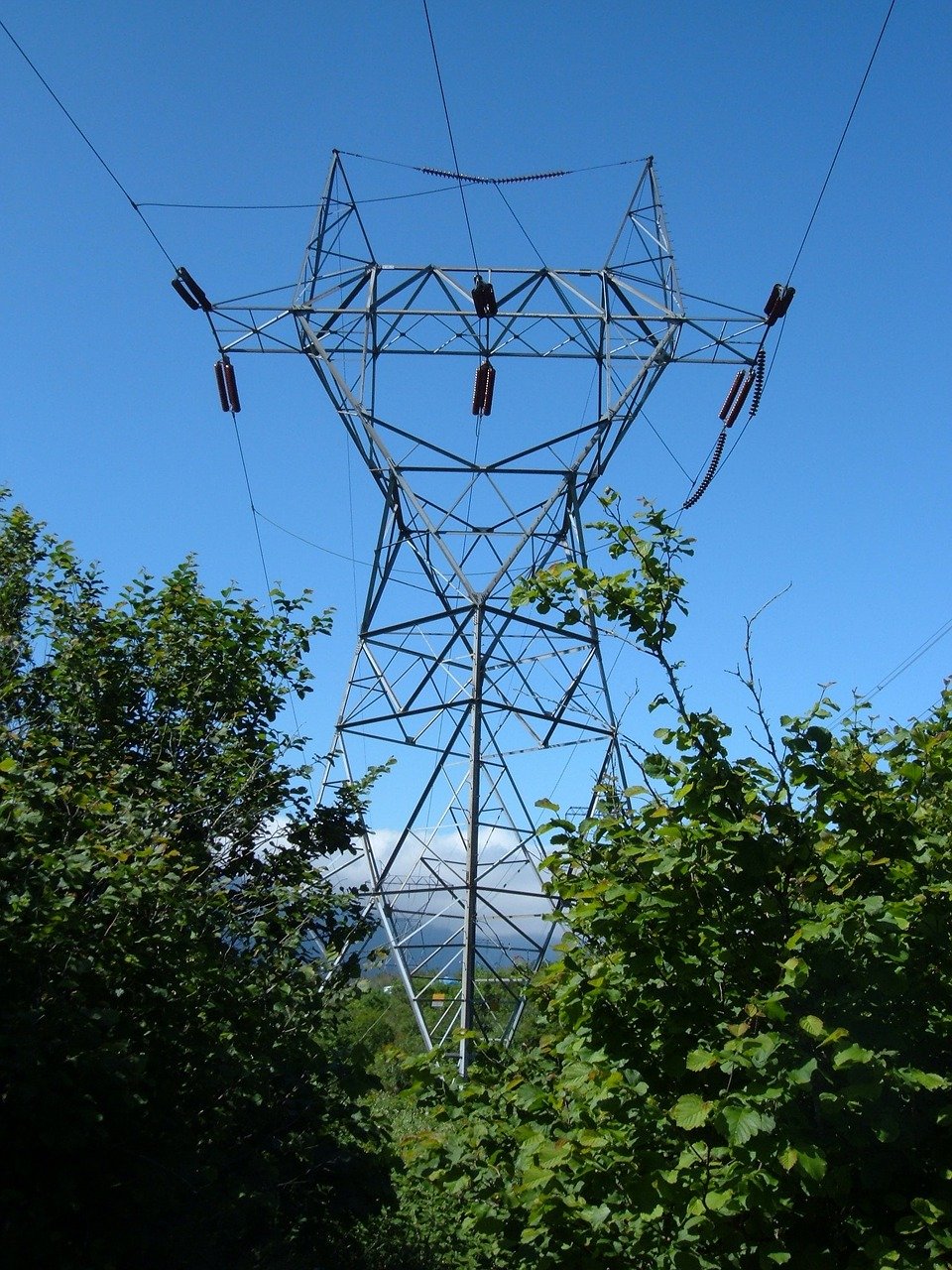
Stopping Power Line Fires

A number of the major wildfires last September were associated with strong winds causing powerline fires (either vegetation fell on the powerlines or the powerlines toppled onto trees).  The power line initiated fires included the Malden Fire in eastern Washington and the Holiday Farm Fire in Oregon.  I could name a dozen more.

Although vegetation management can greatly mitigate such fires and should be done, the only way to effectively eliminate the threat is to de-energize power lines in rural areas where a fire could be sparked by failing power infrastructure.  Such powerline shutdowns have been used effectively in California.

A powerful tool for initiating such shutdowns is the ability to accurately forecast winds and dry weather.   Using excellent forecasts, de-energizing lines can generally be done for a short period of strong winds.

At this stage, Washington State does not have a general or effective policy on shutting down powerlines and needs to develop one immediately.

Time To Act

Governor Inslee needs to deal with the wildfire threat immediately by establishing a fireworks ban and putting into place a de-energization plan that will be in place within weeks.   Extensive parts of the state are dry enough to burn right now....all that is needed is the initiation of the fires and wind.

Today, a major (lightning-caused) fire has started in nearby British Columbia (the Lytton Fire) and has spread to over  12,000 acres, showing that the potential for large fires exists right now.

If state leaders do nothing and a major fire occurs during the next few months due to fireworks or powerline interactions with vegetation, responsibility will be clear.  And vague statements blaming global warming will not be acceptable.

Finally, I should note that there are many long-term steps to reduce the wildfire threat that have been neglected, such as thinning the forests, bringing back more controlled fire, and modernizing the state's aged fire response capabilities (e.g., lack of modern aircraft), to name only a few.    There is so much that can be done to lessen the potential for catastrophic fires in our state and we need leaders that will deal with the problem in a more coherent, energetic, and sustained way.

June 29, 2021

The Big Heat Post Mortem and the Next Few Days

 It's over.   

Throughout the region, all-time temperature records have been broken, if not smashed.   Just to name a few:

  • SeaTac hit 108F, beating the previous record of 103F.
  • Olympia reached 109F, exceeding the previous record of 105F
  • Quillayute, on the WA coast, zoomed to 110F, absolutely smashing the previous record of 99F
  • Portland hit 116F, incinerating the previous record of 107F.
  • In eastern Washington, Dallesport tied the all-time state record of 118F
  • East of I5, many locations in western Washington exceeded 110F yesterday.


Some High Temperatures Over the State, Click to Expand

Believe it or not.

Seattle now has a higher record maximum temperature than Miami, Atlanta, Washington DC,  or Chicago.  Portland's record high exceeded that of Houston, Austin, or San Diego.  

Over 50 observing sites in western Washington surged above 110F

You want record high temperatures?  Come to the Northwest!  

But we had not only had extreme heat....far beyond that observed over the past century... but also record-breaking cooling as a thin layer of marine air surged in last night.

  • Portland cooled by 52F (116 to 64) and Salem by 56F (117 to 61) in a matter of hours.
  • Seattle cooled by an impressive 46F!
  • Quillayute by 48F.

The visible satellite imagery this morning showed that marine clouds not only covered the coast but pushed inland around the Olympics.


The cooling west of the Cascades will be a two-step affair.  Last night's intrusion of cool, marine air was quite shallow.  The figure below shows temperature (red lines are temperature in C, wind barbs in black) above SeaTac Airport during the past day.  No cooling above 5000 ft.  But lots of cooling and a switch to southerly flow below 2500 ft.

What happens in this situation is that where there is sun at the surface, the air starts to mix, with the mixing getting deeper over time.  Eventually, we mix down the warm air above and temperatures surge.  You will notice that today---- sometime after 10 AM temperatures will warm rapidly into the upper 80s.  Sorry.

But the good news is that the marine air will push in again tonight as the thermal trough decidedly moves into eastern Washington...resulting in an additional temperature step down on Wednesday.  The ensemble forecasts for Seattle show this clearly (see below).  Good sleeping weather ahead!

Environmental Impacts of the Heat Wave

Air quality really took a hit, with increasing amounts of particles and ozone in the atmosphere, something that was evident by the increasing haze I am sure you observed.  Here in Seattle, small particles increased to moderate levels (42 micrograms per cubic meter) before plummeting last night.  (Figure below from Puget Sound Clean Air Agency)


Ozone is another issue and is actually worst not in the cities, but downwind in vegetated areas, such as the foothills of the Cascades.  Look at the ozone in Enumclaw, southeast of Seattle.  Progressively increased during the last week before dropping rapidly last night.


And there is the plant damage.  Yesterday's searing heat fried many plants, including native species, with leaves turning brown and discolored.  How many of you notice wilted and damaged vegetation?  The soil was not dry....it was the sheer heat that damaged the plants.


We Can Greatly Reduce Wildfire Risk

There is a lot of concern about regional wildfires.  My next blog will talk about how we can radically reduce the risk if our state leaders would act energetically.   First, immediately ban all private fireworks statewide, with serious penalties.  Second, effectively use weather forecasts for de-energizing powerlines in rural areas where wildfires could break out.  I will note that predicted dry conditions can be associated with a reduced lightning threat and lightning starts many of our major fires.

June 28, 2021

Showtime. Temperatures Are Surging to Unparalleled Highs.

What is going to happen during the next few hours can only be described as weather whiplash.

Here is the latest super high-resolution temperature forecast for 5 PM today over western Washington.  Much of the western lowlands away from the water will be above 104F (light brown) and limited areas will surge about 110F.  I expect some localized hot spots around 115F.  Just extraordinary.   You will also note the onshore movement of cool air off the coast: an incipient onshore push of marine air.


SeaTac Airport is now running 8 degrees above normal and with its record-breaking 104F yesterday, it will certainly get near 110F today. Particularly since it is in a particularly favorable area of easterly downslope flow off the Cascades.

The difference between the temperatures at 11:30 AM today and yesterday is quite revealing (see below). MUCH cooler along the southwest coast (15-35F!), but much warmer from Seattle southeastward.  This is the result of the well-predicted southeasterly flow descending the Cascade slopes.


The current visible satellite imagery shows the cloud-laden cool area moving northward up the coast.  Our future comfort depends on it.


The cool-down tonight over Puget Sound still looks good: here are the latest high-resolution ensemble (many forecasts) predictions for SeaTac.  High of 110F this afternoon, but lows below 70F tonight.  Tomorrow will ONLY be in the upper 80s.  And back to normal on Wednesday.


Did you notice the hazy skies?  (see below)  No real wildfires in the region, so it isn't that.


I asked a local air quality expert, Phil Swartzendruber of the Puget Sound Clean Air Agency.   He suggested it is "secondary photochemical formation."   Translation: photochemical SMOG.  

The kind of unpleasant conditions that Los Angeles was so well known for.  The reason for this unpleasant bounty:  lots of sun and very warm temperatures that promote photochemical reactions (interactions of ultraviolet light with organic volatiles and nitrogen oxides).  As shown below, air quality has declined to moderate (yellow colors) around the region.


Finally, where do you think the warm air over us came from?   Well, I was curious and ran some air parcel trajectories back in time (such trajectories show the three-dimensional paths of air parcels reaching a point).  I went back 48 hours.

For this exercise, I traced back the air over SeaTac Airport at 100 meters, 500 meters, and 1000 meters above the surface (see below).  The top panel shows their position and the bottom panel provides their elevation.  

Wow...the air started well above the surface (roughly 3500 to 5000 meters) and then rapidly descended during the last day as it swung around the major high-pressure area over the region.   The air started warmer than normal aloft and warmed rapidly as it descended.


Stay cool.   Marine air is on the way for the west.  But then attention turns east of the Cascades.  Will the all-time high temperature for Washington State be broken (118F)?

June 27, 2021

Even More Extreme: Extraordinary Record Highs Followed by Perhaps the Most Rapid Cooling in Northwest History

 If you are living west of the Cascade crest of Oregon and Washington, tomorrow will be a day you will never forget.

The latest model runs, all at very high resolution, show even more profound extremes than previously predicted.  And the end of the event will be extraordinary, with temperatures falling by as much as 50F within a few hours.

Our upcoming weather

Records Already Broken

   Many records fell yesterday, including a new all-time high temperature at Portland (108F) and daily or monthly records falling at dozens of stations.  But his is nothing compared to what will happen now.

Situation Right Now (Noon Sunday)

A fascinating plot (below, click on image to expand) shows you the 24-h temperature change--how we stack up temperature-wise compared to exactly one day ago.  

Along the SW WA coast, some locations are 15-30F warmer, because of the switch to easterly (from east) winds--pushing away the cool, ocean air.  But look at the Portland area...many locations are 10-15F warmer because of increased offshore flow, with the air warming by compression as it sinks over the western slopes of the Cascades.


The new 108F record at Portland is going to be OBLITERATED today.  115F is quite possible.

But north of Seattle temperatures were a bit cooler. 

 Ironically, it is connected with the warmth along the coast and around Portland!  To explain, here is the forecast sea-level pressure map at 5 PM today.  You can see the low-level winds and lines of constant pressure (isobars).  You will also notice an area of low pressure--the thermal trough--centered in the Willamette Valley.  It is the result of warm air produced by easterly flow descending the western Cascade slopes.  With low pressure to the south and high pressure to the north, the thermal trough produced northerly winds over the Puget Sound, with the air cooled as it moved over cooler water to the north.


But that low pressure is going to move northward overnight and Puget Sound will be "enjoy" the torrid conditions now burning Portland.

Here is the latest temperature forecast for 5 PM today.  You can see the very warm conditions around Portland (dark brown is 109-112) and you will see very warm conditions along the lower western slopes of the central Washington Cascades and nearby lowlands.  Near the water around Seattle near the water, it will ONLY be the upper 90s.


Tomorrow: The Day of Unimaginable Extremes

But tomorrow, it all goes horribly wrong.  The thermal trough moves northward and westward, pushing the strong easterly, downslope flow northward to over the central Cascades (see map for 11 AM Monday).  The sinking air will compress/warm as it sinks.


The burst of downslope, compressional heating will cause temperatures to warm beyond the experience of any living inhabitant of the region (see forecast temperatures at 5 PM Monday).  
Temperatures will rise above 112F on the eastside of Puget Sound and above 100F for everyone more than a few miles from the water.  Portland will be similarly warm.  And so will the lower elevations of the Columbia Basin.  

Heat apocalypse.   What more can be said?


You all know that looking at one forecast is not good enough.  We need to examine many (ensembles) to evaluate our confidence in the forecast.  Well, here are the high-resolution ensemble temperature forecasts at SeaTac airport.  Time is on the x-axis (00Z29 is 5 PM Monday).    Nearly every model run is taking SeaTac to around 112F.

And there is more.....after the temperature peaks around 5 PM it plummets steeply, like an insane meteorological roller coaster.   Some of you will be sweating in 110F temperates around dinner time, but looking for a light sweater around 6 AM.

The reasons for this profound shift?   The thermal trough will begin to move eastward over the Cascades, with an onshore marine push bringing in cool air off the Pacific (see forecast map at 2 AM Tuesday, green and blue colors indicate cool temperatures)


It will still get warm on Tuesday (80s for many), but the savage heat will be broken.  Good luck tomorrow.  You will be talking about it for a long time.

This is the "perfect storm" producing extreme temperatures for our region.  If you want to see how I feel, check out the video (go 60 seconds in)


June 26, 2021

A One-Hundred Year Heat Wave Event Comes Into Focus

 Update at 1PM Sunday.  I will talk not only about the records but something else...the amazing temperature drop late Monday...one for the record books.

______________________________

As we get closer to the big heat event, powerful new forecasting tools are becoming available.  Tools that provide a higher resolution and more nuanced view of the extreme heatwave event that is about to happen.

One such tool is ultra-high resolution numerical weather prediction models.  My group at the University of Washington runs the highest-resolution operational weather prediction system in the region, with a grid spacing of 1.3 km.  High enough resolution to get many of the local water bodies approximately correct, as well as the impacts of our regional terrain features.

Let me show you the surface air temperatures predicted today through Monday...all shown at 5 PM. 

Today, Portland and the lower Columbia Basin surges above 100F and Seattle rises into the upper 90s. The kind of conditions we typically experience once or twice each summer.


Sunday afternoon is a much warmer story.  Portland is above 104-108 and the central Puget Sound away from the water is above 100F.


What about humidity?  Will the air be so moist that evaporation on your skin won't be effective?  The answer is no.   

Here is the predicted relative humidity at the same time (5 PM Sunday):  most of the region will have relative humidity below 30%.  Sweating or wetting your skin will provide substantial cooling.  Very good.


And then there is Monday, a day that will be the warmest in the past century for portions of western Washington.  

Just madness. If you are right on Puget Sound temperatures will be tolerable (80s), but go inland a few miles and temperatures will zoom above 104F.  Go inland a bit more,  temperatures will be above 110F.  I have provided a zoomed-in view for better viewing below.   I never expected to see such temperatures in my lifetime.

Eastside communities like Bellevue, Redmond, and Woodinville will be hit much harder than Seattle, Tacoma, and Everett.


Another powerful tool is high-resolution ensembles of many forecasts, which allow us to see the uncertainty in the forecasts.   

Here is the University of Washington high-resolution ensemble prediction for the temperature at Seattle Tacoma Airport, with the black line indicating the mean of all the forecasts (a good forecast in general).  Today (00/27) has the ensembles on the same page (the upper 90s).  More variations on Sunday, but nearly all above 100F (man about 104-105).  And on Monday the mean is around 110F, with a range of 100-115.   Yikes.


Now I have been somewhat fixated on high temperatures, but nighttime lows are also important because they greatly influence the quality of our sleep and ability to cool down our homes and apartments.  

The ensemble predictions above indicate a substantial increase in daily minimum temperatures, with temperatures on SundayNight/Monday morning only dropping to around 75F.

Wow...that is more than our typical highs this time of year (~72F).  It will be very hard to cool off before the super warm day on Monday.  We will be breaking major low-temperature records--the highest low temperature in history--at many stations.

The good news in all this?  Tuesday will be considerably cooler, but still way above normal.  More on that in my next blog.

When this is all over, I plan to do a detailed examination of this event in the context of global warming.  
_________________________________________________

The New Edition of My Book:  The Weather of the Pacific Northwest Will be Available in August

The book includes new chapters on the meteorology of Northwest wildfires and the weather of British Columbia, and the rest of the book is greatly enhanced.  It is available for pre-order on Amazon.

June 25, 2021

The Reason for the Extreme Warmth on Monday--And My Podcast on the Heat Wave is Out

 I think I understand why the temperatures in western Oregon and Washington will be so stunningly extreme on Sunday and Monday.

A unique combination of factors will come together to make the unthinkable possible.  Forget the "heat dome" explanations found in the Seattle Times and some media outlets, or those saying that the extreme heat can only be explained by global warming.

I will call the phenomenon a downslope heat surge on the western slopes of the Cascades.   

A relative of the extreme heat associated with Santa Ana winds in southern California, but with a twist.

An Unusual Collection of Ingredients

To get this amazing event, a series of ingredients had to occur at the same time and same place.  To put it another way, it is like throwing several dice and having all of them come up with sixes.


Ingredient One: An unusually strong area of high pressure aloft over our region (known as an upper-level ridge), associated with sinking air and unusually warm temperatures.  

At the surface, this feature is associated with high pressure to the east of the Cascade crest, which tends to produce weak offshore (easterly) flow.  Such easterly flow keeps the cooling influence of the Pacific Ocean away.

Why did we get this high amplitude ridge?   It is associated with a highly amplified wave pattern in the eastern Pacific, which may have been caused by a tropical system interacting with the jet stream (see below).  This is the result of natural variability ( I did a paper exploring this issue with climate models)


Upper level (500 hPa pressure, about 18,000 ft) for 5 AM this morning. Red indicates higher than normal pressures/heights, blue below normal.   Note the highly amplified wave pattern

Ingredient Two: An Approaching Trough of Low Pressure That Creates Strong Easterly/Downslope Flow over the Western Slopes of the Cascades

The key to this situation is that there will be high pressure inland and an approaching area of low pressure (called a trough) that will approach our coast.  Between these two features, a zone of very large pressure difference will be created, which will be associated with strong southeasterly flow.

To illustrate, there is the weather chart for around 5000 ft (850 hPa pressure) that shows the key features.  A narrow zone of strong southeasterly flow will be created that will descend the western slopes of the Cascades.


The air will start off warm, with origins from the desert southwest, but will warm further as it descends the Cascades into western Washington.  Why warm more?  Because the air will be compressed as it descends into western Washington.

The absolutely unbelievable temperatures at 5 PM Monday illustrate what will happen.

Surface temperatures will get above 112F over and near the western slopes of the Cascades.  Large portions of western Oregon and Washington away from the water will be above 104F.


All this is happening during a favorable time of the year (the sun is powerful and days are long).  

Check out my podcast for more of the story:

You can listen to my podcast below or use your favorite streaming service.


You can also use your favorite streaming service (see below)


June 24, 2021

Incredible Temperatures Are Being Predicted and Confidence Is Now High That It Will Occur

Update Podcast and Blog Today (Friday) Around Noon 

________________________________________________

There are two possibilities:

  • The Northwest will soon experience one of the most incredible weather situations in many decades 
  •  There is a major flaw in virtually all of our weather prediction system

Quite frankly, I am somewhat in shock looking at the raw forecast model predictions or the statistically calibrated versions of their output.  The event being predicted is so extreme and so beyond expectation that my natural inclination is to dismiss it.  

But I can't.  Multiple modeling systems are essentially doing the same thing.  Large ensembles of many forecasts are showing similar solutions from most of the runs.

Let me show you the latest.

An important issue will be proximity to water and to get that right, high-resolution forecasts are important, so let me start by presenting the latest UW high-resolution simulations.  The situation is so extreme that I had the colors altered to better define high temperatures.

Saturday will be the transition day.  The temperatures at 5 PM, near the time of the maxima, will exceed 100 F in much of the Columbia Basin and in the northern Willamette Valley (e.g. Portland).  90s will invade the interior of southwest Washington and southern Puget Sound.  Warm, but typical of the hottest days of a typical year.


Sunday is something else.  Temperatures in the Willamette Valley surge ABOVE 108F, as do the lower elevations of the Columbia Valley.  Incredibly, some areas south of the Olympic Mountains get above 104.  Can you imagine the temperature gradients near the coast... from the 60s to over 100F in a matter of a few miles? In central Puget Sound, temperatures will rise the 80s near the water to the upper 90s a few miles inland.


And now Monday at 2 PM.   The model resolution is a bit less but the solution is absolutely amazing.  Temperatures exceeding 108F will be found in and near the western Cascade foothills, thanks to the warming easterly flow descending the barrier.  104F and higher away from the water around Puget Sound.  The Fraser River Valley will also be crazy warm.   


If this forecast verifies virtually every major observing location in the western WA and Oregon interior will achieve their all-time temperature record.  And several of these locations have observations that go back 70-120 years.

Later Monday, marine air will start to move in along the coast, resulting in Tuesday being a bit cooler west of the Cascade crest (see temperatures at 5 PM Tuesday below).  But it will be showtime for the Columbia Basin where the model is going for temperatures OVER 112 F.   It is not inconceivable that some locations in eastern Washington will tie or exceed the all-time temperatures record for the state (118F).


The highly skillful European Center model---absolutely different in every way (different data assimilation, different model, different developers)-- is going for the same story.  

For Sunday, 111F in Portland and 103 in Seattle. 


And for Monday at 2 PM an earth-shaking 108F in Seattle.   You can see the cooling (orange colors) moving in on Monday afternoon.


Let me say again:  the ensembles of many forecasts show that this solution is the preferred one, with a high probability of verifying.   The National Weather Service's most advanced statistical postprocessing system (the National Blend of Models) that combines many forecasts in an optimal way is now going for 101F on Sunday and 104F on Monday at SeaTac Airport:


And at Portland: 101F on Friday, 105F on Saturday, 112 on Sunday, and 108F on Monday.


Finally, a number of people have asked about the role of global warming on this event.   
Is global warming contributing to this heatwave?  The answer is certainly yes.   Would we have had a record heatwave without global warming.  The answer is yes as well.

Our region has warmed by up to 1-2F during the past fifty years and that will enhance the heatwave.  Increasing CO2 is probably the biggest contributor to the warming

But consider that the temperature anomalies (differences from normal) during this event will reach 30-35F.    The proximate cause of this event is a huge/persistent ridge of high pressure, part of a highly anomalous amplification of the upper-level wave pattern. 

There is no evidence that such a wave pattern is anything other than natural variability (I have done research on this issue and published in the peer-reviewed literature on this exact topic).

So without global warming,  a location that was 104F would have been 102F.  Still a severe heat wave, just slightly less intense.


Let me end with the golden rule of temperature extremes:  the bigger the temperature extreme the SMALLER the contribution of global warming.  Think about that.

Now PLEASE do not send me emails or leave comments accusing me of helping "deniers" or calling me all kinds of names.  I had enough of this from 350Seattle activists and Charles Mudede of the SeattleStranger. I have spent my life working on weather prediction and studying Northwest weather and am trying to communicate the best science, whether or not it fits some folks' political agendas.

_________________________________________________

The New Edition of My Book:  The Weather of the Pacific Northwest Will be Available in August

The book includes new chapters on the meteorology of Northwest wildfires and the weather of British Columbia, and the rest of the book is greatly enhanced.  It is available for pre-order on Amazon.

Should I Let AI Write My Blogs?

I spend a lot of time thinking about and writing my blogs.   Could AI apps do the work for me?   Could any of you tell the difference? Well,...