June 29, 2013

Eastern Washington Gets Hit Hard By Strong Thunderstorms

Saturday was an amazing day over and east of the Cascade crest with numerous very strong thunderstorms, particularly along the eastern Cascade slopes.  Large hail, strong winds and heavy rain hit from Yakima to Wenatchee, with some observers describing dime or quarter size hail.  Strong winds have downed trees and powerlines, and localized flooding has occurred (see picture from Ellensburg below).

Downtown Ellensburg:  Picture Courtesy of Stephers
Another picture by Stephers...but NOT a tornado. Rather a heavy rain shaft descending from a large convective system

And for me there was a special touch:  I flew over some of the storms on my way back from a meeting!

As I noted in my last blog, the air over the region has the potential for major thunderstorms activity if there is sufficient lift to initiate the action.

It started quite early, with a collection of severe thunderstorms passing over the Tri-Cities and moving northeastward.  Here is a radar image at 9:08 AM:  red is very heavy rain or hail.
About an hour later I flew just south of these storms on my way returning from Denver.  My flight was at an unusually high altitude (40,000 ft) and it was clear that some of the thunderstorm tops getting very close to our flight level.  Here is a picture from my vantage point:


But then the amazing happened, a continuous train of very strong thunderstorms started to develop along the eastern slopes of the Cascades and never stopped all day.  Let me show you some samples at a few times.  First, at 12:30 PM

A fascinating subtlety was that the radar showed a nice case of storm splitting northeast of Yakima.  Here is the radar 45 minutes later...you see the two red areas of heavy precipitation?


 2:29 PM


4  PM--still going
And here is one at 6:40 PM...it hasn't quit! 


You see that bright red echo (very intense) just east of the Cascade crest northwest of Wenatchee?  According to the radar it reached 31,000 ft and it was clearly visible here in Seattle.  To prove this, I took a quick pic of it from Mathews Beach Park in north Seattle.


According the observed 12-h rainfall totals some observing locations received .5 to 1 inches of rain from these storms (see graphic)....but I am sure that much heavier amounts fell at places without rain gauges.

Thunderstorm activity was substantial on the east side Saturdaydue to the large amount of potential instability (high CAPE)--see graphic below-- and the lift of some weak disturbances approaching from the southwest.  Furthermore,  the mountains produce their own upward motion that can help initiate convection.


According to our computer models, tomorrow should be far drier, with very little thunderstorm activity. 

June 28, 2013

How Bad Will The Heat Wave Be?

There are some interesting elements about the upcoming Northwest heat wave that I wanted to share.

This is NOT going to be an historic heat wave west of the Cascades...but we could well break a daily high temperature record on Monday.  So don't expect the high 90s, with peaks about 100F, that we experienced in late July 2009.  And there is a chance of some major thunderstorms...but just a chance.

So why will this event be modest?  The reason is that the set-up is not correct for one of the big events, because the low-level pressure distribution will be wrong and we won't have sustained offshore flow.  Specifically, to get a big heat wave west of the Cascades, we need the upper-level ridge (high pressure) right over us and low-level high pressure to OUR EAST, which encourages offshore flow.

Here is the latest WRF forecasts for the upper air (500 hPa) and sea level pressure (and lower atmosphere temperatures) for Monday at 5 PM.  The upper level ridge is centered over Idaho and there is lower pressure over eastern Oregon.  There is a hint of a weak thermal trough over the Cascades, but some of that is bogus for reasons I won't get into here.  There is on onshore pressure gradient (difference) west of the Cascades, which allows marine air to seep in.


The ridge is so large and strong, and the air is so warm associated with it, that western of the Cascades will still be far above normal:  upper 80s to 90 is quite reasonable on Monday and Tuesday, especially away from the water.   Eastern Washington, protected from the marine influence and closer to the ridge, will be far warmer:  many locations will get to 100-110F.   I assume the grapes will like it.  Fire danger should be modest because of the recent rains, but the ground will dry quickly with the heat.

Will any records be broken?   Well, for Seattle Tacoma Airport I suspect the daily record will fall on Monday.  As shown below (look at the second to last column), the record high for Monday is 87F...we have a good chance of exceeding that.


   There will be surge of offshore flow near crest level of the Cascades that should result in the highest temperatures that day and Tuesday, but then the pattern will shift subtly after that as a weak system approaches from the west.  The result will be increased onshore flow and slow cooling.  Into the lower 80s on Wed. and 70s on Thursday, with the return of morning low clouds.

For me a very interesting aspect of this event is the development of very high instability in the lower atmosphere, instability that can lead to thunderstorms.  A key measure of the potential thunderstorm "juice" is something called CAPE (Convective Available Potential Energy).  Here is the plot for Monday at 5 PM.  I don't think I have ever seen such high values here in the NW...reaching 2500-3000.  High for us is usually in the few hundred.
The reason the models are not producing massive convection is due to the sinking motion of the high and the lack of strong upward motion necessary to release this instability.  In fact, here is the 48-h precipitation forecast ending 5 AM on Wednesday...some convective showers, mainly over the Cascades.

But the models would not have to be very wrong for something very interesting and severe to happen.   Need to watch this. 

One more thing...does it feel unusually humid outside....reminiscent of the eastern U.S.?  Well, it is!  Check out the latest dew point temperatures, shown below. (Note dew point is a good measure of the amount of moisture in the air.  Starts feeling sticky in the 60s).

Lots of values in the 60s, some in the upper 60s...this is relatively unusual around here and it occurring because today is warming up substantially with a lot of recent rains and wet ground.  All the water is evaporating into the air.

June 26, 2013

Major Warm Up Ahead

The past several days has brought strong showers, lightning, and occasional gusty winds.  But that inclement weather will soon be a memory as a major ridge develops over the western U.S.  Temperatures will climb into the 80s west of the Cascades, with highs reaching into the lower 100's early next week over portions of eastern Washington.

The latest 6-10 day temperature forecast from the Climate Prediction Center says it all:  well above normal in the west, with the most anomalous warmth (dark red) over eastern Washington and Oregon.
The origin of both our current cool/wet pattern and this weekend's warmth is essentially the same:  a perturbed upper level flow pattern.  Let me explain.  The upper level (500 hPa) flow pattern today (at 2 PM, see below) had a VERY deep low over the eastern Pacific and a ridge of high pressure over the Rockies and western Plains.  This left the Northwest in strong, moist southwesterly flow that brought the showers and clouds (remember the winds are parallel to the height lines  and strong winds are associated with large gradients in heights--closer packing of the lines).


By Friday afternoon, both the low center and the ridge move westward, and the ridge builds in amplitude.   Expect substantial improvement.
By Monday the flow pattern is really perturbed and "high amplitude" as we call it in the weather biz.  The ridge will then be just west of the Rockies and the flow over the northwest will be weak and from the south. A warm pattern for the region.

This strange upper atmospheric pattern continues into Tuesday.    The building of high pressure over our region is associated with clear skies, little precipitation, and warming.  This particular pattern will bring the highest temperatures east of the Cascade crest (to get record warmth over western WA the ridge would have had to be centered farther westward).


The UW WRF model is going for a nice warm up by Friday (see graphic), with temperatures reaching into the low-80s over SW Washington and low 90s in eastern Washington.

Sunday at 5 PM, a bit warmer in eastern Washington.

But then on Monday, western Washington and Oregon, start ramping up, with highs up into the 80s in western Washington, 90s into the Willamette Valley and around 100F in the warmer portions of eastern WA.
And Tuesday will probably be even warmer...enjoy.

June 24, 2013

Cosmic Errors

You are a high administrator in NOAA (the National Oceanographic and Atmospheric Administration) or a Senator/Congressman on a committee overseeing NOAA.

You know that, due to mismanagement, the U.S. weather satellite program is in trouble and a key satellite program (the polar orbiters) may not be ready before a current satellite fails.

You know such a gap in coverage could have have very serious impacts on the skill of our weather prediction models (and of other nation's as well).

You know there is currently a highly successful, cost-effective satellite system (COSMIC) that uses the bending of GPS signals in the atmosphere (GPS) to produce huge amounts of atmospheric data over the entire planet, data that has been proven to have great benefits for numerical weather prediction.

But those satellites are past their useful life and failing.  Another country (Taiwan) has helped support COSMIC and now wants to renew and expand it, at a very opportune time since your polar orbiting satellite may soon fail.  AND, Taiwan will pay for HALF the bill, and the U.S. Air Force will pay another quarter.  An amazing deal.

So what do you do?

(1)  Put a modest amount of funding into the COSMIC program, gaining a huge addition of satellite data and hopefully mitigating the upcoming satellite gap.  Others will pay for most of the costs of this system.

(2)  You stop all funding for COSMIC and accept full vulnerability for a major satellite gap.  You lose the contributions of hundreds of millions of dollars by others.

Amazingly, NOAA management and their congressional overseers seem ready to do (2).

 The COSMIC Satellite

This is perhaps one of the most foolish decisions I have seen in a long time, and one that unnecessarily puts American citizens and our economic interests at risk.

As I will describe below, this is a complex story, with some private sector firms doing their best to kill the project.  And yes, some ideological elements are at play here.  But poor NOAA management is the key element.

A little review, first.   The initial COSMIC program, with majority funding from Taiwan, made use of a very clever and inexpensive way to get detailed information on the vertical structure of the atmosphere:  launching a constellation of satellites that receive the signals from the GPS (Global Positioning System) satellite system.  The degreeof bending of the GPS signal by the atmosphere allows one to get detailed information on the vertical structure of the atmosphere, using a relatively simple (and cheap) satellite system (see graphic below).  As the temperature and humidity structure varies, the bending changes. The fancy name for this technique is radio occultation (RO) and it provides information over the entire planet


The top panel of the next figure shows you the number of vertical profiles over a three hour period from the current COSMIC system.  Very nice and includes information over the oceans.  Both the National Weather Service and the European Center for Medium Range Weather Forecasting (ECMWF) have analyzed the impact of these observations and found them of great value (top five observations systems) and with the greatest impact per observation.

The COSMIC system (6 satellites launched in 2006) is now beyond its designed life and the satellites are failing.  Taiwan has proposed a 400 million dollar replacement (that is cheap for a major satellite system) called COSMIC-2 that put up 12 advanced satellites starting in 2015.   The result would be an increase in vertical soundings from around 2000 a day to roughly 10,000 (see bottom panel to get an idea of the difference).  And the soundings would be more accurate and of higher quality.


Simulations by ECMWF demonstrated that increased number of COSMIC soundings would substantially improve weather prediction.  There have been a number of stories in the media about this issue (e.g, Houston Chronicle, Politico)

So why is NOAA management and their Congressional overseers not RUSHING to sign up to contribute to continue and expand the COSMIC program?

Part of the problem is the hapless management of NOAA, which have made mistake after mistake in managing our nation's weather prediction effort (e.g., mismanagement of satellite acquisition, lack of support of weather research.  They spent large amounts of money securing opinions about how to handle the satellite gap, but don't take advantage of a potential solution in front of their faces.

Ah, now it is time for the villains of this story.  Two private sector firms (PlanetIQ and GeoOptics) want to get into the GPS satellite business, which is fine.  But neither has successfully launched such a satellite and neither has a working prototype, from what I can tell.  But they (and particularly the PlanetIQ crowd) are actively working against COSMIC, providing all kinds of misinformation and unfounded criticisms.  For example, a representative of PlanetIQ told me that COSMIC

"misses most of North America, all of Europe and Russia. It also doesn’t cover most of the South-Pacific, a major contributor to global weather activity. "  
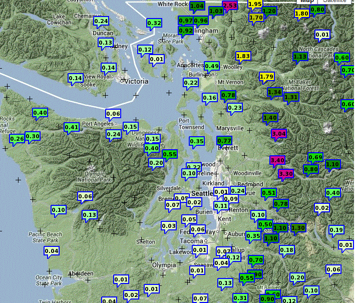
This is totally false, COSMIC and COSMIC-2 have global coverage as illustrated by the map above.

"The experimental COSMIC prototype constellation is dying, the government of Taiwan has not a penny budgeted for its replacement,"  Not true.   COSMIC-2 is well along and Taiwan is investing hundreds of millions of dollars.

There is plenty more of this on their web sites.


These two companies are looking for the U.S. government to agree to purchase data from them,before their systems are launched, essentially looking for a subsidy for their development.   They do not have working satellite systems.  And keep in mind their prices won't included the 200 million being supplied by Taiwan...U.S. tax payers will pay for the full freight.  In fact, they don't seem to be willing to even tell anyone what their data price will be.

This "private sector" solution is being met with sympathy by Republican legislators and some of their Democratic colleagues, who killed support of COSMIC-2 from the Superstorm Sandy supplement.   Clearly, our representatives did not understand what they were doing and were letting "ideology" get in the way of a smart, cost-effective solution.  Don't get me wrong...I am a great believe in private sector weather observations and space solutions, and I have great respect for companies such as Space-X and AirDat (weather observations on commuter aircraft).  But these companies acquired substantial funding and PROVED there were capable of providing a service.  And they didn't try to take down viable competitors with inaccurate information.


Repeated attempts to save COSMIC have been defeated and currently there is ZERO funding in the FY 2013 budget.  The Taiwanese are getting nervous and are considering scrapping the project...which would be a disaster for the U.S.   Congress is now considering the FY 2014 budget, it is critical that our representatives include full funding of our share of COSMIC in 2014.

To be ready for the 2015 launch of COSMIC-2, software development and  necessary hardware acquisition must be started now and it won't be if NOAA funding is not available soon.

So please, contact your Congressmen and Senators and let them know that COSMIC-2 should be supported.

June 22, 2013

The Upcoming Northern Californa Summer Deluge

A highly unusual summer deluge will soon hit northern California.  June is typically quite dry over the Golden State (it isn't called golden for nothing!).  A climatological (1980-2010) precipitation map (see below) tells the story... from the Bay area south and west the monthly totals are .1 to .4 inches and even the northern Sierra Mts. only typically receive about an inch.

But take a look what the models are now consistently forecasting for the 48 h ending
5 AM on Wednesday:   1-5 inches over the northern Sierra (the pink and black colors) and .5 to 1 inches for much of the remainder of northern CA.   We won't escape the rain in the Pacific Northwest, but California will be hit far harder than we.

The origin of this unusual rain is an extraordinary summer atmospheric river, one that is stronger and extends farther west than most of us can remember seeing in decades during this time of the year.  (an atmospheric river is a long, narrow current of high moisture values originating in the tropics or subtropics).  The UW WRF model illustrates the forecast atmospheric river with a plot of the total water vapor in a column for Monday evening.  The dark blues are very high values.  Really quite unusual for this time of the year.

Even today (Saturday) we can see the atmospheric river setting up, as viewed by weather satellites that can sense the amount of water vapor in a vertical column (see image).  You can observe an initial system (green colors of moderate water vapor amounts) that is approaching the NW (yes, we will get some rain tomorrow), but look at the LONG stream of moisture coming off of southeast Asia (highest values are red)!  That atmospheric river is heading for northern California.


The wet pattern on Monday and Tuesday is associated with a highly perturbed weather pattern, with a deep low forming over the eastern Pacific (see graphic for 5 AM Tuesday of the upper level flow pattern).  The flow (which is parallel to the solid lines) will be strong and from the west/southwest...and headed into northern California.


Good news.  The cool, wet pattern should be a memory by next weekend--the models are suggesting a huge high pressure ridge developing over the western U.S. during the second half of the week.


June 21, 2013

Heavy Precipitation from the Wrong Direction

Yesterday, a number of locations, including the north Cascades, northeastern Washington, northern Idaho, and southern BC have received some of the heaviest precipitation they have seen in a long while, with some places getting 2-5 inches over 24 h.  Even Puget Sound folks got a respectable dampening.  And a lot of the moisture came from an unaccustomed direction...from the east rather than off the Pacific.

Here are the 24-h totals ending 8 PM Thursday for western Washington. Some folks on the western slopes of the north Cascades got over 3 inches, and .5 to 1 inch totals were widespread.  But only a few hundredths over the southern Sound.

 Taking a regional view you can see another precipitation hotspot...the eastern slopes of the Rockies, where some rain gauges were filled by over 4 inches of rain.  Lots of flooding a road washouts were reported there.


A closer view is available from a Seattle Rainwatch graph for a similar period, which shows values of 2-4 inches over the western slopes.

The WRF model 24-h precipitation total forecast ending 5 AM today (Friday) shows 2-5 inches over the north Cascades...a very good forecast.

This event was a bit complicated.  An upper level (500 hPa) low center was centered over northern Idaho (see figure) and it brought "wrap around" moisture at mid and upper level across southern BC and Alberta and then down over Washington.  You can track bands of enhanced clouds and precipitation moving around this low, approaching us from the northeast.

At the same time, in the lower atmosphere (see figure below at 850 hPa, roughly 5000 ft) the flow was northwesterly, pushing Pacific moisture up against the terrain.  This dual influx of moisture, and the lift associated with the upper low, brought copious rain to parts of the region.


For me, this rain is all good...my garden was dry and the rain will save me big bucks on my water bills. With a half-inch at least and no heat wave in sight, no watering will be necessary for dhttp://www.summer.washington.edu/summer/enroll/ays.

One final note, the models are  in agreement that Saturday looks very nice....sun and low to mid 70s.    So take advantage of it.  Conditions will deteriorate later on Sunday, but we just may squeak by that day as well.

One final thing...today is the first day of astronomical summer.  BUT NOT METEOROLOGICAL SUMMER.    Everyone knows that starts on July 12th!

For those interested, my dept is giving a course on global warming this summer....starts on Tuesday:

TM S 111 Global Warming: Understanding the Issues (5)

Includes a broad overview of the science of global warming. Discusses the causes, evidence, future projections, societal and environmental impacts, and potential solutions. Introduces the debate on global warming with a focus on scientific issues.

 Enrollment info here.

June 19, 2013

Super Shear

Some days one can look at a time lapse cloud animation and come away amazed...and today is one of them.  A day where the winds are simultaneous blowing at many different directions and speeds above us, producing an effect that either is startling or gives you a case of meteorological disorientation. 

Today (Wednesday) was one in which there was substantial directional wind change (shear) with height.  Our mountains often produce major differences in direction in the lowest 5-10 thousand feet, due to the channeling and blocking influences of the terrain.  But today there was even more going on, with a low center sitting over the region (see map for 500 hPa...roughly 18,000 ft at 11 AM this morning).


Ready to see what I am talking about?  Here is a video from Greg Johnson, taken from his his dual-cam today from 9 AM to 2 PM.  This view is looking north from north Kitsap, with Whidbey Island on the horizon.   Watch the flag, which shows you the near surface winds, and the clouds above, and pay particular attention after 11 AM. (click on image to view or go to the link)

http://www.youtube.com/watch?v=s0IIKWCc_9M&feature=youtu.be

After 11 AM, the winds are easterly (from the right) near the surface (shown by the flag), westerly in the lower atmosphere (check out the clouds over Whidbey Island), and easterly again farther aloft (in the high clouds).

You can get a closer view by just watching the western cam.  Here is is:
http://www.youtube.com/watch?v=QxP7V7lWPM0&feature=youtu.be

You can see the origin of these complex winds by looking at a few weather maps---all valid at 11 AM.  An upper level map (300 hPa pressure, about 30,000 ft) shows the trough south of Washington and strong southeasterly flow over Washington.  That is why the upper clouds were streaming towards the NW.

A  map at 850 hPa (about 5000 ft) shows a very different story,  with northwesterly flow over the area, a deep low over western Montana, and only a weak trough along the coast.


The observed surface winds show weak easterlies near the surface over the cam location.  The easterlies were probably due to weak troughing to the northeast of the Olympic Mts.

 The vertical shear of the wind was quite apparent still at sunset (and very beautiful as well)


Large directional  and wind speed shear in the vertical is not unusual around our region, and as noted above, our terrain is a major contributor.

One final thing...large vertical wind shear can produce turbulence for those flying through it.  There was major vertical wind shear (mainly in speed) between roughly 15,000 and 25,000 ft over our region today (the southeasterly winds strengthened rapidly with height) and this led to many reports of light to moderate turbulence.  Here is an example pilot report (pirep):

SEA UA /OV SEA104035/TM 1726/FL250/TP B737/TB LGT OCNL MOD CHOP 250-210/RM -ZSE
(translation.  Turbulence light with occasional moderate chop between 21,000 and 25,000 ft)


Should I Let AI Write My Blogs?

I spend a lot of time thinking about and writing my blogs.   Could AI apps do the work for me?   Could any of you tell the difference? Well,...