But this weekend we will experience a dirty ridge that will produce substantial contrasts in local weather.
My advice in a nutshell: for sun and warmth go south or east
A dirty ridge is a ridge of high pressure that is of insufficient amplitude to clear out the skies over the region. Often clouds are found in the northern portion of the ridge and sometimes even heavy precipitation.
Let's start by showing you the upper level (500 hPa) charts forecast by the UW WRF at 10 AM on Friday, Saturday, Sunday, and Monday.
Nice ridge on Friday...expect sun and highs in the lower 70s.


The amplitude picks up on Sunday over us...which should lessen clouds and precipitation.
.gif)
And the ridge gets really pressed down on Monday at 10 AM. Dirty ridge again.
.gif)
Kind of subtle, right? Let's check the cloud fields from the model. On Saturday at 10 AM clouds extend over NW Washington, getting as far south as roughly Olympia
.gif)


So you want sun and temperatures in the 70s and lower 80? Head to southern WA, eastern WA, or Oregon.


So basically a dry weekend for us, with temperatures getting well above normal south of roughly Seattle. Sunday will be the better day. Here are the predicted temps from UW Probcast for Saturday....it shows you where to head for warmth...south and east.

We had an extraordinary summer. This fall is following suit. And something scary is happening this week....the return of the POLAR VORTEX. (see upper level map for 5 PM Monday) Just like last year! We need a meteorological silver bullet to put this beast to rest.


What are the outlook, Cliff, for the eclipse on the 8th?
ReplyDeletePlease say it's going to be nice!
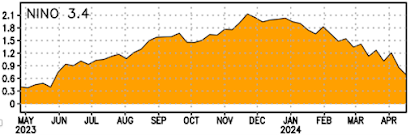
This summer wasnt that dry and we did have some decent rains in September. I remember real Indian summers where it literally didnt rain for weeks on end. Some years in the late 80s and early 90s. And as recently as 2012. As for the polar vortex, that pattern is bad news for California as it usually means an upstream ridge that keeps them high and dry. I think the silver bullet will be El Nino. It should help flatten that western ridge with a more zonal flow taking place.
ReplyDeleteFor once there's sunshine in Oregon in October! lol
ReplyDeleteWhen you say the return of the polar vortex do you mean for us or the east/midwest like last winter? I'd love some snow around here!
ReplyDelete.. If I may Professor. .. The term "dirty ridge", stemming from the idea that whatever ridge's main crest-line has broken down somewhat, in the general case allowing for some amount of offset of warmer and wetter air's intrusion, even weaker strength precipitation, as a result.
ReplyDelete