Here is the latest Forest Service map of fire incidents over the region--all of the them are east of the Cascade crest, mainly in Oregon.

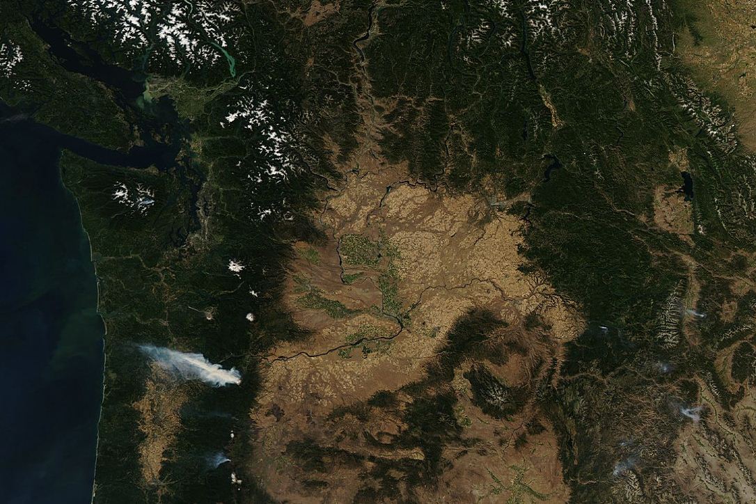
The most prominent smoke plume is not from the largest fire-- the High Cascades fire, which is now encompassing over 100,000 acres near Madras, Oregon--but from the Dollar Lake fire, 16 miles south of Hood River (roughly 3000 acres). The winds are clearly from the east and you can see the smoke plume moving WNW towards Portland. If you look carefully you can see the smoke from a small fire over the Olympics.
Here is a nice shot of the smoke from north of the Gorge looking south and another near Mt. Hood.


Both of these fires were initiated by lightning strikes.
The local wildfire problem is probably going to get much worse during the middle and end of next week. No rain is in sight and after a minor cooling on Monday and Tuesday, the heat should really rev up mid-week as the ridge over the western U.S. greatly amplifies into a huge atmospheric blocking pattern. Here is a sample forecast for next Wednesday...wow. And there is no end in sight.

West of the Cascades we should see the entire region (away from the water) moving into the mid-80s, with a number of daily high temperature records falling.
A major concern is that the burnable surface materials ("the fuels") are drying out rapidly. Here is a Forest Service figure showing you the moisture content of the "1000-hr" fuels---the bigger, thicker branches and debris. Darker red indicate seriously dry fuels and this is only going to get worse.


In short, we are going into one of the warmest September periods we have experienced in a long time and fire danger is getting serious. The only good thing is that there won't be much lightning.


Yup. The smoke covered the Portland/Vancouver area for most of the afternoon. Smells awful.
ReplyDeleteTimely blog given the Big Hump Fire in the Olympics which was so dramatically visible from Seattle today and this evening. Relatively tiny fire compared to thousands of acres that burn in other parts of the state. Lots of fuel this year because of how wet it has been, but the longer cooler evenings will help in Eastern WA. Wheat farmers in the family worried about harvesting as those crops all late. Reported it was 37 this AM when they started out to the fields. Chronic ambivalence in eastern WA is wanting it dry for grain harvest (hay is usually all in by beginning of July) but worry about forest and field fires if it is too hot and dry. Delicate balance.
ReplyDeleteSmall - 50 acre fire burning in the Olympics today.
ReplyDeleteThank you for another essential article. Where else could anyone get that kind of information in such a complete way of writing? I have a presentation incoming week, and I am on the lookout for such information.
ReplyDeleteThis is really interesting, a cool spring/early summer and a very warm September. Thanks for the blog post!
ReplyDeleteWe're doing a weather prediction chart on the KPTV weather blog in Portland. I'm going with a good chance for a late triple digit reading in the PDX area for Wed/Thurs, and again maybe on Saturday as the pattern reestablishes itself after a brief weakening on Friday of the ridge. Remarkable!!! We'll be talking about this weird summer for some time to come. And it looks like the monsoon season has rekindled in the SW. That bodes very badly for forest fire potential!!!
ReplyDeleteWow, learned so much from your most recent post. I had no idea!
ReplyDelete