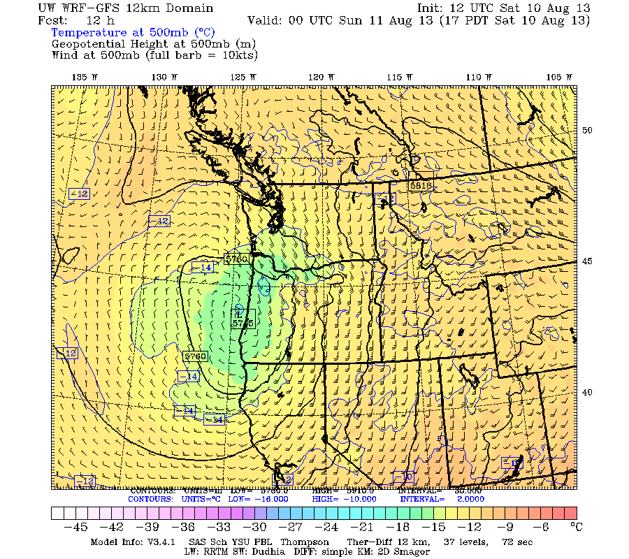
On Friday through Sunday, the region was covered by a moist, relatively unstable air mass that brought strong thunderstorm activity and lots of lightning. The proximate cause was an upper level low that was slowly moving up the coast, resulting in southeasterly flow in the lower atmosphere (see 500 hPa map, roughly 18,000 ft, for Saturday at 5 PM below).


How high was this monster? The radar suggested about 40,000 ft, very high for our neck of the woods (see figure)

There were no surface observations under that storm. But we can see the total precipitation for the entire thunderstorm period (based on radar) in the following figure. Keep in mind that radar-based precipitation totals are rough estimates and that the north Cascades blocked a lot of the radar echo. Clearly, the eastern side of the Cascades was hammered, with some places getting 4-6 inches over a several day period. I cannot imagine what happened under that intense thunderstorm over the North Cascades.

With rain wetting the soil over the past day and then being hit by a deluge that certainly was well over an inch in an hour, there were mudslides and debris flows over portions of the north Cascades, including a section of State Route 20. That road was covered with mud, rocks, and trees--in some places as deep as 25 feet. WSDOT has closed the SR 20 from mile markers 147 to 157. Take a look at some of the amazing photos provided by WSDOT personnel. You got to appreciate the folks at WSDOT, having to deal with massive slides like this and collapsing bridges on I5.


In my book, I talk about several other eastern slope thunderstorm road closures and landslides, such as the 1998 and 2012 events on the Yakima Canyon road (SR 821).

The eastern slopes of the Cascades is a very beautiful and bountiful place (fragrant pine forests, apples, wind power and more), but it also has its vulnerabilities, including intense thunderstorms, powerful downslope winds, and lightning-induced wildfires.


Other slides also closed Cascade River Road (in Marblemount off of Rt. 20) near mile 18.
ReplyDeleteHere's a link to a video of Boston Creek cutting through the road:
http://sdrv.ms/15xC9Xv
Any chance of offering your book in kindle format?
ReplyDeleteI was at Labyrinth Mountain/Minotaur Lake Friday through Sunday. I would love to see the radar image around 6pm on Saturday as I think the red cell was over us about then. At that time, a hailstorm hit us with stones exceeding 1" in diameter. It lasted about 15 minutes. After midnight, rain started and lasted for several hours. Fortunately, it tailed off before sunrise, and the mornings were peaceful and sunny (plus my tent handled this well)
ReplyDelete