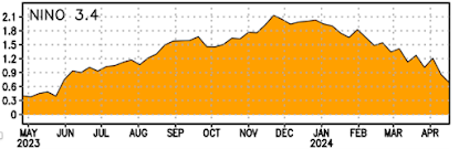
There has been a substantial amount of gnashing of teeth about the lower-than-average snowpack this winter, but the truth is that the situation has gotten immensely better.
On January 1st, the situation seemed dire (below), with much of the region at less than 50% of normal snowpack. The Olympics was at 19-22% and major sections of western Oregon were as low and lower.

Consider the situation yesterday (below).
Most of Oregon is now above 100% with large sections (blue color) MORE THAN 150% of normal. The Olympics went from roughly 20% to over 60%, roughly a three-fold increase. Large areas of the Rockies that were below 50% are now 65-100%. The southern Cascades went from around 20% to roughly 100% and the critical Yakima drainage is above 80%.


 A warm, dry period is predicted and this weekend should be nothing short of spectacular.

I could go on and on....the improvements have been huge and there is no looming water shortage in our region.
The NOAA/NWS River Forecast Center in Portland predicts the region streamflows 120 days in advance. The latest prediction (see below) for the period through July is for above-normal streamflow for Oregon and southwest Washington, but approximately 75-80% over the remainder of the region. We can live with that. So can the salmon.

Water resources should be sufficient to prevent any significant negative impacts. Furthermore, the wise stewardship of local reservoirs has ensured sufficient water this summer. For example, Seattle's reservoirs are well above normal at this point (see below)

But don't think that that means the mountain snowfall is over. Bountiful rain and snow will return during the last week of the month (see below).


I agree that the recent snowfall has helped a lot, and that Oregon's above-average snowpack will help mitigate some of the impacts of Washington's shortfall. But if you highlight Oregon, shouldn't you do the same for BC, where snowpacks are well below average? Both seem equally relevant to Washington stream flows, air quality, etc.
ReplyDeleteDrainage for the Okanogan River and the Columbia are about mid 70%-to as high as 90% in BC. Don't quote me on this, but water for the westside doesn't rely much on drainage from Canada. At least I know not as much as Eastside and it's looking ok.
DeleteCan you share the link for Northwest snowpack information. The one I used for a long time has been discontinued. Thanks
ReplyDeleteYou need to click on "snow water equivalent index" for Washington.
Deletehttps://www.nrcs.usda.gov/programs-initiatives/sswsf-snow-survey-and-water-supply-forecasting-program/snowpack-and
Cliff - Thank you for the update. This is certainly good news. But I think it would be useful to discuss the importance of maintaining reasonable in stream flows during the latter part of the summer through the fall period, which is a critical period period for spawning salmon. In the Skagit River system over the last few years, we have experienced extremely low flows during these months. These low flows have resulted in important tributary/off channel habitats being inaccessible to spawning adult salmon which has forced adult salmon to spawn in suboptimal habitat.
ReplyDeleteI believe it. It's gorgeous out there now and as you said, lovely over the weekend. Even touching 70 on Sunday. However, low to mid 50's at at least periods of rain through the remainder of the month (not atypical)
ReplyDeleteCasey LaDelle, who has a YouTube channel who lives just north of Bend Oregon has been showcasing the snow fall, especially in the mountains in the past several weeks as he goes on heavy rescues throughout the area. He was complaining how late it came though.
I am about to talk to the local AM/PM store for lunch in this beautiful weather.
Good news all around, but the important question is will the MSM report it that way, or will they as per usual look at the glass as being half empty? I think we all know the answer to that one.
ReplyDeleteFor anyone recreating in the mountains this weekend, please be cautious and aware if you are going into terrain with snow on a slope or traveling under such slopes. Be aware due to the rapid warm up (and lack of overnight refreeze) there is high likelihood of wet loose avalanches. In addition there are deep persistent slab from a weakly bonded layer from early February. A release could be potentially massive and very destructive and deadly. Check the daily Northwest avalanche center forecast it is issued at 6pm for the following 24hrs.
ReplyDeletenwac.us
Cliff, it's been great to see the snow pack increase- but things in the Yakima, while better than they were, are still headed for a water supply limited year. You've been citing the snowpack for the Upper Yakima , but our water supply comes from the entire Yakima watershed, also including the Naches and Lower Yakima. Current snow pack for the whole basin is 78%- but thanks to last years early melting of a decent snow pack, reservoirs were drawn down harder than average last year, and are currently at only 69% of average. Right now that puts us at about 70% water supply for our junior irrigation districts- not a full out crisis, but not a full water year, with resulting reductions in in-stream flow for fish and likely use of drought-relief wells by farmers. We could catch up to normal with late snow (crossing my fingers)- or if it goes like last year, we could loose ground and end up at as low as 50% for juniors (last year's above average reservoir carryover saved the day last year- we don't have that this year). Here's the graph of reservoir storage: https://www.usbr.gov/pn/hydromet/daily_grapha.html?list=yaksys%20af
ReplyDeleteThe recent snowfall will help but how much will depend on how this snow comes off. If conditions are favorable, much of it will melt and go into the ground and into the reservoirs. However, under certain conditions, a considerable amount may just evaporate into the air (sublimate) and this upcoming dry, warm period may favor sublimation over melting.
ReplyDeleteAs always, Cliff shows us the data...not the scarifying politics of weather/climate. We have a running joke in our house: "not enough snow, we need to raise taxes!" or "too much snow, flooding imminent, we need to raise taxes"! Sigh. Thank you Cliff.
ReplyDelete