During the past six months, research scientist David Ovens and I have worked intensively on the meteorology of the August 2023 Maui wildfires and have completed a paper that was accepted in an American Meteorological Society journal with a few revisions.
This blog will describe our results, some of which provide different conclusions than those discussed in many media accounts.
The City of Lahaina with the West Maui Mountains to the east before the fire.
The August 2023 wildfires were associated with strong, dry downslope winds gusting to 60-80 mph.
But why did it happen?
An unusually strong high-pressure area developed to the north of Hawaii (see map below), which resulted in very strong northeasterly trade winds approaching the West Maui (and other) mountains.
Importantly, the subtropical inversion, a stable layer often evident over Hawaii, was unusually low (because of the high pressure).
The strong trade winds and inversion were optimally positioned to produce a high amplitude mountain wave downstream of the West Maui mountains, a wave that resulted in intense and very dry downslope winds on the west slopes of the terrain (see cross section of winds and temperature for northwest Maui, below).
The winds that descended into Lahaina and initiated and spread the fire.
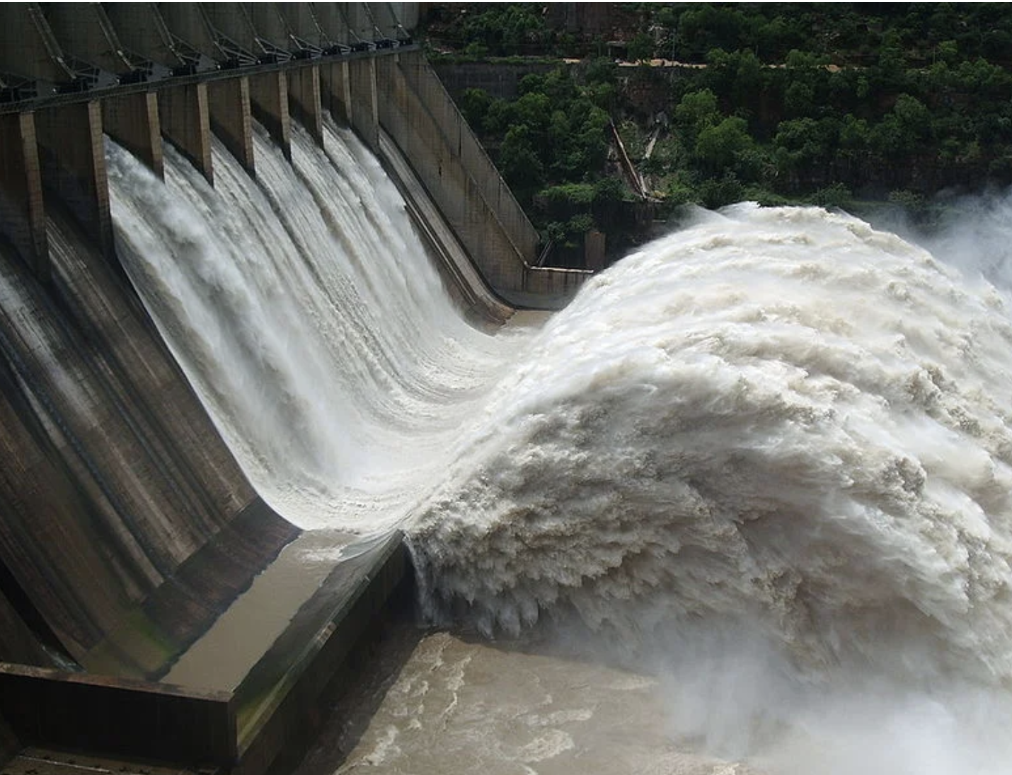
Look closely at the above figure and you can see a hydraulic jump structure, not unlike the situation accompanying water descending a dam ( see below).
This structure was even evident in the clouds and smoke the day of the Lahaina fire (see below)
Top picture taken by Robert Markwardt
One of the most amazing aspects of this event was that it was forecast nearly perfectly DAYS before by operational models and certainly by the research model I am using (WRF).
Below are the predicted surface winds on Maui for a short (17-h) forecast, as well as predictions 41, 89, and 137 hours in advance. All are similar and very accurate. The star shows the position of Lahaina; red and brown show the strongest winds.
The National Weather Service HRRR model was similarly accurate. There was no excuse for not warning the population of a terrible threat.
There was a lot of talk about the role of Hurricane Dora, which passed about 800 miles to the south of Hawaii (see satellite imagery below). Many media outlets and some politicians blamed the strong winds on Dora.
But is this true? The wind circulation of the storm was not large in scale, so the direct winds of Dora would not be a factor, but what about indirect effects?
We started with an excellent 6.5-day forecast of the Maui winds and the hurricane. Then we weakened the storm by slightly cooling the surface around the storm. Hurricanes are VERY sensitive to the temperature of the sea surface and require sea surface temperatures of at least 80F.
The result was a profoundly weakened storm (see the difference below for the flow around 5000 ft (850 hPa)
And now the exciting part. The winds with the weakened (attenuated) storm were essentially the same as the full throttle beast (see below).
Hurricane Dora played little role in the Maui wildfire disaster.
Finally, there was a lot of talk about the Maui fires being the result of drought and climate change, particularly from Hawaiian politicians, the power company whose lines failed. and some advocacy groups.
So we checked out the conditions before the fire. Turned out that precipitation around Lahaina was above normal BOTH for the summer and the previous year (see below)
And temperatures were near normal (not shown here, but in the paper). Ironically, the heavy rain contributed to the fires by increasing the amount of grass upwind of Lahaina.
In short, climate change or drought had little to do with this event.
The Bottom Line
Lahaina was a disaster ready to happen. A human-caused disaster. Large areas of highly flammable invasive grasses were just east of Lahaina. Grasses growing in abandoned farmland.
The power infrastructure was poor and prone to wind damage.
The National Weather Service and local agencies did not make the best use of greatly improved weather forecast models.
Warnings were inadequate, and roads were blocked by powerline crews and fallen poles/lines.
But the weather forecasts were stunningly good. We have come a long, long way.
Hopefully, our paper and future work will contribute to ensuring this terrible tragedy never happens again.


They should have done a prophylactic back-burn, when the winds started, with fire crews standing by. It would have solved the problem, at least in the short term. But hindsight is 20/20...
ReplyDeleteThe Maui government failed to make the owners of the plantations mow the invasive grasses. A tractor with a flail-mower could have kept the grasses mowed to a safe level without much effort. If the owners wouldn't do it, then the government could have done that and put a lien on the property.
ReplyDelete