

But first, let's get oriented. The location is found in the western Cascade foothills, an area of often very heavy precipitation produced by air being forced to move upward by the terrain (area map below with oval in the slide area)

And here is a closer-inn view.

A major issue was the extraordinary precipitation of the past month. Here is a map for the entire western U.S., showing the departure from average for this period: the north Cascades stick out like a sore thumb, with anomalies of over 12 inches more than normal!

Percentage of average for the past month? The north Cascades were above 300% of normal!

Or looking at the departure from normal in inches--big values in the North Cascades.

There were some very wet conditions earlier in the week. Since there are not that many observations in the immediate area of the slide, lets look at the "storm-total" precipitation from the Camano Island radar encompassing the period from March 18th at 10:33 AM through March 21st at 3:36 AM. The area in question got hit hard with at least 3-5 inches.

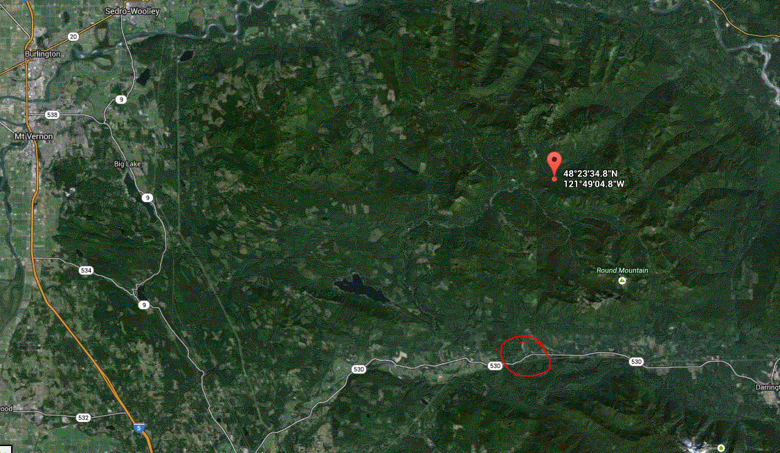
A nearby weather observing location in the hills behind the slide, Finney Creek, has had 24.2 inches of rain this month. This satellite image shows the location of the slide (red circle and Finney Creek observing site (red balloon symbols).

So we had a very wet month, topped off very heavy precipitation earlier in the week.


You can also see in the top arial photo of the slide at least two other past slides equal or larger in size. Clearly this is a very slide prone area.
ReplyDeleteThat is a very wet area of the Cascades. I've learned by experience to not go hiking anywhere in the Mountain Loop area if the weather is so much as slightly showery anywhere else — unless you wish to hike in a continuous steady downpour.
ReplyDeleteGreat post Cliff.
ReplyDeleteAny explanation for the apparent "dryness" of Arlington (KAWO) obs?
Take a look at:
http://www.wunderground.com/history/airport/KAWO/2014/3/25/MonthlyHistory.html#calendar
Versus Seattle (or the WRCC maps shown):
http://www.wunderground.com/history/airport/KBFI/2014/3/25/MonthlyHistory.html#calendar
The same apparent dryness is exhibited in Feb. too. Is the Arlington station in error, or is it really somehow receiving considerably less rain?
No expert am I, but on Google Earth it looks to me like this slide was directly above (behind?) a much older one. It had that slumped-out shape, noticeably younger trees than the surround, and bare ground just below the ridge.
ReplyDeleteI own a farm about 10 miles west of the slide area, in the valley and 5 miles east of arlington. I installed a lacrosse weather station this year, and I regularly get readings of double or triple the arlington KAWO obs.
ReplyDeleteI think that the rise in elevation as you go up the valley means much more rain.
Hey Cliff, a family friend of mine said he was driving by the river in the exact spot of the mudslide just a day beforehand. He saw something funny with the river, so he pulled over to take a look. When he got closer, he said that there was muddy water bubbling up from the river.
ReplyDeleteAny thoughts on an explanation?
Are the slopes of this area the remnants of old pyroclastic flows redeposited by glaciation?
ReplyDeleteWhat a sorry tale. I have gotten used to the earthen cliffs around the Sound collapsing every so often. But what surprises me is, that hill that collapsed was not at all steep- 25 to 30 degrees at most.
ReplyDeleteI like to think I am smart about natural hazards. But had I lived there, I don't think I would have been worried about that hill- and it was across the river.
It seems like you can't trust a natural feature unless it is made of bedrock...