I know..the title is a bit edgy, but both topics happen to be appropriate today.
First, the all important Mother's Day Forecast.
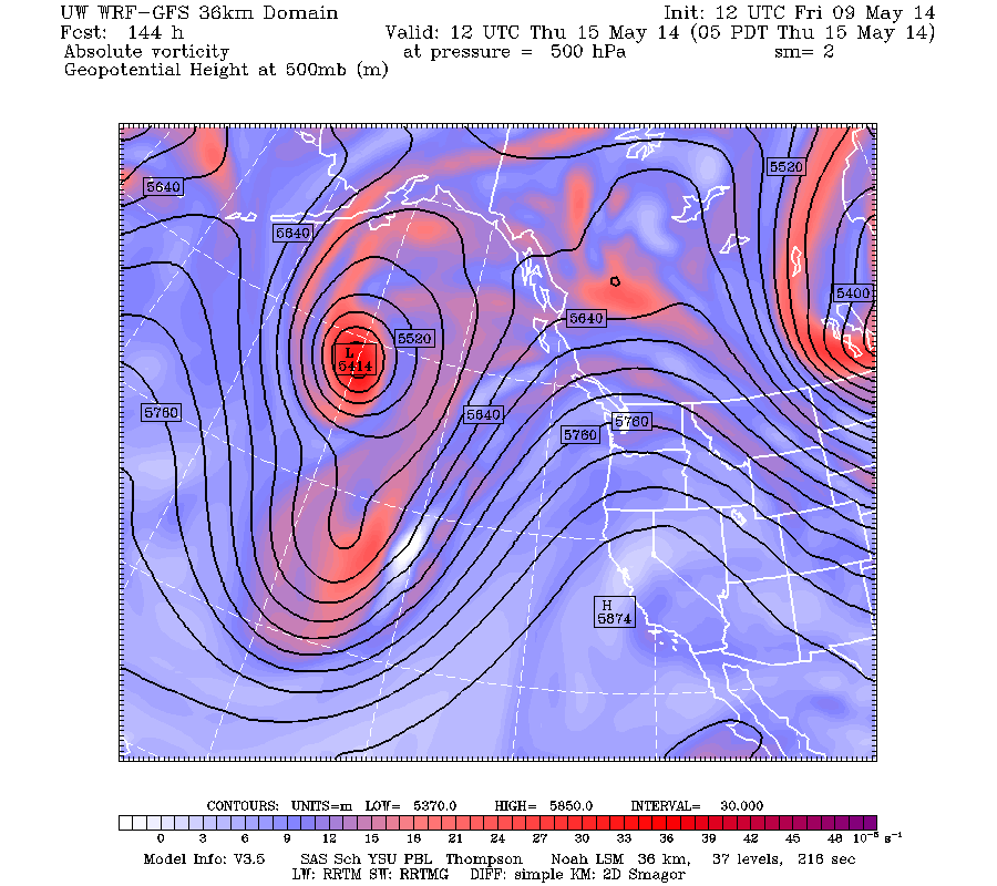
After a period of cool, unsettled weather a ridge of high pressure will develop over the region on Sunday and remain in place through the middle of the week. To illustrate, here is the upper level map at 5 PM on Sunday for 500 hPa (about 18,000 ft above sea level). The pesky trough has moved over the southwest, with the ridge extending north-south over the eastern Pacific.
In fact, the ridge holds in through most of next week....here is the forecast for Thursday morning.
Great Mothers Day gift for all, with temperatures getting into the upper 60s on Sunday and staying in the low 70s through Thursday. No precipitation.
Now, the mammatus clouds. A number of folks sent me pictures of these interesting clouds on Friday AM and I was even able to view them myself. Here is a picture sent to me by Nate Deardorff from NE Seattle.
and here is the picture I took with my smartphone:
These clouds were associated with a fairly strong convective cell. Mammatus clouds forms in situations with negatively buoyant air (translation: air that sinks). I explained these clouds in a previous blog, so check it out if you want to learn more.
Happy Mother's Day
This blog discusses current weather, weather prediction, climate issues, and current events
Subscribe to:
Post Comments (Atom)
Substantial Precipitation Will Soon Return to the Pacific Northwest
For those worried about Pacific Northwest drought, I have some news that should give them substantial comfort: substantial rain and snow wil...

-
Today may be the last day you will need air conditioning this summer in western Washington. And fears of wildfires west of the Cascade cres...
-
Over the eastern U.S., the passage of a strong cold front, with a rapid decline of surface temperature, is a frequent winter treat. In contr...


Mammatus clouds seem to be quite rare around here.
ReplyDeletei was treated to quite a show of them right over my home in Oso on the afternoon of August 4, 2010.
Wanted to share this picture I took of them that day... http://www.fruitfulfarm.net/mammatus-clouds-august-4-2010.jpg
Hey Cliff! thanks for sharing this photo! I am glad to see that there are others that were equally excited about this yesterday.
ReplyDelete-Nate
Cliff, it seems statistically unlikely but I have seem it before: This is the third week in a row that a sunny, warm spell is hitting the workweek dead center, but mostly missing the weekends...
ReplyDeleteAnsel