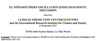
Earlier in the year it appeared that we would have a neutral (or La Nada) winter, but recently the waters of the tropical Pacific have cooled and the National Weather Service has released a La Nina Watch (see below).
La Nina is associated with cooler than normal waters in the central and eastern tropical Pacific Ocean, with enhanced easterly trade winds near the equator and the shifting of convection (thunderstorms) westward in the Pacific.

Moving the convection to the west has huge impact on the rest of the atmosphere, even outside of the tropics. This is the source of long-range forecast skill with El Nino/La Nina.
Let's look at the change in tropical Pacific sea surface temperatures for the Nino 3.4 region (see map below)

Examining a map of anomalies (differences from normal) reveals that during the past few months, the Nino 3.4 area ocean temps have dropped below normal (blue color).

Just as important, the temperatures BELOW the surface have also cooled. Here are a series of views below the surface at the equator (the x axis in longitude across the Pacific, and the y axis is depth below the surface) for July through now. Cooler than normal temperatures (blue) have developed.


OK, what does all this imply for the Northwest winter? Generally cooler and wetter than normal. More snow than average in the mountains.
Here are some statistics from the National Weather Service for the region encompassing western Washington and the western slopes of the Cascades. The eastern side of the State is similar.
For precipitation, two plots are shown, one for fall (OND) and the other for mid-winter (JFM). The red line is the mean and 50% of the years are within the blue boxes. The extremes are shown by the "whiskers". La Nina years tend to be wetter than normal (neutral) and El Nino years.


The implications for snow is clear, especially after January 1.... a higher probability of the white stuff, particularly in the mountains. Yes... a reasonable year to get an annual pass at your favorite ski area.

The strength of this relationship depends on the amplitude of La Nina, and at this point the models are only going for a modest one. And the La Nina/El Nino connection is not dominant, with natural variability being larger. Finally, one should NOT expect more precipitation than last winter, which was the wettest on record by several measures.
But after the smoke and heat of last summer, I suspect many Northwesteners are breathing a sigh of relief. And the upcoming week promises plenty of clouds and rain to get us in the mood.


I hope the part about having a lot of snow doesn't hold true for the valleys and other lower lying areas of Portland. The city and county proved their gross negligence in attempting to mitigate the effects of even one inch of snowfall, with the city basically being paralyzed for days on end after every incident of precipitation last winter. Even after the disaster of last year, they still refused to even consider the possibility of putting down salt for times when the ice and/or snow is not going to melt quickly. What was that famous quote from Einstein? Something along the lines of the definition of insanity is doing the same thing over and over again, yet believing each time that a different outcome will result.
ReplyDeleteSeattle using salt: http://sdotblog.seattle.gov/2016/12/09/surviving-seattle-snow-with-plows-plans-and-a-lot-of-salt/
DeleteYou got that right. I drive city bus in Portland and the transit centers and downtown Portland are dangerous due to lack of plowing with applications of salt and it gravel. Salt would be great. Oh here we go again.
ReplyDeleteHow does California compare? They had a pretty exciting rain year last year, but are they likely to have a La Nina drought?
ReplyDeleteThank you for your report of cooler and wetter forcast to come... After this dry smokey summer, we are ready to return to out PNC Fall and Winter norms!
ReplyDeleteReturn of smoke to Puget Sound and the Olympics today - did anyone forecast this? Must have missed it.
ReplyDeleteMichael, check: wasmoke.blogspot.com
ReplyDeleteMichael DeMarco: The Forecaster Discussion section talked about it a few days ago for Seattle. The thinking was that it would stay high and not cause too many surface problems. But not bad enough to raise an alert.
ReplyDeleteThat appears to be largely true out here in the Olympics.
I find it indispensable to carefully read the Discussion section a couple of times a day (it's normally updated 4x per day) to understand the iffy parts of the forecast and the general thinking of the forecasters. It doesn't take long once you get used to the terminology.
Link is: http://www.wrh.noaa.gov/total_forecast/getprod.php?wfo=sew&pil=afd&sid=sew
Wow did not expect the flip to moderate La Niña conditions for this winter! Looks like probabilities will be increased for more lowland snow than usual for the Willamette Valley for the second straight year. Don't remember this ever happening since I moved here in 1989. I love seeing the snow on the valley floor to see the 'Snowpacalypse 17-18'
ReplyDeleteWill stil be pretty hard to top last year's 5-6 epic lowland snow event barrage unlike I have ever seen here. I still expect at least 1 prolonged arctic polar weather event for this winter though.
Bryan - it's more than passing strange that anyone would wish for a repeat of the awful conditions the Portland area experienced last year, made more so because they're either unable and/or unwilling to deal with it. You must be retired, because the millions of dollars lost in terms of productivity because no one could get to work was astronomical. Not to mention the numerous incidents of serious traffic accidents, fatalities and lack of EMT's being able to provide adequate treatment of those in serious need of medical care.
ReplyDeleteWell last winter was good experience then so some will be more prepared for it. I doubt it will be as bad this winter anyway.
DeleteLaurie and John - thanks for the input - I read those sites and others daily. that where I got this info: "This smoke is trying to show us who's boss. Even when its days are numbered
ReplyDeleteWhen the Canadian smoke model forecast some smoke in Seattle this morning, we thought it was over-doing the east winds. Turns out it wasn't. Smoke from the Jolly Mountain and Norse Peak fire are now being transported to western WA. Today's satellite picture has too many clouds to see the smoke clearly, but a look at last afternoon's satellite image tells the story."
2 cold winters in a row??? In Eastern Wa, we had a 34yr winter
ReplyDeleteA 34-year winter? Do you live in Westros? ;-)
ReplyDeleteJeff, try living in Chicago for over 50 years, it would feel like Siberia compared to a place like Spokane.
ReplyDeleteIt appears that Chicagos Dec/Jan are about 5F colder on average for low temperatures and about 2F colder for highs than Spokane. Record lows are even at -30F although due to its location, Chicago sees more frequent arctic air intrusions.
DeleteSpokane, however, averages nearly a foot more of snowfall annually. Id prefer more snow to more cold, personally.
In Redmond this late night/early morning we got hit with a TORRENT of rain. Multiple inches at least. The gods are smiling!
ReplyDeleteHello Dr. Mass,
ReplyDeletePerhaps you might write in an upcoming blog about how hurricane forecasts could be improved. Puerto Rico has been hit by Irma and is about to be hit by Maria.
Cheers,
Bert
Here's the fun part: The '20s are shaping up to be a cold decade. By '30, the global temps will be back to where they were in the 1970s, when today's global warming crowd was warning us about the next ice age.
ReplyDeleteThe AGW cult is currently trying to figure out how to spin it. The line is now: "Oops, the models were wrong, and we have more time as long as you keep taking us seriously."
This will not end well for your religion.
http://www.nature.com/news/limiting-global-warming-to-1-5-c-may-still-be-possible-1.22627
I have very much enjoyed what posts I have read and wonder if you could suggest other scientists out there that also have blogs such as yours? That is one that instructs and takes a scientific view leaving out all the politicized sensationalism that mostly occupies all sides of this subject.
ReplyDeleteThanks again for this blog!
Mark Rand
What kind of ENSO analysis are you trying to do?
ReplyDeleteProbably better to apply some geophysics to the problem:
http://contextearth.com/2017/09/14/second-order-effects-in-the-enso-model/