The Seattle Space Needle PanoCan at noon yesterday says it all (see below).
Dark and dismal.
Why so dark? We start with our northern latitude and the fact that we are within a month of the winter solstice. Thus, we are near rock bottom for radiation reaching the top of the atmosphere.
Then we are in the cloudiest/stormiest time of the year. End of November is our worst.
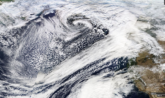
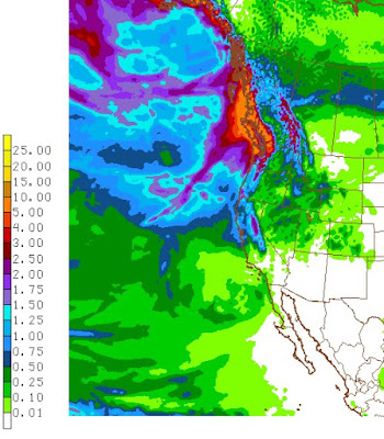
The visible satellite image and the regional radar at noon yesterday tells the story. Thick clouds and rain greatly reduce the feeble solar radiation reaching the surface.
How bad was it? Here are the radiation and weather measurements from the roof of my department in Seattle for the 72 hr ending 5 AM today (Wed.) The bottom panel is solar radiation.
Almost nothing....I couldn't believe it when I first looked at the plot. The third panel gives temperature (black line). THE SUN WAS SO FEEBLE THAT THERE WAS NO DAYTIME WARMING. In fact, temperature dropped during the day.
OK, the sun situation is really bad now. What do you do?
Listen to a meteorologist!
My first advice has nothing to do with weather. Get out during the middle of the day. Take a walk, go for a run, ride a bike. Just get outside during the brightest time of the day...that really helps me.
Second, go to whether there are less clouds...and nearly every day there are places to get a lot more light. For example, head for rain shadow areas in the lee of mountains..
During the winter storm season when southwesterly flow is prevalent, head towards the Olympic Rain Shadow, northeast of the Olympic Mountains. Northern Whidbey Island, Sequim, Port Townsend, Victoria or the southern San Juan Island will do.
Here is an example...you see the clearing NE of the Olympics?
After fronts go through and the winds turn more westerly, head east of the Cascade crest over the eastern slopes. Places like Cle Elum. (see satellite image of such a situation).
But during the winter (November to February) don't do too far down into the Columbia Basin. Why? Because it often fills up with low clouds. Very bad.
As shown below.
Sometimes in mid-winter under high pressure, the lowlands are full of low clouds, sometimes from the Willamette Valley to Bellingham. But the mountains are in the clear! To get out of it, just go up in elevation...drive up to the passes or climb one of our hills.
Now, 10-20 times a year, we get a Puget Sound convergence zone and there are clouds (and often rain) right over Seattle (see below). Want to escape the murk? No problemo. Just head north or south by 10 miles and you will be in sun!
Finally, head up into the snow in our mountains. Snow reflects solar radiation and makes it much brighter, WHEN there is no active weather going on.
Pretty bright at Snoqualmie Summit!
There are more "secrets" I can tell you, but the message is clear. Don't be passive in accepting a dark fate. You can do something about it. 90% of the time you can get to a LOT more light with a short drive.
Do what I do on one of the dark days....take a look at the visible satellite imagery (here), find the nearest bright spots, and make your plans!
He May Like the Dark Side. You don't have to.


