Looking at the temperatures in the central tropical Pacific (the Nino 3.4 area), the water temperatures have moved from a bit cooler than normal in September to around .5C above normal. This is a minimal El Nino.


Next, viewing water temperatures in an east-west slice of the Pacific Ocean--from the surface to about 300 meters below the surface-- show warmer than normal conditions (red/orange colors).
The trade winds have weakened as well--another marker of El Nino. This is a very weak, minimal El Nino. And the strength of the signal is important.


And the January extended forecast from many modeling systems (see below) generally indicates neutral conditions, slightly weighted towards the warm side. The latest European Center model is similar.

The key point in all this, is that with a weak El Nino grading to neutral (normal, La Nada) conditions in the tropical Pacific, there is no reason to expect conditions in our area to be different from normal. They could be, of course, but the tropical Pacific will not be weighting the atmospheric dice in any direction (something that a strong El Nino or La Nina would do).
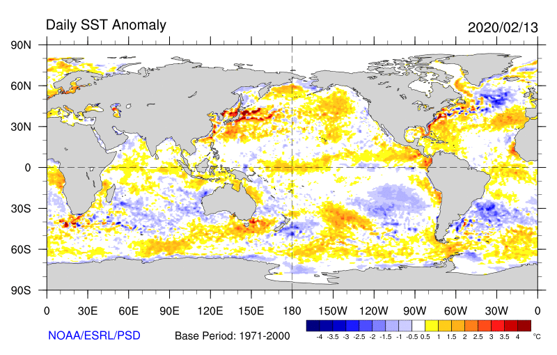
What about the BLOB? How is it going? The latest sea surface temperature anomaly map (difference from normal) shows cool water immediately off the West Coast, but evidence of a weak blob (1-2C above normal) off the coast. Let's call it a junior blob...much, much weaker than the one we experienced a few years ago.


However, it looks like California is going into a new drought. The east Pacific high has been keeping them dry for two months.
ReplyDeleteI am confused. You said this was a neutral year back in the Fall. Then, beginning in the 3rd week of December through now (2nd week in Feb), we've had torrential rain and wet conditions. About 2X normal for December, January, and almost that for Feb so far. So that doesn't seem normal. You also didn't seem to catch the last big storm to hit Seattle in early Feb.
ReplyDelete