Record cold, heavy mountains snows, extreme winds, and lowland snowflakes.
Winter conditions have returned to the Northwest.
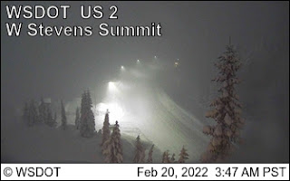
Heavy snow fell across the Cascades last night, with nearly two feet at Stevens Pass and about a foot at Snoqualmie. Chains are now required for both passes.
The snow was particularly heavy in the central Cascades. Why?
Because a convergence zone, forced by the Olympics, created a band of enhanced precipitation, stretching across Puget Sound and into the Cascades, something illustrated by the radar image around 4 AM this morning (the red arrow shows the band)

Cold Air in Two Stages
A Pacific cold front, associated with an upper-level trough of low pressure, moved through yesterday, with cooler air and northwesterly flow (from the northwest) aloft. Thus, the bountiful snow in the Cascades. This was stage one.
In stage two, cold air pours into central British Columbia and pushes southeast of the Rockies, as the upper-level trough of low pressure over the Northwest strengthens and extends southwestward. Thus, by tomorrow morning a very chilling situation is set up (see surface pressure map at 8 AM Monday, colors are temperatures about 2500 ft above the surface).
Very cold, subfreezing air will be in place over BC and northeast Washington and eastern Montana, with modified arctic air in eastern Washington and Northwest Washington. With high pressure over BC and a low center of southwest WA, cold air will push through the Fraser River Valley into Whatcom County and western WA.

The winds pushing into Bellingham and the San Juans will be cold and ferocious, gusting to 40-60 knots (see wind gust forecast for 10 AM Monday). The dark blue colors are the strongest. Dangerous stuff for the unprotected.

With cold air pouring into the region, temperatures will plummet throughout the Northwest, with the coldest temperatures on Tuesday and Wednesday morning. Low temperatures in the low 20s in the west (and some locations in the teens) and around 10F in eastern Washington, with colder locations getting into the single digits.
Take a look at the National Weather National Blend of Models predicted minimum temperatures for Wednesday morning (graphic below courtesy of WeatherBell).

A number of locations in our region will experience record-low daily temperatures (lowest temperatures for those dates).
With such cold temperatures, you should protect vulnerable plants. Municipal authorities should ensure that the region's large homeless population is off the streets. Strong winds will create dangerous wind chills in much of the region. Unprotected individuals could die of exposure.
Lowland Snow
I don't want to hype this. Western Washington is not going to get a major snowstorm. But some lowland residents will see white flakes, particularly Monday morning.
The "problem" is that the main upper trough will be south of Washington by the time the primo cold air gets in on Monday. So strong upper-level forcing of snow will be absent.
Thus, snow will depend on localized areas of upward vertical motions. Let me demonstrate.
The UW model forecast snowfall through 4 PM today (Sunday) shows snow in the mountains, driven by the cool, northwesterly flow. Where the snow belongs.

But as cold winds surge out of the Fraser River Valley and northwest Washington, they will be pushed upward by the Olympics, and the predicted result will be substantial snow extending from the northeast Olympic Peninsula back to Whidbey Island. The normal rainshadow in reverse.

We call this Arctic Front snow, and it won't add up to much. What makes this forecast even more difficult, is that cold high pressure in eastern Washington will force some downslope flow over the west side of the Cascades, which works against the snow.
In such a marginal, locally forced situation, uncertainty is large. For example, here is the latest forecast of the NOAA/National Weather Service HRRR model, which pushed more of the northerly flow into Puget Sound. The forecast only goes through 1 AM Sunday morning, but more snow is predicted over Puget Sound than in the UW simulation.

One way meteorologists define uncertainty is by using ensembles of many forecasts. The University of Washington high-resolution ensemble snow forecast for Seattle shows a large variation in possible snowfalls (see below), from .2 to .9 inches. No forecast gives a big snowstorm. And snow depth is always less than snowfall.

The Bottom Line
The mountains are being hammered with 1-2 feet of snow. Very good for skiers and water resources. Little uncertainty
It is going to get very, even record, cold on Monday through Wednesday, with western Washington high temperatures just getting into the 30s and lows in the 20s and teens. Eastern Washington and Oregon will be even colder.
Localized snow will fall near sea level over limited areas of western Washington, with the northeast Olympics being the most probable, but with potential for light snow over Puget Sound as the "Arctic front" moves southward.
Enjoy


Thanks Cliff!
ReplyDeleteThanks for your in depth coverage Cliff. There's a mother hummingbird nested outside my backdoor in a pear tree with two newborns that are only a few days old. I'm worried about them freezing on Tuesday night. I can't think of anything I could do without disturbing them. Does anyone have any advice?
ReplyDeleteIf you can't add some moss or similar to add insulation, you could place a hummingbird feeder very close (into the tree) for a couple of days. The greatest danger is when the mother leaves to feed. so you want to minimise that time. Also, of course, make sure that none of the hummingbird feeders freeze up. You can increase the sugar concentration slightly to make it harder to freeze. It's best if you have an extra base so you can just swap them out rather than having to take them in to thaw. Best to take them in overnight and put them out with harm, not hot, liquid BEFORE first light.
DeleteIf you can't add some moss or similar to add insulation, you could place a hummingbird feeder very close (into the tree) for a couple of days. The greatest danger is when the mother leaves to feed. so you want to minimise that time. Also, of course, make sure that none of the hummingbird feeders freeze up. You can increase the sugar concentration slightly to make it harder to freeze. It's best if you have an extra base so you can just swap them out rather than having to take them in to thaw. Best to take them in overnight and put them out with harm, not hot, liquid BEFORE first light.
DeleteGreetings, and thank you for for caring outside your heated walls. You could try to drape old blankets/towels/fabric or even weighted plastic bags over branches/limbs; draping down to form a kind of wall/barrier from the wind and cold. Probably need to be careful of the weather weight on your branches and choose sturdy limbs. Or, you can string some holiday lights to the tree and wrap near or on the nest. Good luck!
DeleteCan you find a heat lamp?
DeleteI'm really sorry to have to point out that the vast majority of young brood die every spring. This is the cold reality, forgive the pun.
DeleteWinthrop is forecast to get down to -3 Tuesday night.
ReplyDeleteInteresting that Port Townsend is forecasted to get more snow that typical for a Fraser outflow event. While Sequim and Port Angeles usually take the brunt of snowfall during these things.
ReplyDeleteGetting cold here on Hood Canal, temp is now starting to drop, down 2 degrees from the high, clods and frankly, not all that pleasant....
Lol
Fascinating set of features. Thanks for the explanations Cliff.
ReplyDeleteThanks, Cliff. Monday morning weather report from Kingston. 2 inches on the ground. Just quit snowing. We're at 300 feet.
ReplyDeleteI have 4 frickin inches here on Camano. You gotta be kidding me...
ReplyDeleteWas this storm a bust? Nothing to write home about in N Bend. No wind, light rain and a dusting on the mountains. Meanwhile the birds have moved back into their resident trees and buds are abundant. Winter is over it seems.
ReplyDeleteThe northeaster is blowing us away in north Whatcom County ~ the Fraser Valley outflow that Cliff mentioned. My son who works in Skagit County texted a picture from Arlington this morning. Looked like a good half foot of snow in the convergence zone.
DeleteColleen...can you share the picture?...would love to see it..cliff mass
DeleteI retract my comment :) looks like the action arrived tonight, at least for N Bend. Heavy snow for about 4 hours with ~3 inches around downtown.
DeleteAlso, there was a segment on King 5 about snowpack and climate change with some inputs from UW scientists. I wondered if you could share your thoughts Cliff?
https://youtu.be/hm5VrEWg7cQ
I see the cold air will be very dry too. The Tacoma Narrows airport hourly weather forecast (5 day lookahead) has dewpoints as low as 11 deg F on Tuesday and Wednesday. Time for the chapstick.
ReplyDelete