 East and West Coast weather is very much a meteorological see saw--when we are warm they tend to be cold and snowy. And vice versa.
Take a look at the minimum temperatures ending at 5 PM today (click to expand). Highs into the 60s and low 70s over coastal California..and 50F here in Seattle, while east of the Rockies, 30s extended way south into Texas and the deep south.
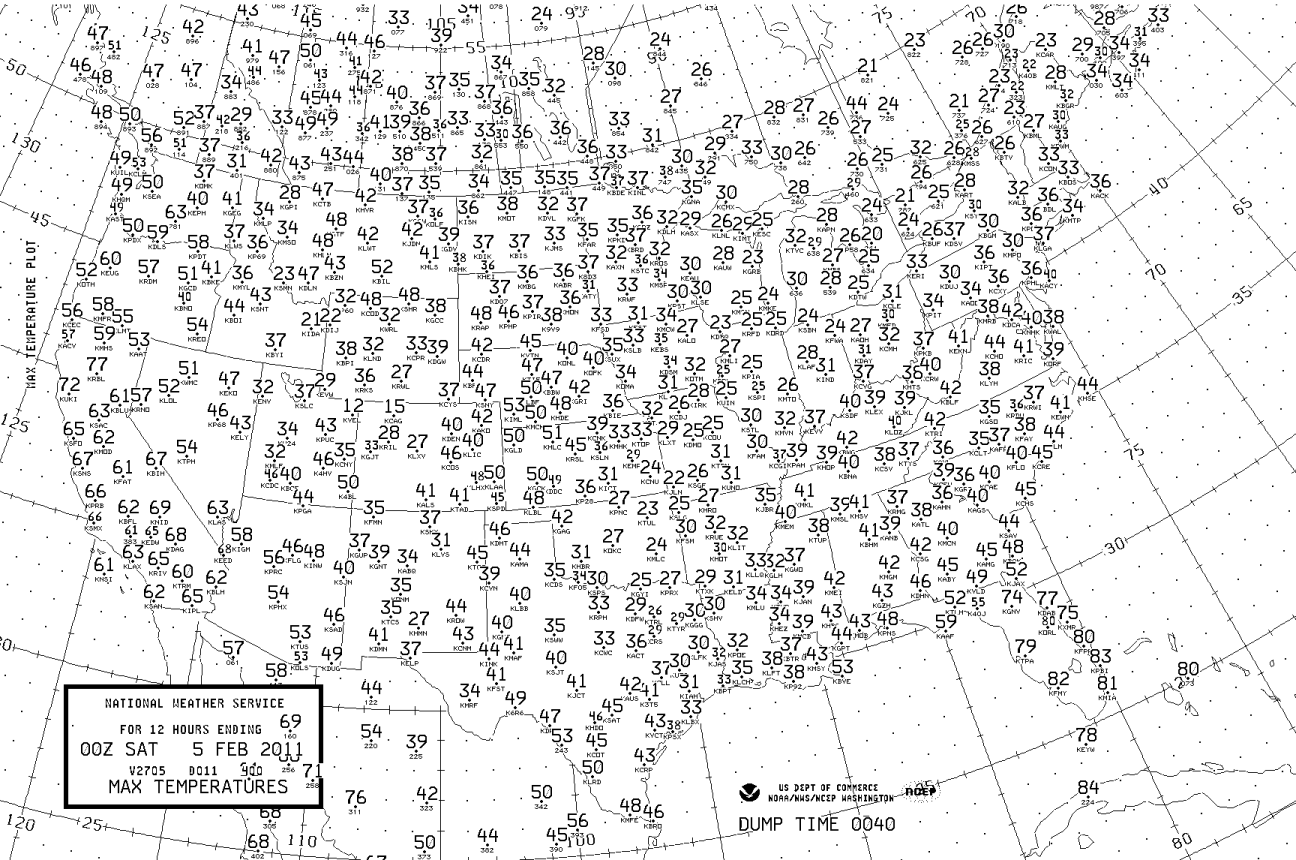 The minimum temperatures on Thursday morning (see below) were amazing, with record-breaking cold hitting Arizona, New Mexico, Texas and the high plains.
 There has been a lot of media attention to the snow back east, but it is the cold that has been really unusual for this last event. And the shear number of cold/snow events over the eastern U.S. have been extraordinary.
And while they shiver, the snowpack in the Cascades and Sierra have been fading fast, with the snow water equivalent in the central Cascades dropping to roughly 60% of normal. As noted in this blog the cause of both our warmth and drought, and their cold and snow, are the same. A high amplitude upper level pattern--with a ridge of over the eastern Pacific, and a trough over the central U.S. that has been locked in place for weeks. And it looks like we have another week to go.
Here is the upper level map for Sunday...there is the ridge in the west and trough in the east.

And here is for Thursday...look familiar? I am getting tired of this pattern!
 A few disturbances will move though the West Coast ridge this weekend, mainly later tomorrow and Sunday, so expect some showers then. But by late Monday, the ridge amplifies and we get dry again. Right now the models are suggesting the pattern will break down next weekend...but it is really too soon to be sure.
By the way, I am giving two talks during the next few weeks:
Tomorrow (Saturday, Feb 5) at 3:30 PM at Port Townsend High School I will talk about the Regional Influence of Global Warming (see side bar)
At 7 PM on Feb 23rd I will be at Ivar's Mukilteo Landing Restaurant to talk about the big storm that destroyed the original restaurant in October 2003. Quite a tale. And then they rebuilt the restaurant based on a weather theme, with a huge storm mural at the entrance and a working weather station in the lobby. AND they have added weather instruments and a cam you can see on their web page. Food will be available before, during, and after the talk (normal menu and prices), but if you want to go please make sure you get a reservation since this place has only moderate capacity (as soon as possible, 425-742-6180). You can see the mural and read the description of this event in my book.


Cliff:
ReplyDeleteLove your blog. Took your book to my friend in Australia last month. We both enjoy weather. Is this letter to the editor of the NY Times an accurate and simple way to explain our current state of weather patterns?
Thanks!
February 3, 2011
Speaking of the Weather ...
To the Editor:
Re “Cold Jumps Arctic ‘Fence,’ Stoking Winter’s Fury” (front page, Jan. 25):
Climate scientists tend to overcomplicate things. These processes are not that hard to
understand.
There is no contradiction between global warming and cold winters in Europe and on the
East Coast. These are caused partly by the melting of the ice in Greenland, which is slowing
the gigantic heat conveyor (the Gulf current) that used to bring more heat from the Equator
than it does today.
On top of this, because of the warming of the arctic air, its density is dropping, which
weakens the polar vortex that used to keep the frigid air near the pole and causes cold jet
steams to move south. Arctic warming is further accelerated by the melting of the sea ice,
which increases the absorption of solar heat, because the water absorbs more solar energy
than does ice (which reflects it).
The increase in rainstorms and flooding is also caused by the general warming of the planet,
which increases the rate of sea water vaporization. This in turn — as the air moves north —
results in a higher rate of condensation (more rain). In the winter, this increased water
circulation results in more snowstorms. Their intensity is increased because of the cold air
jets that move south as the polar vortex diminishes because of arctic warming.
Béla Lipták
Stamford, Conn., Jan. 25, 2011
The writer is the editor of the Environmental Engineers’ Handbook.
Speaking of the Weather ... - NYTimes.com http://www.nytimes.com/2011/02/04/opinion/lweb04climate.htm...
1
Off-topic, yet amusing:
ReplyDeletehttp://www.marriedtothesea.com/020611/wintry-mix.gif