
Today, I received an impressive picture of two funnels caught over the tulip fields on Sunday at around 12 PM. This photo was taken by Chris Evans.
 |
| http://spindriftphoto.photoshelter.com/image/I0000L1WR_zt.Y50 |


To be honest with you, I as a little surprised by these funnels. Yesterday was not very unstable and there was very little precipitation or convection. Here is the NWS radar at that 12:29 PM. UNIMPRESSIVE.

And here is a blown up view over the area of interest 10 minutes later...a developing cell near Mt. Vernon (green color)...but nothing significant.

And take a look at the high-resolution satellite imagery at 12:30 PM..the arrow is pointing to the convective cell (white spot).....you would not write home to your mother about this.

So the only explanation of this is that there was enough horizontal shear (change of winds in the horizontal) to produce some rotation (we call it vorticity in the business). A weak updraft spun this weak rotation up, like an ice skater rotating faster as she pulls her arms in. In my NW weather book I go into this mechanism in some depth.
Why Mt. Vernon in spring? Spring is the most unstable time of the year, with the atmosphere still being cool and the ground warming up rapidly from a bulked up sun. Mt. Vernon is near terrain and a place that often has regional horizontal wind shear (flow though the Strait versus flow up or down the Sound). Both can produce low-level wind shear that can have rotation..rotation that can be spun up by convection.
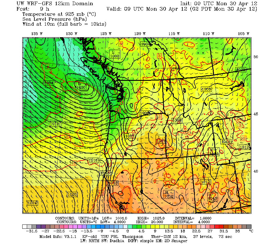
As an aside...quite a blustery April day today as a fairly strong low pressure passed to our north, setting up a large north-south pressure difference (see map).
Some folks got gusts to 30-40 mph, particularly near the water--branches and leaves were all over the ground as I biked home today from the UW. Take a look at the winds on the Evergreen Point Floating Bridge...bet there was some serious spray on the eastbound roadway!


I bicycled the I-90 bridge and while there were white caps both this morning and this evening, no spray seemed to be blowing up over the roadway.
ReplyDeleteThis comment has been removed by the author.
ReplyDelete