Update: It appears that the problem has been identified and can be fixed. Satellite might be back online by Friday.
Yesterday the National Weather Service GOES-West (GOES-15) geostationary weather satellite failed. In a geostationary orbit that allows it to stay above the same location in time, GOES-W is positioned over the equator at 135W at around 36,000 km above the surface.
The folks at the National Weather Service are trying to bring it back, but right now there is no information on how long this will take or whether they will succeed.
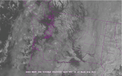
In the meantime, we are getting images from the other U.S. geostationary satellite (GOES-E) positioned over the equator at 75W, but that results in distorted images over the Northwest, with coverage rapidly fading/smearing out over the Pacific (see two samples of images this morning...the first infrared, the second visible).
In addition to the geostationary weather satellites, the U.S. has several polar orbiting satellites that circle the earth at a much lower altitude (about 800 km) and view the earth in relatively narrow swaths (about 2000 km wide). The trouble is that this coverage is not continuous, but at least we get a view everywhere at regular intervals.
The weather satellite systems are hugely expensive, and their costs are now squeezing out other functions of the National Weather Service. But their value is also substantial, and much of the credit for the improvement of weather prediction goes to the availability of huge amounts of satellite data everywhere over the planet.
Of course we have our coastal radar painting out approach weather along the Washington coast! As you can see below, a line of showers is approaching us Thursday AM...
This blog discusses current weather, weather prediction, climate issues, and current events
Subscribe to:
Post Comments (Atom)
Modified Arctic Air Reaches the Northwest, Colder Air Is Yet to Come
The coldest air of the season has reached the Pacific Northwest, and some western Washington locations are already reporting precipitation i...

-
In act one of this meteorological drama, yesterday and this morning brought heavy rain and flooding to many sections of western Washington. ...
-
The heavy rainfall is over, but some rivers are still rising. The most impactful atmospheric river event of the past few decades. Consider...


I was wondering what had happened. Both Portland TV stations I go to for satellite images have been locked in at 2:00 Thursday. I feel blind.
ReplyDeleteSolar storm activity take the satellite out? We've had a lot of them recently. Always wonder if they have an effect on the short term weather, or if the effect is more of a long term thing. Huge amounts of energy released from these things.
ReplyDeleteAt about 500ft elevation in Bellevue we got an early morning show! It was slush by the time I left for work. Looked like about 1/2" fell.
ReplyDeleteWe used images from this satellite as we sailed back across the Pacific this summer. Hope it gets fixed soon!
ReplyDeletehttp://www.oso.noaa.gov/goesstatus/spacecraftStatusSummary.asp?spacecraft=15
ReplyDeletehttp://www.spaceref.com/news/viewsr.html?pid=40350
And it appears to be fixed. Good work!
ReplyDeleteSolar storm activity take the satellite out? We've had a lot of them recently. Always wonder if they have an effect on the short term weather, or if the effect is more of a long term thing. Huge amounts of energy released from these things.
ReplyDeletefree to air satellite receivers