

A 13-h model forecast of winds and surface air temperature valid at 4 PM was very realistic, showing the threatening cool temperatures over the accident region, while warmer temperatures were predicted over SE Washington.

The cool temperatures were accompanied by low clouds and fog, something shown by a high resolution visible satellite image around 1 PM (see below).

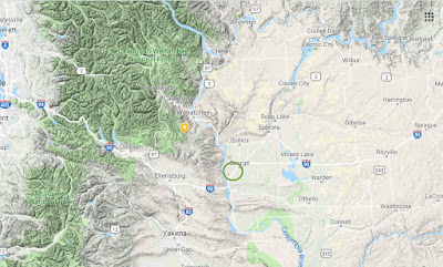
The nearby Grant County Airport (MWH) reported dense fog all day and FREEZING FOG and Freezing Rain starting around 435 PM (times in UTC, with 0000 UTC being 4 PM)

The freezing rain was associated with an approaching frontal system, which dropped light rain into a cool layer near the ground. The 13-hr forecast that morning showed the precipitation arriving into the region around George by 5 PM (see below)

Freezing rain is rare over western WA, except near the outlets of the Columbia Gorge and Fraser River Valley (e.g., Bellingham), but often occurs in eastern WA as cool air pools in the Columbia Valley or is pushed on to the eastern slopes and adjacent regions.
I have spent a large amount of time studying and working with WSDOT (Washington State Department of Transportation) and SDOT (Seattle Department of Transportation) on the issue of roadway icing. And I have occasionally done some forensic work on roadway icing accidents. Roadway icing is probably the greatest meteorological threat faced by WA State citizens. More than windstorms, flooding, thunderstorms and everything else (I have checked the numbers).
One thing I learned: freezing fog can be a huge threat. Fog has lots of water content and when fog droplets contact a cool roadway surface, substantial icing can occur rapidly.
When air temperatures are below 35 F and you see fog, you should immediately slow down.
Why 35F? Because air temperatures are measured at roughly 6 ft above the surface (car thermometers are at roughly 2 ft above the surface) and surface temperatures can be cooler that air temperatures, particularly at night.
The threat of icy roads was already evident that morning with the Grant County Sheriff reported icy roads.

Reducing Roadway Icing Injuries and Deaths
There has been substantial progress in reducing roadway icing injuries and deaths. WA State WSDOT has made large strides, putting up RWIS roadway weather stations around state roadways, educating their plow operators (e.g., bridges ice up first!), using aggressive anti-icing pretreatments on vulnerable roads, and working with us at the UW to build the road temperatures prediction capabilities and public websites that would provide guidance to their staff and warn drivers. One application I am particularly proud of is our Road-Weather web displays, such as the I-90 page (see
below)

But unfortunately, Washington State efforts are beginning to slide and new technologies that would promote roadway safety are not moving forward. Recently I learned that Washington DOT (WSDOT) is going to cut all funding to the roadway weather pages and data streams produced by the UW (e.g., I-90, SR-20, I-5, Ferry Weather), substantially cutting back the information available to the public.
Just as serious, we are not moving forward with protective warning technologies that could produce timely warnings of dangerous road condition for WSDOT personnel and the motoring public.
Today, there are immense amounts of information describing, in real-time, weather and surface conditions around the State. Thousands of surface stations, weather radar information, amazing new weather satellite capabilities, smartphone pressures, to name only a few. Plus, high resolution weather modeling has improved rapidly, with new rapid-fresh forecasts being made every hour. And soon cars and trucks will serve as massive data sources.
This huge potential is magnified by the fact that most folks have smartphones, and thus we could provide real-time, vehicle specific warnings of threats on the roads ahead. I believe we can stop many of the fatal/injuring accidents caused by snow and ice on the roadway, such as the tragic accident of a pregnant woman on I-90 last year.

Unfortunately, the Washington State transportation bureaucracy is not pushing forward on such technological advances, with the explanation that WSDOT lacks the funds to do so. Hopefully that will change someday. The effective use of weather information, coupled with smartphone distribution of warnings, has the potential to save many lives and to substantially lessen weather-related carnage on our roads.


That photo shows a little bit of snow on the grass--and a band of precip went through the Columbia Basin from about 3-5pm yesterday (the Silica Road sensor says as much in the observation--and that is much closer than Moses Lake). My wife drove I-90 on Thanksgiving and did not encounter "severe icing conditions". I suspect there was a little slush on the shoulder and the bus got into that, plus visibility was not good in the fog. If conditions had been severely iced up, nobody would have been making the climb up from the river.
ReplyDeleteCliff I definitely agree with your post but living near the region, the culprit was freezing rain. My house experienced straight rain but it cleared off so quickly the stars were shining about an hour after the rain fell, and the roads got slick quick. This spot at 31 degrees was probably freezing rain. I bet they got around a tenth of an inch.
ReplyDeleteAnd a lot of times, when you know it precipitated, and the data doesn’t show any rain accumulation, it’s a tell tale sign the meter iced over and won’t record until it melts. Majority of wsuagmeters do this as an example. My 2 cents. Thanks.
This comment has been removed by the author.
ReplyDeleteSame thing is happening in the winter time mountain avalanche safety world.
ReplyDeleteThe very few Mountain Telemetry data stations suffer frequent breakdowns, at least in my area.
And many more of those sites are needed.
However,the commercial guide centric NWAC is using money to pay for commercial guide observations, which have an inherent subjective money and ego bias built in. They aren't snow scientists.
Some of those critical avalanche observations become filtered through NWAC and are not accurately conveyed to the public.
Last year, I posted an Avalanche and snow instability observation from my area on the public page of the nwac site.
I deliberately reported the observation as being "near washington pass" which is a the common inaccurate way that nwac reports Avalanche incident location in our area.
Spatial variability concerns requires exact location. Accurate reporting matters.
For my observation post on NWAC, I used the moniker "Vauge observations for money" in order to convey my frustration at the inaccurate information that was coming out of that Avalanche Center.
Even though nwac had my phone number and email address and could have easily asked for clarification,they chose instead to delete my observation.
Two days later we suffered our first Avalanche fatality involving a skier in our local area here on the east side of the North Cascades.
On turnsallyear,I was critical of nwac for deleting my post and inaccurate reporting. They responded by putting pressure on that site.
The result was, my membership was terminated after 6 years and a over 1000 posts were deleted.
Many of the posts were discussing Mountain safety from a POV of my 37 years of dealing with uncontrolled snow while climbing and skiing mountains.
But it hasn't always been that way at nwac.
I should say that under a previous nwac administration, one of my TAY near-miss avalanche incident analysis postings was picked up by NWAC and used for their yearly incident summary report.
It's always sad when commercial money interests rule over Public Safety concerns.
Chris H
Heli-free North Cascades
there can be warnings, but there is also the reality of a lack of alternate routes with safer conditions.
ReplyDeleteGlad there were no serious injuries. Would have been a big loss on an otherwise great Apple Cup day for the Dawgs. Be careful out there. A lot of people don’t take driving seriously as evidenced by the increasing number of smartphone and distraction related crashes.
ReplyDeleteThis is an excellent article. Thank you very much for doing this.
ReplyDeleteI had a car that would warn me when the temperature hit 35 degrees, but I never made the fog connection until reading this. It so happens that we've moved to a place with a foggy winter microclimate. You kind of exist in a fog bank where we are for two to three months in winter. This article, published at this time, really helps. It's going to make a definite difference in how we get around, starting right away.
and another thing...
ReplyDeleteI was thinking about a new car I just bought with all of its electronic traction control, which I suppose comes with most modern cars. Instead of smartphones reporting as you say, the vehicles themselves should be reporting traction events--all automated. If cars a few miles ahead of you run into slippery conditions, or if your car starts reporting braking (for traffic congestion) all of this is relayed to all the cars coming down the interstate.
For their part, the DOT can have adjustable speed limits--just like they have coming into Seattle. And enforce it with video when safety is an issue--send people speeding tickets if the limit is 40mph coming over the pass. Now, last night chains were required on Snoqualmie and spinouts closed the pass for awhile. When it started snowing more heavily maybe the amount of traffic going over the pass should have been restricted? I know you cannot account for lousy drivers, but America went with cars instead of trains, so what can you do.
There is a new talk about magnetic poles in the Sun, and how there is likely to be a "Maunder Minimum" of reduced sun activity starting as soon as 2020.
ReplyDeleteVery interesting talk.
Clear prediction about global cooling due to the sun, by a Solar Physicist.
http://electroverse.net/professor-valentina-zharkova-breaks-her-silence-and-confirms-super-grand-solar-minimum/?fbclid=IwAR0UrPm-Jkg0TBzdi3oyTbmRHfpEiyv9_uL8aVzHk-2CpZFVLHD2fXC9mDo
What do you think?
Or people could just learn to drive.
ReplyDeleteTom Grey - I posted this information a few days ago.
ReplyDelete"Recently I learned that Washington DOT (WSDOT) is going to cut all funding to the roadway weather pages and data streams produced by the UW (e.g., I-90, SR-20, I-5, Ferry Weather), substantially cutting back the information available to the public."
ReplyDeleteWhy is there a cost to the "data streams" and "weather pages"? Is this data being produced by the UW WRF which is going to keep running anyhow? How does turning off the public view save money?
Chris...there are substantial costs to keeping the DOT products going. First it requires a server, which costs money and the support of IT folks. The software is complex with many feeds, and there are always problems, as data formats change or as software gets updated. This requires time of a highly skilled research meteorologist. Left alone the systems would rapidly fail...cliff
ReplyDeleteI appreciate it's always more complicated than it looks, and working with multiple large organizations with different needs is not an envious position to be in.
ReplyDeleteAn option is separating the WRF from its data product by an integration layer with a standardized layout, meteorologists can focus on the upstream forecast creation and tools such as this can be done more easily by traditional comp sci folks. Undergrad and grad students in data science who are constantly hungry for big data to sharpen their skills on are a great resource. They can build products that would forecast icing on all roads, not just a select few, in a reasonable amount of time if the data was in a usable format. Going further you would have the option of open source collaboration if it ever got the legs. There would still be cost to the overall project, and sure they would still have to work with meteorologists, but the incremental cost to add new products would be minimal and the support on these products even less. On the other-side if all of the work is custom to each product and done in niche languages such as ncl it is much more of a struggle.