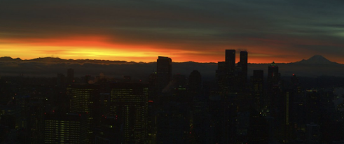
We a moist lower atmosphere, a cool air mass over the region, and relatively clear skies (which allows good cooling to space), we had good conditions for frost and fog across the region.
So be careful this morning. Fog and freezing temperatures are the most dangerous combination, capable of laying down a thick layer of ice on cold roadways.
But first: the sunrise. It is spectacular this AM, with a poor sample from a cam this morning.
Surface air temperatures dropped to below freezing over much of the state this AM (see below, click on image to enlarge), with near 0F numbers in really cold locations (like Mazama to Winthrop).
And never forget the differences around our region, with temperatures near the water above freezing, but well below freezing in the interior (e.g., Woodinville, Duvall)
For road safety, the temperature of the road surface is what counts and that temperature can be VERY different than the temperatures of the air, which is measured 2-meters above the surface. In fact, air temperatures at 2-m can be 3-6F cooler than at the surface under strong inversion conditions.
Consider this morning. Below is the latest (7AM) graphic of surface air temperatures and road temperatures (in boxes) from the City of Seattle SNOWWATCH web site. A lot of below freezing air temperatures, with warmer temperatures near the water. But there is a lot of variability in the road temperatures.
Road temperatures on bridges, like the University of Washington viaduct (30F) are below freezing-- a real icing threat if the city did not pretreat the surface. In contrast, road sensors in contact with the ground (e.g. West Seattle, 40F) are "toasty." Heat is transferred up to roadway surfaces when they are in contact with the earth.....and that warming is particularly significant if temperatures have been mild (and they have been).
Again, be particularly careful if temperatures are cold and fog is around, something that is occurring right now over the south Sound area. Here are a few shots of WSDOT cams south of Olympia this morning. THIS is exactly the kind of situation you should fear. If you see such conditions, slow down and be particularly careful around turns.
Finally, a final sunrise picture from WSDOT:


Very interesting business - freezing fog, yes! High humidity and a clear-cold night (22.1 overnight here in Glacier) were perfect conditions for hoarfrost. A significant crust of gorgeous ice crystals have formed on the surface of the standing snow over the 24 hr (7a-7a CoCoRaHS) observation period (yesterday's high only 30.4 F). Roadways and streets under trees are notoriously as icy as bridges during cold humid spells like this. Great topic today!
ReplyDeleteAny snow events on the horizon or for that matter any snow flakes on the horizon..
ReplyDeleteI guess we should enjoy the chill because I keep hearing of major change for January. One that's not very la nina like at all. Greenland blocks, -NAO. Basically east coast frozen. West coast not. Been some talk of this a bit now. I'm not scientist so I just going on what was explained. But if what I've been told comes to fruition then it's gonna be not such a good year for snow in the mountains or the lowlands.
ReplyDeleteDrive down to the OR coast and it has so far hit 63° today (12/24). Guessing this is due to the front moving in tomorrow? Such a huge temperature swing from last night in Seattle.
ReplyDeleteOn Tuesday evening, I went for a walk around the neighborhood and quickly discovered that the sidewalks were consistently less slippery than the roads were. There were a few steps where I actually to pay attention to my footing, and they were always while crossing a road. I can't really explain why this would happen, as I figure the surface of the roads would thaw and dry up quicker because of the increased usage relative to a neighborhood sidewalk.
ReplyDelete