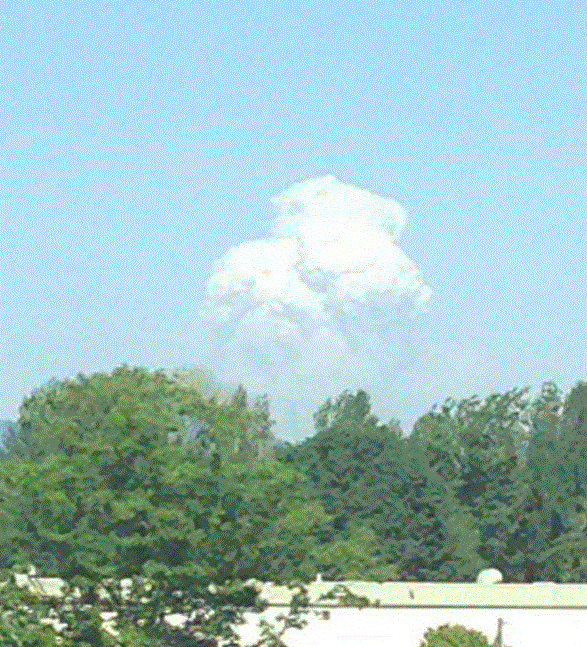
Wednesday, I received nearly a half-dozen emails about strange clouds over the Cascades, many with accompanying pictures. Here are some samples:
Picture courtesy of Jeff Boselly
Picture courtesy of Brian Aher
These clouds looked like a tall cumulonimbus but there was a lot of smoke at their base.
The origin?
A pyrocumulus cloud caused by the growing Chiwaukum Creek fire. This feature strengthend rapidly during the afternoon as the surface warmed and the regional winds became more favorable.
It was quite obvious in visible satellite imagery, as this example taken at 4:40 PM Wed. clearly shows (I have circled the feature in red). You can see the smoke blow off to the west. The smoke plume from another fire is seen to the northeast of it.
This pyrocumlus cloud was very evident in the Camano Island weather radar yesterday (see image at 5:04 PM, the bright green area is the cloud). The radar indicated an echo top of approximately 20,000 ft
Pyrocumlus, like all cumulus, are associated with the atmosphere going unstable, which means air parcels are buoyant and accelerate upwards. Instability is associated with a large change of temperature with height, and having a fire near the ground really helps this along! The air rises, cools, and the water vapor in it saturates...producing clouds.
There are over a dozen major fires burning over the Northwest and southwest Canada. The MODIS satellite image today shows considerable smoke over the region:
Lightning on Monday started a number of fires, particularly over northern Oregon.
Wednesday was was a very, very warm day in eastern Washington, with a number of locations getting above 105F. As noted by past Washington State climatologist Mark Albright:
On Wednesday (16 July 2014) Pasco
reached 109 and Hanford 110. This is the first time Hanford has reached 110
since they recorded 110 on 5 July 2007. The all-time high temperature at
Hanford is 113, recorded 3 times on 4 August 1961, 13 July 2002, and 23 July
2006. Records extend back 69 years to 1945 at Hanford.
Wednesday was the last really warm day west of the Cascade crest for a while. Wed. afternooon marine air started to surge in from the Pacific and this (Thursday) morning will bring low clouds. Expect temperatures to drop by about 10F.
But ironically, this cool down is bad for the wildfires, since it will result in a larger pressure difference across the Cascades and thus stronger westerly winds, winds that can potentially stoke the current fires. Fire fighting personnel need to be ready for this change.
 No one can say that we don't have contrasting weather around the Northwest. You can choose heat and smoke, cool and cloudy, and cool and clear. Never boring in our area.
.png)