Had enough of the coldest mid-April on record? Problem solved. The frigid temperature regime is over.
But there is a catch. The atmosphere is transitioning to a new regime, where the weather will be cloudy and wet over the Northwest and northern California.
A deep trough of low pressure will settle in over the northeastern Pacific, as illustrated by the forecast upper-level flow at 500 hPa (about 18,000 ft) for the next ten days. The blue colors indicated whether the upper-level heights/pressure will be lower than normal...something called a trough.
A strong trough offshore means lots of clouds and precipitation over our region. This is not a particularly cold pattern.
Take a look at the predicted precipitation through Wednesday afternoon. Oranges and reds are the heavy stuff, with lighter precipitation in green and blue.
Precipitation everywhere, but heaviest over Oregon and northern CA, where they need it. Good for water resources.
The precipitation total through Saturday is impressive with 3-5 inches in the mountains from northern CA into southern BC.
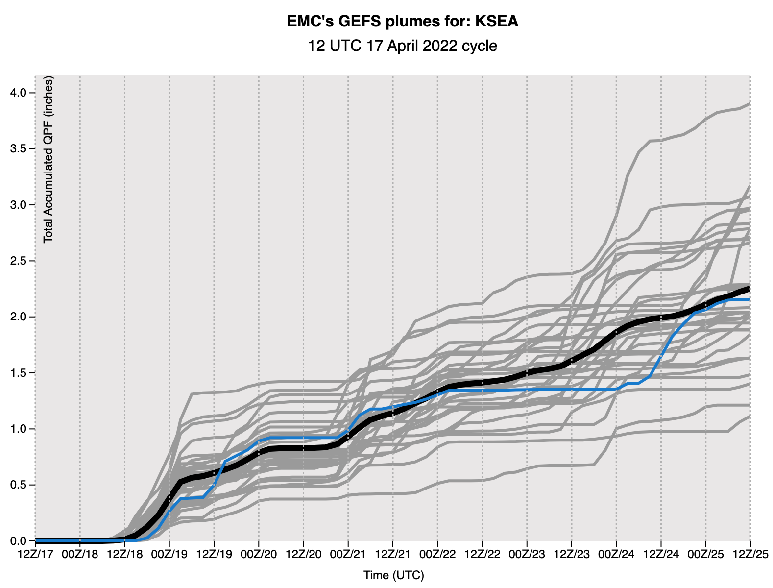
The precipitation is going to be relentless this week.
To illustrate, let me show you the prediction of cumulative precipitation in Seattle, based on many forecasts (known as an ensemble), using the U.S. GFS model. Each forecast is shown by a gray line and the average of all forecasts by the solid black line. Over 2 inches during the next week. And there will be more snow in the mountains...keeping the ski season alive and ensuring that the snowpack will be near normal going into the summer
Slugs and ducks will be very happy.
Picture courtesy of Julian Burgess