The Seattle Times this week published an article, Seattle Nights Are Getting Hotter, that irresponsibly exaggerates the effects of global warming on minimum temperatures in our region.

This sponsored "journalism" by the infamous Seattle Times ClimateLab, is based on a report by a well-known climate change advocacy group, Climate Central.

Before I get a dozen strident emails from climate activists, let me note that global warming, forced by increasing CO2 and other greenhouse gases, is occurring. The science is clear on this---and I have published many papers on this topic.
At this point, such greenhouse gas warming is on the order of 1.2°C--a little over 2°F.
Not the end of the world.
But that is not what is being communicated by the Seattle Times.
They prominently display a figure from Climate Central that shows an EXPONENTIAL increase in the number of warm nights (see below) using the proprietary CLIMATE SHIFT INDEX.
As we will see, this is scary nonsense.
Why don't they show you changes in temperature? Because those are unimpressive.

The Seattle Times starts by highlighting the "heat wave" of June 7-9 of this month as an "example" of what will happen in a warming world.
Just silly. This was a run-of-the-mill warm period--the kind of short-term warmth that has been observed frequently in the past.
Let me demonstrate this to you.
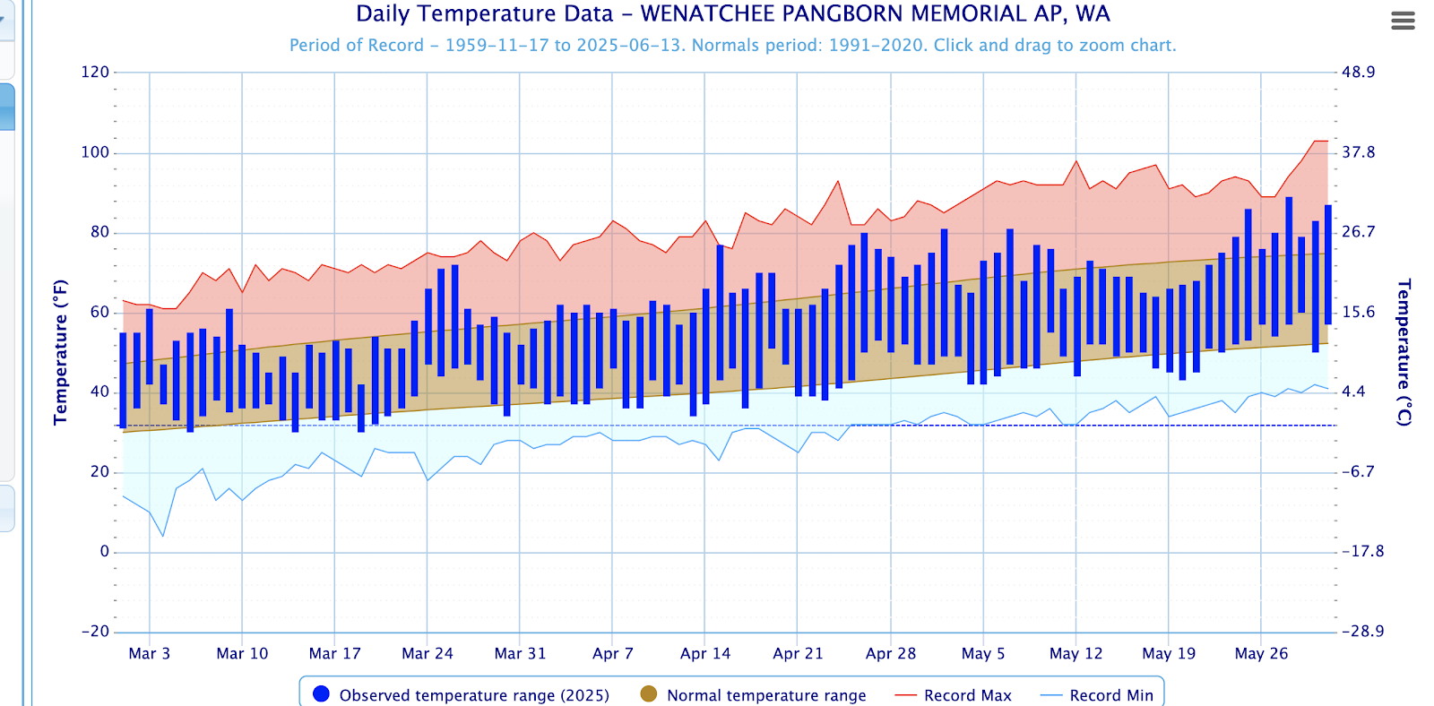
Below are the temperatures of the last month, with the observed highs and lows shown by the blue bars, and the extreme highs and lows by red and light blue shading. The brown shading indicates the normal daily range. During the past month, we have experienced both warmer and cooler than normal periods. June 8-9 was warmer than normal, but no high temperature records were broken.
Of the past 30 days, 22 days had low temperatures below the normal lows. You note the Seattle Times did not point it out.

Of the 30-day warm periods in June, the three days of June 6-9, 2025, came in 47th. Stop the presses!
But it is worse than that.
SeaTac Airport is the last place you would want to use temperature to understand global warming.
Why? Because of the profound warming influence of the construction of the third runway and massive development in and near the airport. A large (cooling) vegetated area was removed and replaced with a huge area of concrete.
You want proof of the impact of the development? Here is the plot of summer nighttime mean minimum temperatures at SeaTac. I have indicated (red bar) the period of construction. Notice the shift upward?
The mean temperature was roughly 54°F before and 57°F after. 3F increase.

Now compare to the Olympic Airport, where no third runway was added and development was far less (below).
No big jump. Summer minimum increased from about 48F to 50°F. Yes, there is warming, but it is not abrupt or extreme. You would hardly notice this.

Finally, the rapidly rising number of warm nights shown on the Climate Central plot is based on meteorological sleight of hand.
They start by using an inappropriate station (SeaTac), in which development has caused substantial warming. Then, they don't show temperature changes (which would not have impressed), but their "climate shift index", based on their artificial (and incorrect) assumptions of changes in probability distributions.
This index exaggerates change, since only a very small temperature increase can radically increase the probabilities of exceeding some extreme value.
Very deceptive and wrong.

.png)