November 30, 2018

The Rewetting of the Western U.S.

The last two weeks have been a major turnaround for water resources along the west coast of the U.S.  And a decided end of California's dry season and enough water to end the wildfire threat over central and northern CA.

Here are the precipitation totals for the past two weeks from the National Weather Service official analysis for the western U.S..   Significant totals, ranging from around 15 inches in the northern Cascades to 5-10 inches in the higher terrain of California.


But how much has this differed from normal for the past 2 weeks?  The figure below has the answer!  Most of Washington has been near normal, but California is another story....way above normal (3-7 inches)


The latest streamflow levels show most of our state has normal to above normal streamflow, with the exception of a few rivers over SW Washington.

California has normal to above normal streamflows after all the rains.

Reservoir storage in California is in good shape, most at or near normal (the red line), except for Lake Orville, the heavily damaged reservoir in which water levels have been held low).  There is plenty of room to store more water, and the recent rains are starting the process.


For example, there has been a huge surge upwards in the storage at Trinity Lake in northern CA (see below)

Here in Seattle, both cumulative precipitation and reservoir levels are close to normal (see below)

The bottom line is that worries about drought are now fading, as substantial precipitation has reached the west coast of the U.S.

November 28, 2018

Finally some snow over the Pacific Northwest

There has been a substantial increase in our snowpack during November.  To illustrate, here are the snow depths on November 1 and last night.  Notable increases, particularly over the north Cascades and southern BC..

But even with increases, the snowpack is less than at  the same time last year (see below).

In fact, although there have been considerable increases in higher elevation snowpack the past few weeks, the latest USDA Snotel data shows that the Cascades are still below normal (about 40%), while the northern Sierra Nevada is above normal, as are the western slopes of the Rockies.


The last day has not been kind to our mountain snowpack, with warm, rainy conditions caused by a moderate atmospheric river.  But that is past now and we have been experiencing cooler, unstable conditions, with decent snow showers in the mountains.

The forecast for the next 72 hr  (ending 4 AM Saturday), suggests another half a foot at higher elevations in the  Washington Cascades and huge snow dumps over northern CA and southern Oregon.


Now modern ski areas have considerable capabilities for making snow if the temperatures are cold enough, and there is good news on that front--we are heading into a period of much cooler lower atmosphere temperatures. 

To show this, here are the NOAA/NWS GEFS ensemble air temperature forecasts at the surface for Stampede Pass in the central WA Cascades around 4000 ft  (remember that in an ensemble system we run the forecast model many times to explore uncertainty).  The black line is the average of the forecasts, the ensemble mean, which is usually a very good forecast.  Temperatures really drop the next few days and generally stay below freezing.   Any snow won't be melting and snow making should be fine about 3500 ft.
Crystal Mountain will reopen on Friday, Baker  and Stevens are getting close, and Whistler is open with early season conditions.  Enjoy.

November 26, 2018

Strong Winds and an Atmospheric River Hit the Northwest

Strong winds, some exceeding 50 mph, are hitting some parts of the Northwest today.  And a moderate atmospheric river promises substantial rain in the mountains.

The maximum wind gusts over the past 24 h, shows a fascinating picture of very strong wind in some locations, while lighter winds are evident in others. 45-55 mph gusts in the San Juans and along the coast.  And 40 mph gusts east of North Bend as one ascends towards Snoqualmie Pass.   But light winds around Puget Sound.


Such huge differences result from our terrain and land-water contrasts.

A forecast from the UW WRF modeling system of sustained winds (not gusts) for 10 AM this morning shows the pattern (see below).  In particular, look at the strong winds from the eastern Strait of Juan de Fuca across the San Juans. 

Why are they there?  Blame the Olympic Mountains!   The sea level pressure forecast is shown by the light brown lines.  There is relatively high pressure on the windward (south side) of the Olympics and a leeside pressure trough on the northern side.   This pressure pressure pattern results in a strong pressure difference on the northeast side of the Olympics that accelerates the winds from the southeast.  And strong winds are found on the western side of Snoqualmie Pass because there is a large pressure difference across the Cascades and air is accelerating towards lower pressure to the west.


Smith Island, just west of Whidbey Island, has had recent gusts to 48 knots (SISW1) and  similar winds are being experienced along the coast, such as at Destruction Island (DESW1).   Destruction winds are particularly vicious because of the Olympics as well, since the barrier enhances the pressure gradients in the area.


But winds are only part of the story today.   A moist flow, known as an atmospheric river, is heading right into us, as shown by the infrared satellite image at 7:30 AM (below).  A really juicy frontal cloud band that stretches well into the Pacific.


We can see the plume of moisture clearly in a short-term forecast of total atmospheric water vapor in vertical column of air:

The resulting precipitation over our region during the next 24h  will be substantial, with parts of the Olympics and north Cascades getting over 5 inches of liquid water equivalent:


Note the light precipitation to the NE of the Olympics?   A world-class rainshadow is happening as the air sinks on the lee side of the barrier.  Here is the latest weather radar image--the rainshadow is spectacular:

And then mid-week the jet stream goes south and California gets hit hard by precipitation and mountain snows.  Fire season is over for central and northern CA.
____________________________________

Atmospheric Sciences 101:  Weather

I will be teaching atmospheric sciences 101 during winter quarter at 11:30 AM at UW's Kane Hall. Basic introduction to atmospheric sciences, with a 10 minute "weather discussion" starting every class.

November 23, 2018

Fog, Freezing Rain and Roadway Icing: The Warning of the Husky Bus Crash

Yesterday, a bus with a number of students of the Husky Band overturned on Interstate 90 just west of the town of George, Washington (see map  below) as they headed to the Apple Cup game in Pullman.   A number of students sustained injuries, but thankfully none were life threatening.


As I will discuss below, severe icing conditions occurred due to fog, freezing rain, and freezing temperatures, and with modern observing, modeling, and warning technologies, coupled with cautious driving, the number of  such events can be greatly reduced.


The accident occurred around 5:30 PM Thursday.  A plot of temperatures at 5 PM (with the accident location indicated by the red circle) shows freezing and below freezing surface air temperatures, with 31F reported in the immediate vicinity, while to the southeast temperatures were in the 40s.


A 13-h model forecast of winds and surface air temperature valid at 4 PM was very realistic, showing the threatening cool temperatures over the accident region, while warmer temperatures were predicted over SE Washington.


The cool temperatures were accompanied by low clouds and fog, something shown by a high resolution visible satellite image around 1 PM (see below).

The nearby Grant County Airport (MWH) reported dense fog all day and FREEZING FOG and Freezing Rain starting around 435 PM (times in UTC, with 0000 UTC being 4 PM)


The freezing rain was associated with an approaching frontal system, which dropped light rain into a cool layer near the ground.  The 13-hr forecast that morning showed the precipitation arriving into the region around George by 5 PM (see below)


Freezing rain is rare over western WA, except near the outlets of the Columbia Gorge and Fraser River Valley (e.g., Bellingham), but often occurs in eastern WA as cool air pools in the Columbia Valley or is pushed on to the eastern slopes and adjacent regions.

I have spent a large amount of time studying and working with WSDOT (Washington State Department of Transportation) and SDOT (Seattle Department of Transportation) on the issue of roadway icing.  And I have occasionally done some forensic work on roadway icing accidents.  Roadway icing is probably the greatest meteorological threat faced by WA State citizens.  More than windstorms, flooding, thunderstorms and everything else (I have checked the numbers).

One thing I learned:  freezing fog can be a huge threat.  Fog has lots of water content and when fog droplets contact a cool  roadway surface, substantial icing can occur rapidly.  

When air temperatures are below 35 F and you see fog, you should immediately slow down. 
Why 35F?  Because air temperatures are measured at roughly 6 ft above the surface (car thermometers are at roughly 2 ft above the surface) and surface temperatures can be cooler that air temperatures, particularly at night.  

The threat of icy roads was already evident that morning with the Grant County Sheriff reported icy roads.


Reducing Roadway Icing Injuries and Deaths

There has been substantial progress in reducing roadway icing injuries and deaths.  WA State WSDOT has made large strides, putting up RWIS roadway weather stations around state roadways, educating their plow operators (e.g., bridges ice up first!), using aggressive anti-icing pretreatments on vulnerable roads, and working with us at the UW to build the road temperatures prediction capabilities and public websites that would provide guidance to their staff and warn drivers.  One application I am particularly proud of is our Road-Weather web displays, such as the I-90 page (see
below)

But unfortunately, Washington State efforts are beginning to slide and new technologies that would promote roadway safety are not moving forward.   Recently I learned that Washington DOT (WSDOT) is going to cut all funding to the roadway weather pages and data streams produced by the UW (e.g., I-90, SR-20, I-5, Ferry Weather), substantially cutting back the information available to the public.

Just as serious, we are not moving forward with protective warning technologies that could produce timely warnings of dangerous road condition for WSDOT personnel and the motoring public.  

 Today, there are immense amounts of information describing, in real-time, weather and surface conditions around the State.  Thousands of surface stations, weather radar information, amazing new weather satellite capabilities, smartphone pressures, to name only a few.  Plus, high resolution weather modeling has improved rapidly, with new rapid-fresh forecasts being made every hour.   And soon cars and trucks will serve as massive data sources.    

This huge potential is magnified by the fact that most folks have smartphones, and thus we could provide real-time, vehicle specific warnings of threats on the roads ahead.  I believe we can stop many of the fatal/injuring accidents caused by snow and ice on the roadway, such as the tragic accident of a pregnant woman on I-90 last year.


Unfortunately, the Washington State transportation bureaucracy is not pushing forward on such technological advances, with the explanation that WSDOT lacks the funds to do so.  Hopefully that will change someday.   The effective use of weather information, coupled with smartphone distribution of warnings, has the potential to save many lives and to substantially lessen weather-related carnage on our roads.


November 21, 2018

Thanksgiving Forecast

A band of moderate rain is now moving through western Washington, but the good news is that it will clear the region by 3 AM Thursday.


There will be a period of dry conditions from roughly 4 AM to 1 PM around Puget Sound, so if you want to get your Thanksgiving walk or run in, this will be the time.

The 3-h precipitation totals ending at 7 AM shows dry conditions over the western lowlands (and a few showers over the mountains).   A juicy band of precipitation is offshore.


 The next three hour totals (ending 10 AM), show the frontal band making landfall.


And the 3-h rainfall ending 1 PM shows the wet stuff over Portland and just reaching Seattle.


The following several days will be characterized by lots of showers.  The 72h total ending 4 PM Saturday has up to 2-5 inches over WA terrain and 5-10 inches over some portions of northern CA.

But what really has me excited is the snow.  We will have cool, showery weather, with a low snow level. Over the next 72 h, 1-2 feet will fall above 4000 ft.  Cross country skiing will be possible by Sunday.


The precipitation totals over northern California so far in this storm have been moderate, with around 1.25 inches in the mountains behind Paradise, CA and a few locations getting 2-3 inches.  A lot more is coming.


The good news is that the California-Nevada River Forecast Center indicates little chance of flooding over California (since the ground is starting out so dry) and air quality has rapidly and profoundly improved over much of the Golden State.    To show this, here are the latest Air Quality Index values:  many are green, indicating healthful air.


So enjoy the return to normal weather and wonderful sound of rain on the roof and trees.

November 20, 2018

Was Global Warming A Significant Factor in California's Camp Fire? The Answer is Clearly No.

The Camp Fire that struck the northern California town of Paradise and vicinity is a profoundly disturbing environmental disaster of first magnitude.  Nearly 100 people have lost their lives, approximately 10,000 homes have been lost, a major community has essentially been destroyed, and millions of people have been exposed to high concentrations of smoke.  Tens of thousands of people have been displaced and lives of millions substantially affected.


And beyond the heart-wrenching losses noted above, it is doubly tragic that this disaster was both foreseeable and avoidable, resulting from a series of errors, poor judgment, lack of use of available technology, and poor urban planning.

It is more than unfortunate that some politicians, environmental advocacy groups, and activist scientists are attempting to use this tragedy as a tool for their own agenda, make the claim that the Camp Fire was result of global warming.


As I will discuss below, this claim has little grounding in fact or science.  Global warming is a profoundly serious threat to mankind, but it has little impact the Camp Fire and many of the coastal California fires of the past few years (e.g., the Wine Country Fires of October 2017).  And blaming global warming takes attention away from the actions needed to prevent such  tragedies from happening again.

Analyzing the Origins of the Camp Fire

Winds

A central causative factor was the strong, offshore-directed, winds that both initiated the fire and drove it rapidly towards the town of Paradise.   These winds are known as Diablo winds, and are driven by the difference in pressure between the intermountain interior (e.g., Nevada) and the coast.

The easterly (from the east) winds that struck that day were not that unusual, something that is evident by looking at the wind climatology at the nearby Jarbo Gap USDA RAWS weather station.  The sustained winds on the day of the fire initiation (November 8) accelerated to 32 mph (with gusts to 52 mph), with peak winds at 4 AM that day.   Looking at the entire record at Jarbo (back to 2003), northeasterly winds of 30 mph or more have occurred 508 times in those 15 years--not an unusual event.  And my inspection of the individual records does not suggest an increasing trend.


Furthermore, there is no reason to expect that Diablo winds will increase under global warming; in fact, the opposite is the case.  Global warming preferentially warms the interior of the continent compared to the eastern Pacific.  Thus, human-caused warming would tend to weaken the interior high pressure, thus lessening a key driving force of the Diablo winds.   There are several studies in the peer-reviewed scientific literature  (e.g., this one) that show that global warming should weaken southern California's Santa Ana winds, which are also driven by the pressure difference between the western interior and the coast.

Initiation of the fires

There is strong evidence that that Camp Fire was caused by failure of PG&E powerlines, not by any natural causes that could be linked to global warming.  In fact, nearly all wildfires in California are caused by human error or arson.  Increased population in California would clearly lead to more human fire initiation.  Thus, global warming is not a factor in fire initiation.


Surface dry conditions

One of the most popular handwaving arguments about why global warming is enhancing wildfires is through temperature and precipitation changes.   It is argued that warming temperatures are causing more evaporation and thus drying the "fuels" at the surface.  And it is argued that global warming is causing increasing drought that dries fuels and encourages fires.

Now this sounds reasonable enough on the surface, but when you examine the facts more closely, it rapidly becomes clear that global warming has little role in producing the dry conditions that assisted  the Camp Fire, the wine country fires, or the fires in coastal southern CA.

The truth is that California is quite dry during nearly half of the year and that fuels such as grasses, bushes and small vegetation dry out during any typical summer.   Even more important, virtually all of the fires noted above (including the Camp Fire) were associated with offshore, downslope winds which rapidly dry out vegetation, even it is wet the day before!

A nearby landscape.  Not all the grass and small vegetation

The fire weather community divides fuels by how quickly they dry.  1-h fuels are less than 1/4 of an inch in diameter and can dry in LESS THAN AN HOUR.  This includes grass and small weeds/plants.  10-h fuels have diameters of 1/4 to 1 inch and dry in less than 10 hours, and include small bushes, branches, and the like.

In much of California, and particularly in the areas of the fires noted above, most of the fuels were grasses and small stuff--mainly 1 and 10-h fuels.    Thus, they dry very quickly, such as when Diablo winds start to blow.  This kind of small diameter fuels is known as chaparral in California, and there was a lot of such ground cover north and east of Paradise.

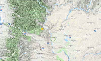
Now let me prove to you that global warming had nothing to do with the dry conditions near Paradise on the morning of November 8.  Below is a plot of the ten-hour fuel moisture at the nearby Jarbo Gap observation side, a site that was in the path of the fire, for the five years ending November 20.  You will note a repeatable pattern, with values reaching around 27% during the winter, but 3-8% every summer and early fall.  The fuels are not getting progressively drier.  I should note that I was told by local fire experts that values below approximately 10% are plenty dry enough to burn.


Looking at a blow-up image of the fuel moisture of the last 3/4 year you can see the summer drying clearly and something else very important....there are short dry periods even in the middle of winter when rain is falling occasionally.  Why?  Because there are diablo wind events that can dry out the vegetation even then.


The bottom line is that the vegetation is plenty dry enough to burn every summer right now...and has been like that forever.  Even if global warming is increasing temperatures a few degrees (and it probably is), IT DOESN'T MATTER.  The fuels are plenty dry enough to burn already.  That is why the handwaving argument that global warming is contributing to the fires simply don't make sense.

And then there is the argument that global warming is somehow decreasing autumn rains in the area.  This has little basis in truth.  Here is the plot of precipitation form the NOAA/NWS climate division data set for 1930-2018 for August to October precipitation for the area of the Camp Fire.  There is no obvious trend.  August to October precipitation is typically light (about 2 inches), with lots of variation year to year.  Many years are as dry or drier than this year. And the global warming simulations for the end of the century that I have seen do not show a consistent change in fall precipitation.


As long as I taking on taking on claims of global warming-fire connections, some folks like to talk about tree deaths, bark beetles, and the like, with the claim that global warming is killing trees and thus leading to fires.   The Camp Fire areas is NOT  noted for tree death and besides, most of the fire was on chaparral vegetation.  Below is a satellite photo showing the boundaries of Paradise (brown line), with the fire starting near Pulga (on the NE side of the image).   The fire spread over a region that had been logged, previously burned, and was then mainly grass and small shrubs.


In summary, if one analyzes the situation, it is evident that global warming had little to do with the Camp Fire. 

As I will discuss in a future blog, the Paradise area was a ticking time bomb.    There was a huge influx of population into a wildland area, which had burned many times in the past.  Previously logging and fires had left a conduit of highly flammable grass and bushes, through which fire could move rapidly.  Flammable, non-native invasive grasses had spread through the region. Homes were not built to withstand fire and roadways were inadequate for evacuation. Powerlines started the fires and were not de-energized even though strong winds were skillfully forecast.   Warnings to the population were inadequate.  The list is long.   And global warming should not be on the list if we are to focus on the real problems.


Should I Let AI Write My Blogs?

I spend a lot of time thinking about and writing my blogs.   Could AI apps do the work for me?   Could any of you tell the difference? Well,...