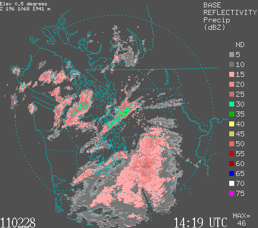
 The most extensive precip is south of the city, but some strong bands to the north. Light snow last hour at Sea Tac in the southern band, and Port Angeles and Friday Harbor in the northern features. Too warm for snow at sea level--Sea Tac is at 452 feet. In heavy precip, the snow level can descend to the surface. Hard to get snow to the surface in strong onshore flow...even cold flow like this..unless you have sufficiently intense precipitation.
The mountains are just getting pummeled.


We actually got a light lumpy covering in the wee hours of the morning on Sinclair Island. Looks like it came down as very large snowflakes. Temperature just below the freezing point now.
ReplyDeletethe I-90 traffic cams are amazing. Nothing moving at the top.
ReplyDeletethe ski folks must love this. You predicted a good season to invest in a Lift Pass!
Snow rain mix in Maple Valley @ 8am
ReplyDeleteSeems to be moving more to snow than rain.
Feb 28 2011 15:39:27
ReplyDeleteTECHS ARE AT KATX RADAR. SHOULD BE BACK UP AND RUNNING BY 12 NOON PST.
http://weather.noaa.gov/monitor/radar3/
At least it's not a storm!
Big, heavy snow flakes coming down thick and fast 5 miles ESE of North Bend @ 700' and yet the icicles hanging off my eaves are dripping....I have to admit, though, I am sick to death of this winter. Are we done yet Cliff?
ReplyDeleteClose to an inch here in parts of Victoria BC. It's all melting away quickly now. Definitely a surprise waking up this morning.
ReplyDeleteNothing down in the Green River Valley, but when I drove up the hill to the I-5/SR-516 junction at about 7:45 am there was a snow shower going on there. Nothing was sticking, though.
ReplyDeleteBeen snowing for at least 3 hours in central Tacoma. Elevation around 200 ft. Thin layer of white slush on the ground!
ReplyDelete23" in 12 hours at Stevens Pass, 32 " in the last 24 hours. Dare I say that is almost too much to be skiable?
ReplyDeleteThis skier stayed home yesterday for fear of getting caught in too much snow - 6-10' forecast - and we don't have 4WD. Alas, it was late in arriving and only snowed 2" during the day. The ski operators are having a hard time staying in front of it. Approx. 5' forecast for the next several days.
ReplyDeleteI was just looking at the winds at Camp Muir on Mt. Rainier. At 1am this morning it was blowing 112 mph and gusting 137 mph And it was blowing 100 mph or better for over 11 hours. I think one could describe this as....Breezy...
ReplyDeletehttp://www.wrh.noaa.gov/mesowest/getobext.php?wfo=sew&sid=MU101&num=48&raw=0&dbn=m
Bill...
I was just looking at the winds at Camp Muir on Mt. Rainier. At 1am this morning it was blowing 112 mph and gusting 137 mph And it was blowing 100 mph or better for over 11 hours. I think one could describe this as....Breezy...
ReplyDeletehttp://www.wrh.noaa.gov/mesowest/getobext.php?wfo=sew&sid=MU101&num=48&raw=0&dbn=m
Bill
You are the only weatherman that called the winter snow in SW Washington. They all said rain and it strted snow at 8:30 this morning and has not stop at 800ft. Thanks for the heads up
ReplyDeleteJill, how much snow did you get Monday morning?
ReplyDeleteThe NWS forecast called for up to an inch on the hills--this was the text forecast issued Sunday afternoon. Here is the text
SOUTHWEST INTERIOR-LOWER CHEHALIS VALLEY AREA- INCLUDING THE CITIES OF...OLYMPIA...LACEY...TUMWATER...CENTRALIA...TOLEDO...MONTESANO
249 PM PST SUN FEB 27 2011
.TONIGHT...RAIN. LOWS IN THE MID
30S. SOUTHWEST WIND 10 TO 20 MPH.
.MONDAY...RAIN SHOWERS...MIXED
WITH SNOW SHOWERS IN THE MORNING.
MORNING SNOW ACCUMULATION UP TO 1
INCH ON HILLS. HIGHS IN THE UPPER
30S TO MID 40S. SOUTHWEST WIND 10
TO 15 MPH.
The forecast issued at 4am Monday had "local snow accumulation up to 1 inch".
I'm curious to know if you had more than that, but it does not look like Cliff is the only forecast to have mentioned snow.
In the Central Cascades...I went skiing Monday--but didn't see any new snow til I got to Baring on US2. The snow level on the trees was right at the top of the left most part of that terminal moraine ridge just up from Zekes drive inn. The snow level probably tapered from 1000' there, down to 700 feet or whatever Baring's elevation is. So the NWS forecast was spot on for the Central Cascades.
It is pretty easy for the snow level to be off 500', maybe the forecast for 1000' could have said 500-1000', anyway it is not surprising that hills had a little snow here and there--but as I said I'm be curious to know if you had more than that, thanks!
Cliff you`r a great resource,'surf cam links' etc thank u.
ReplyDelete