 |
| Image from the video at 1:12 PM Feb. 12 |
The temperature and dew point at Skunk Bay (see graphic) and other nearby sites (e.g., Wahl Rd on Whidbey Is, also shown) were close but not at saturation (the dew point was a few degrees less than the temperature).
Whidbey Island is about 300 ft high for the peninsula in view, with a relatively abrupt cliff facing the southeast. (see blow-up of the terrain below) The winds were from the southeast over the area and so
air was forced up quickly along that share.. As the air was forced to rise, it cooled (air moving from higher pressure to lower pressure expands and cools). The temperature fell to the dew point and the air became saturated, producing a cloud. As shown in the picture above, and the video below, the cloud was not only maintained over the land, but streamed downwind of the island.
How much will air cool moving up a slope? If we assume that the air rose 100 meters (328 ft) and assume the dry adiabatic lapse rate (9.8 C per km, the rate that unsaturated air parcels cool when they are forced to rise), we get a decrease of .98C or 1.8F, which was enough to bring the temperature down to the dew point.
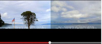
Greg Johnson produced a wonderful slow-motion video of the event; click on the image to view it yourself.
If you want real visual treat, check out his melding of TWO cams into one wide image--it doesn't get much better than that! (click on image below):


Thanks for this AWESOME video! I've seen it happen before, but at this view and speed, it looks like Whidbey is a fine old steam train, chugging along in the distance. :-)
ReplyDeleteCorrection Cliff Mass; That cliff face on the eastern end of Double Bluff is quite a bit taller than 200 ft. as stated. Done a fair bit of climbing at that point from bottom to top and my huffing and puffing put its elevation at 359 feet (going to ground level on Google Earth also confirms this)! G.L.
ReplyDelete"sophisticated meteorological palates??" I think this is sour grapes for our lousy winter. Let's hope for an interesting spring!
ReplyDeleteSpeaking from a place where we've had a lot of interesting weather lately, thank your lucky stars that you have been able to watch in comfort. Some people still don't have power after Sandy, and many of my neighbors lost power for at least two weeks (we had a health situation, so local authorities (NJ) got our power back first - that was 4 1/2 days, which is nothing to sneer at, even with a generator).
ReplyDeleteI rode home on my bike that afternoon, from Capitol Hill to West Seattle just south of the Alaska Street Junction (Edmunds St.). The roads were dry until I climbed the last 50 feet or so before the crest of the hill a block east of California St, then quite wet until I dropped about the same altitude down the west side, then completely dry again. Could this have been the same phenomenon?
ReplyDelete