
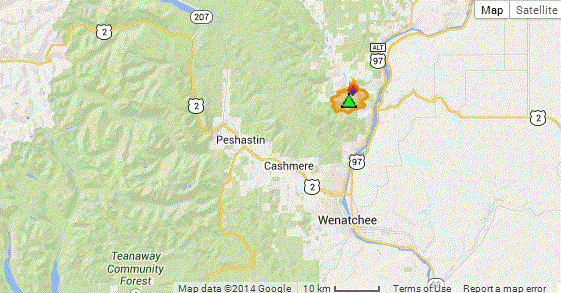
Here is a map to get you oriented. The fire is centered in the foothills east if SR 97.
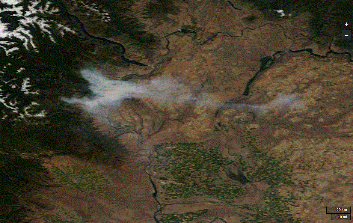
Let's begin by looking at two high-resolution MODIS satellite images, both of which clearly show the dense smoke emitted by the fire. In the earlier shot (top one), some smoke had pushed eastward into the Columbia basins, with some extending westward into some Cascade valleys. In the latter image, you can clearly see the location of the fire.

The smoke plume was dense enough and high enough to be picked up for a while by the National Weather Service Camano Island weather radar. Here is the proof. You see the red splotch north of Wenatchee? That's it.

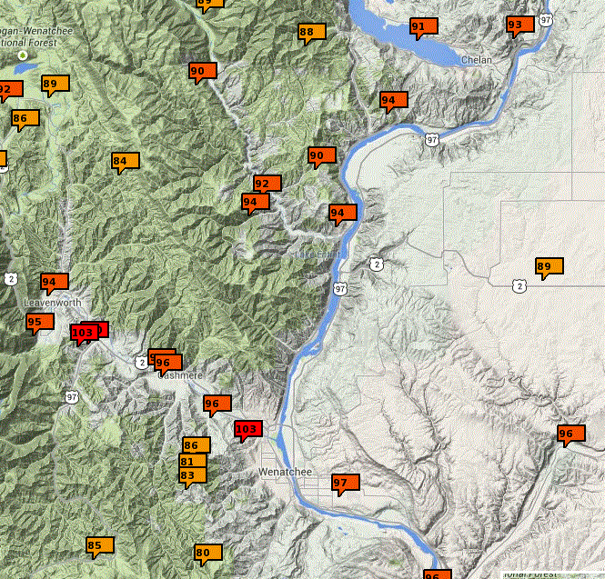
The maximum temperatures today got into the mid-90s in the vicinity of the fire and will only get warmer tomorrow.
In fact the forecast from the Weather Channel for Wenatchee is way above 100F next week.


This is going to be a very hot week for the Northwest. Ironically, the eastern U.S. will be unusually cool, associated with a trough of low pressure being termed POLAR VORTEX 2. (I am not making this up....search news in Google or Bing).
Want to be impressed? Here is the latest Climate Prediction Center 6-10 day forecast. Just amazing, isn't it. Huge warm anomaly in the west, even more intense cold anomaly in the east.
.gif)
The 99 hour, GFS model upper level (500 hPa pressure level) forecast tells you why (see graphic). Ridge of high pressure in the west, trough in the east.

Keep cool....
Global Warming, the Media, and Coal Trains
I will be giving a talk in Friday Harbor and Eastsound, sponsored by the San Juan Island and Orcas Is. libraries.
I will be discussing the serious threat of global warming, how the media is generally doing a poor job in educating about this issue, and how mankind is really not taking it seriously (e.g., the coal trains).
Friday Harbor: July 22nd, 6:30 PM, The Mullis Community Center, 589 Nash St.
Orcas Island: July 23rd, 5:30 PM, Orcas Center


The map with contours saying "probability of above", "probability of below" is a bit confusing. If it's red, very hot, why does it say things like "90% probability of above"? It seems there'd be a 90% probability of the temperature being *below* this.
ReplyDeleteAs I read the chart it is giving the probability of temps being above normal (orange to brown) or below normal (blue to black). Areas of dark red to brown are a "near certainty" to have higher than normal temps.
ReplyDelete